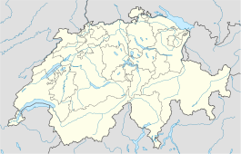
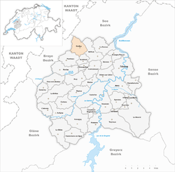
- Grolley
-
Grolley Country Switzerland 
Canton Fribourg District Sarine 46°50′N 7°4′E / 46.833°N 7.067°ECoordinates: 46°50′N 7°4′E / 46.833°N 7.067°E Population 1,640 (Dec 2009)[1] - Density 308 /km2 (798 /sq mi) Area 5.34 km2 (2.06 sq mi)[2] Elevation 625 m (2,051 ft) Postal code 1772 SFOS number 2200 Surrounded by Autafond, Belfaux, Léchelles, Misery-Courtion, Ponthaux Website www.grolley.ch
SFSO statisticsGrolley is a municipality in the district of Sarine in the canton of Fribourg in Switzerland.
References
- ^ Swiss Federal Statistical Office, MS Excel document – Bilanz der ständigen Wohnbevölkerung nach Kantonen, Bezirken und Gemeinden (German) accessed 25 August 2010
- ^ Arealstatistik Standard - Gemeindedaten nach 4 Hauptbereichen
External links
- Official website (French)
- Grolley in German, French and Italian in the online Historical Dictionary of Switzerland.
Arconciel | Autafond | Autigny | Avry | Belfaux | La Brillaz | Chénens | Chésopelloz | Corminboeuf | Corpataux-Magnedens | Corserey | Cottens | Ependes | Farvagny | Ferpicloz | Fribourg/Freiburg | Givisiez | Le Glèbe | Granges-Paccot | Grolley | Hauterive | Marly | Matran | Le Mouret | Neyruz | Noréaz | Pierrafortscha | Ponthaux | Prez-vers-Noréaz | Rossens | Senèdes | La Sonnaz | Treyvaux | Villars-sur-Glâne | Villarsel-sur-Marly | Vuisternens-en-Ogoz
Fribourg | Districts of Canton Fribourg | Municipalities of the canton of Fribourg
 Categories:
- Municipalities of the canton of Fribourg
- Municipalities of Switzerland
- Canton of Fribourg geography stubs
Wikimedia Foundation. 2010.


