- RCAF Station Mont Apica
-
RCAF Station Mont Apica Type Radar Station Coordinates 47°58′41″N 071°25′51″W / 47.97806°N 71.43083°W In use 1952-1990 Controlled by  Royal Canadian Air Force
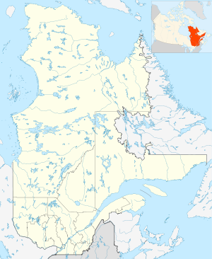
 RCAF Station Mont ApicaLocation of RCAF Station Mont Apica, Quebec
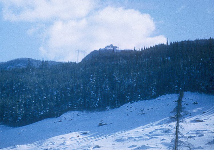
 Radar station on top of Mont Apica
RCAF Mont Apica (later Canadian Forces Station or CFS Mont Apica) (ADC ID: C-1) was a radar station of the Pinetree Line, located in Mont-Apica, Quebec, Canada, during the Cold War. The station opened in 1952 and had a staff of some 500 persons at its peak. Political and technological changes made the station redundant and it closed in 1990.[1] The radar squadron that was there (No. 12 Radar Squadron) was transferred to CFB Bagotville.
2452 AC&W squadron, an auxiliary (reserve) unit from Quebec City trained at Mont Apica until its closure (of 2452 AC&W squadron) in 1960.
There was also a weather radar used by the military and later by the Meteorological Service of Canada. After the closing of the station, it was transferred to the Lac Castor site of the Canadian weather radar network.
References
- ^ "Mont-Apica (Lieu-dit)" (in French). Commission de toponymie du Québec. http://www.toponymie.gouv.qc.ca/ct/ToposWeb/fiche.aspx?no_seq=42026. Retrieved 2010-10-28.
External links
 Canadian Forces bases and stations
Current CFB Borden · CFB Edmonton · CFB Gagetown · CFB Kingston · CFB Montreal · CFB Petawawa · CFB Shilo · CFB St. Hubert · CFB Suffield · CFB Valcartier · CFB Wainwright · LFAATC Aldershot · LFCATC MeafordCFB Bagotville · CFB Borden · CFB Comox · CFB Cold Lake · CFB Gander · CFB Goose Bay · CFB Greenwood · CFB Kingston · CFB Moose Jaw · CFB North Bay · CFB Trenton · CFD Mountain View · CFB WinnipegAll servicesDND Headquarters · CFS Alert · CFS Leitrim · CFNA HQ Whitehorse · CFNA HQ Yellowknife · Camp Nathan Smith · ASU Saint-JeanDefunct BasesCFB Calgary · CFB Baden-Soellingen · CFB Chatham · CFB Chilliwack ASU Chilliwack · CFB Clinton · CFB Cornwallis · CFB Downsview Denison Armoury · CFB Griesbach · CFB Lahr · CFB London · CFB Moncton · CFB Ottawa · CFB Penhold • CFB Picton · CFB Portage la Prairie · CFB Rivers · CFB Rockcliffe · CFB Shearwater · CFB St. Jean · CFB Summerside · CFB Toronto · CFB Uplands · CFB WinnipegStationsCFS Aldergrove · CFS Alsask · CFS Armstrong · CFS Baldy Hughes · CFS Barrington · CFS Beausejour · CFS Beaverlodge · CFS Bermuda · CFS Carp · CFS Chibougamau · CFS Churchill · CFS Cobourg · CFS Coverdale · CFS Dana · CFS Debert · CFS Falconbridge · CFS Flin Flon · CFS Foymount · CFS Frobisher Bay · CFS Gloucester · CFS Gypsumville · CFS Holberg · CFS Kamloops · CFS Ladner · CFS Lac St. Denis · CFS Lowther · CFS Masset · CFS Mill Cove · CFS Moisie · CFS Mont Apica · CFS Moosonee · CFS Newport Corner · CFS Ramore · CFS Senneterre · CFS Shelburne · CFS Sioux Lookout · CFS Sydney · CFS Val-d'Or · CFS Whitehorse · CFS YorktonTemporary basesCanada Dry One • Canada Dry Two • Camp Julien • Camp MirageCategories:- Royal Canadian Air Force stations
- Canadian military history stubs
- Quebec stubs

Wikimedia Foundation. 2010.