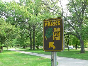
- Oak Leaf Trail
-
The Oak Leaf Trail (formerly 76 Bike Trail) is a paved 108-mile (174 km) multi-use recreational trail which encircles Milwaukee County, Wisconsin. [1] Clearly marked trail segments connect all of the major parks in the Milwaukee County Park System with a "ribbon of green."
Contents
Description
Early bicycling advocate Harold "Zip" Morgan first conceived and laid out a 64-mile (103 km) trail in 1939. The route made its way around the edge of the county and through natural resource corridors found along the rivers and lakefront. [2] Three decades later the trail was officially established by the Milwaukee County Park Commission, and in 1966 construction of the parkland trails began. [3] It became known as the 76 Bike Trail for the 76 miles (122 km) it spanned.
The present system of inter-connecting trails consists of 48 miles (77 km) of asphalt paths and 31 miles (50 km) of parkway, along with 27 miles (43 km) of municipal streets that have designated bicycle lanes and sidewalks. [2] An outer loop of 64.5 miles (103.8 km) joins together the 5.4-mile (8.7 km) Lake Loop, 1.6-mile (2.6 km) Lincoln Creek Spur, 2.6-mile (4.2 km) Whitnall Loop and 13.7-mile (22.0 km) East-West Connector. [3] The 2.1-mile (3.4 km) Root River Trail Extension was added in 2006. [1] Another 31 miles (50 km) are currently in the planning stages, including trail linkages with the newer Hank Aaron State Trail in the Menomonee Valley and Lakeshore State Park.
Scenery along the Oak Leaf Trail varies from woodland parks, nature reserves, and a wildlife corridor along the lakefront, to urban industrial settings in Milwaukee's downtown area.
-
The Oak Leaf Trail on the East Side
-
The Hank Aaron State Trail in the Menomonee River Valley
-
Oak leaf trail in McCarty park
See also
References
- ^ a b Ceremony to mark Oak Leaf Trail extension, Milwaukee Journal Sentinel, October 19, 2006.
- ^ a b Ray Hoven. Biking & Hiking the Greater Milwaukee Area. Antioch, Illinois: American Bike Trails, 2005.
- ^ a b Oak Leaf Trail offers scenic biking nestled in city limits, OnMilwaukee.com, May 30, 2004.
External links
Categories:- Wisconsin culture
- Transportation in Wisconsin
- Transportation in Milwaukee, Wisconsin
- Protected areas of Milwaukee County, Wisconsin
- Hiking trails in Wisconsin
- Geography of Milwaukee, Wisconsin
- Visitor attractions in Milwaukee, Wisconsin
-
Wikimedia Foundation. 2010.


