- O'Bryant Square
-
This article is about the park nicknamed Paranoia Park, aka "Paranoid Park". For the novel, see Paranoid Park (novel). For the film, see Paranoid Park (film).
 O'Bryant Square
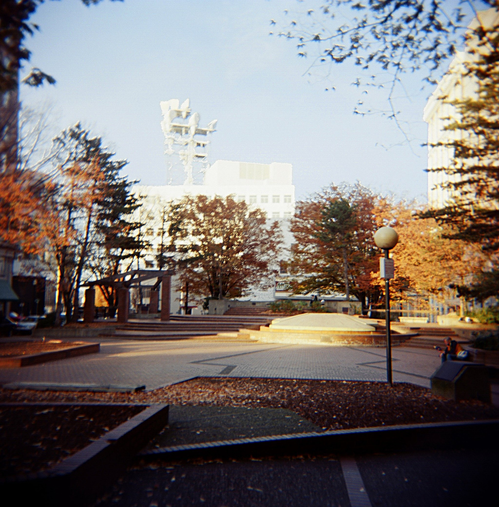
O'Bryant Square is a small park and fountain at the cross streets of Southwest Park Avenue and Stark Street in downtown Portland, in the U.S. state of Oregon. The park is officially O'Bryant Square, but also known as Paranoid Park, Paranoia Park and "Needle Park".[1]
In 1971, the property was donated to the city by Mr. and Mrs. William E. Roberts,[2] having once contained a quarter-block building and surface parking.[3] Development of the park and underground parking cost $1.25 million, backed by federal grants and bonds built on the projected parking revenue.[3] The park was popular in both the business and planning communities.[3]
The park got its nickname from near-exclusive frequenting by street kids, users of illicit drugs, sex workers, and homeless people due to a Portland Police Bureau precinct office across Ninth Avenue from the Northwest corner of the park. In the 1980s, Paranoia Park served as a hub for punk activity, and is also one of Tri-Met's last bus stops in the immediate downtown hub. The square serves as common point between many areas of interest to specific audiences. The park is the first open public space north, downhill, from the transportation and social center point of Portland, the Pioneer Courthouse Square. As a resting point, the park sits closely between many areas of interest to those in the street life, for example the Tri-Met transit mall, the east-west light rail service, the Portland Streetcar service, Powell's Books, and Burnside Street as well as Stark Street, home of Portland's The Roxy, which is open 24 hours most days. The park is designated as both part of Portland Police Bureau's "Drug-Free Zone" as well as "Prostitution-Free Zone", due to its frequent association with drug- and prostitution-related crimes.[citation needed] Formerly, several organizations for homeless and other youths were located in the buildings one block to the north, including the Salvation Army's Greenhouse, Street Church, Streetlight and Porchlight youth shelters, and the New Avenues for Youth Access and Reception Center. Often, while awaiting space in the shelters at night, or to regroup with fellow youths immediately after leaving in the morning, homeless youth would frequent the park as the closest open public space. The park also was host to regular meal offerings intended for the homeless. Due to its frequenting by homeless persons, areas of the park covered and sheltered from the Portland rain were sealed or otherwise re-exposed to the elements during the era of Mayor Vera Katz's sit-lie law.[citation needed]
Many places in the park are found by some to be suitably concealed from storefronts and shopping centers or the nearby police precinct, and because of terraced topography, as well as obstructions such as a former permanent Tri-Met bus shelter (which was sealed due to its frequent use by the homeless and for illicit purposes),[citation needed] landscaping fixtures, and a fountain which help to shield some areas of the park from immediate street view, Paranoia Park has served as a place for much illegal street activity.[citation needed]
The 2006 Blake Nelson young adult novel Paranoid Park and the 2007 Gus Van Sant film based on the novel take place in Portland, but Blake and Van Sant's Paranoid Park is Burnside Skatepark.
Laurie Olin was brought on to redesign the park in 2006 when he was designing Director Park.[4] Olin called O'Bryant "a real ugly duckling".[4] In 2007, The Oregonian called it "a relic of 1970s urban design".[5]
References
- ^ Gragg, Randy (1999-03-21). "Little Park Needs Less-Is-More Vision: Bring Less 'Vision' To Pocket Park; Park Block 5 Can Be An Urban Jewel, Unless Planners Cram In Too Many Amenities". The Oregonian. "it could turn into another O'Bryant Square, another missing Park Block now unofficially known as "Needle Park.""
- ^ http://www.portlandonline.com/parks/finder/index.cfm?PropertyID=488&action=ViewPark
- ^ a b c Mackenzie, Hilary (1988). The Portland Park Blocks: their origin and development (thesis). Seattle: University of Washington. OCLC 19841853.
- ^ a b Gragg, Randy (2006-11-08). "Sight Lines: Of parks and plazas". The Oregonian.
- ^ Leeson, Fred (2007-02-28). "Storm water utilized in designs for two parks". The Oregonian.
- The Portland Mercury:Asleep On The Street - Feb 21 – Feb 27, 2008
- Willamette Week Newspaper:SKOOL'S OUT 4-EVER? - August 29, 2001
Coordinates: 45°31′17″N 122°40′48″W / 45.521435°N 122.679918°W
Categories:- Parks in Portland, Oregon
- Protected areas established in 1971
Wikimedia Foundation. 2010.