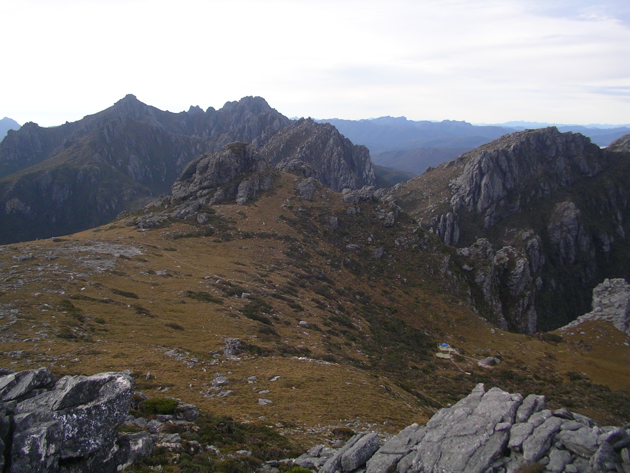
- Arthur Range
Geobox | Range
name = Arthur Range
native_name =
other_name =
other_name1 =

image_size = 290
image_caption = Looking across High Moor from Mount Columba towards Mount Capricorn and Mount Pegasus
country =Australia
country1 =
state =Tasmania
state1 =
region =South West Wilderness
region1 =
district =
district1 =
city =
city1 =
parent =
border =
border1 =
geology =
geology1 =
period =
period1 =
orogeny =
orogeny1 =
area =
length =
length_orientation =
width =
width_orientation =
highest =Federation Peak
highest location = Eastern Arthurs
highest_country =
highest_state =
highest_region =
highest_district =
highest_elevation = 1224
highest_lat_d = 43
highest_lat_m = 16
highest_lat_s = 17
highest_lat_NS = S
highest_long_d = 146
highest_long_m = 28
highest_long_s = 32
highest_long_EW = E
lowest =
lowest_location =
lowest_country =
lowest_state =
lowest_region =
lowest_district =
lowest_elevation =
lowest_lat_d =
lowest_lat_m =
lowest_lat_s =
lowest_lat_NS =
lowest_long_d =
lowest_long_m =
lowest_long_s =
lowest_long_EW =
free_type =
free =
map_size =
map_caption =
map_first =The Arthur Range is a
mountain range in theSouth West Wilderness ,Tasmania ,Australia . The range is broken into two main section, the Western Arthurs and the Eastern Arthurs. Both sections of the range are popular overnight bushwalking destinations, generally in summer.History
The range was named by
George Augustus Robinson who climbed Mount Frederick (nowMount Hayes ) in March 1830. [Cite book |last=Doran |first=Kevin |title=Federation: Australia's Adventure Peak |publisher=Desdichado |year=2004 |pages=pp 14 |isbn=0-9586935-1-X]Geology
It is mainly composed of
Quartzite and features evidence of pastglaciation such asmoraines andhanging valley s.Flora/Fauna
Much of the Arthur Range and the area surrounding land is covered by button grass wet sedgelands. Most of the remainder of the land is covered by eucalypt. Birds are the most common animals (e.g.
yellow tailed Black Cockatoo s). In dryer areas,Pademelon s may also be seen.Climate
The climate in the Arthur Range is extremely unstable - weather predictions are virtually useless here, as it is very common to have sun, heavy rain, cloud, strong winds, even snow all in the same day. The top of the range is classed as Sub-Alpine or Alpine. During winter these mountains are snowcapped. Snow has been experienced every season with regular freak snowfalls during summer, though many of these snowfalls don't settle. The climate is mostly decided by the wind. The temperature can chance very quick with warm air from Northern Tasmania, or very cold from the Southern Ocean and Antartica.
Walking
As with other parts of Tasmania's south-west, the trails are extremely muddy - very frequently it is more than ankle deep. The mud does not dissipate with altitude up the mountain range either, except where there is bare rock.
Like many other parts of Tasmania, this area is susceptible to
Phytophthora (root rot). To avoid spreading it, walkers are encouraged to stay to the main trail. In order to reduce mechanical damage to plants, walkers are also encouraged to wade through the middle of muddy track sections.Hikers should ensure they are well prepared for any weather conditions, and have enough food for one or two extra days.
Western Arthurs
The Western Arthurs extends generally East West from Mount Hesperus to West Portal. This section of the range was first traversed in the early 1960s. [Cite book |last=Chapman |first=John |title=South West Tasmania |edition=4 |publisher=JOHN CHAPMAN |year=1998 |pages=pp 12 |isbn=0-9596129-5-5]
Access to the Western Arthurs is usually from the Scotts peak dam camp site (coord|43|02|15|S|146|17|52|E|type:landmark_region:AU), although it is possible to enter via the end of the Port Davey track.
Lakes
The Western Arthurs are studded with many beautiful lakes formed from ice-age glaciers. Among these are:
*Lake Oberon (coord|43|08|55|S|146|16|20|E|type:landmark_region:AU) : The subject of a well known photograph byPeter Dombrovskis , and where there are camping platforms
*Lake Cygnus (coord|43|07|79|S|146|14|16|E|type:landmark_region:AU) : Also has an established camp site
*Lake Ceres (coord|43|08|29|S|146|15|11|E|type:landmark_region:AU)
*Square Lake (coord|43|08|29|S|146|15|46|E|type:landmark_region:AU)
*Lake Fortuna (coord|43|07|31|S|146|13|39|E|type:landmark_region:AU)Eastern Arthurs
The Eastern Arthurs runs North-South from the end of the Western Arthurs and includes the highest peak of the range, the striking
Federation Peak . This section of the range was first traversed in December 1947 by a group from the Hobart Walking Club. [Cite book |last=Chapman |first=John |title=South West Tasmania |edition=4 |publisher=JOHN CHAPMAN |year=1998 |pages=pp 144 |isbn=0-9596129-5-5]References
Wikimedia Foundation. 2010.
