- Pennine Alps
Geobox|Range
name=Pennine Alps
other_name= _fr. Alpes valaisannes
other_name1= _de. Walliser Alpen
other_name2= _it. Alpi Pennine
image_caption=
country=Switzerland |country1=Italy
region=Valais | region1=Piedmont | region2=Aosta Valley
parent=Alps
border=Graian Alps| border1=Lepontine Alps| border2=Bernese Alps
length=| length_orientation=
width= | width_orientation=
geology= | period= | orogeny=
highest=Dufourspitze
highest_elevation=4634
highest_lat_d=45|highest_lat_m=56|highest_lat_s=12|highest_lat_NS=N
highest_long_d=7|highest_long_m=52|highest_long_s=00|highest_long_EW=E
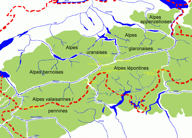
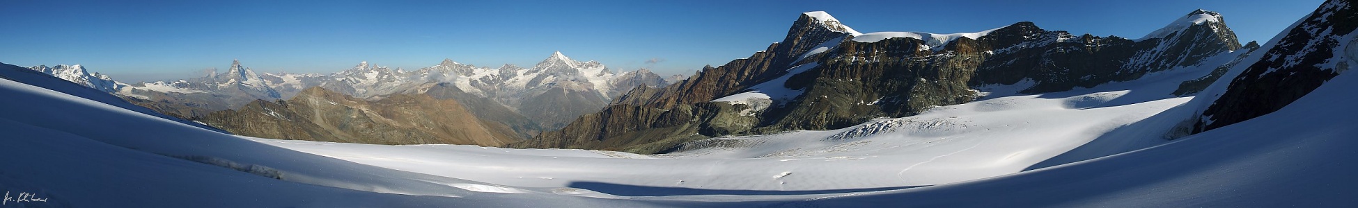
map_caption=Central AlpsThe Pennine Alps (also: "Valais Alps") are amountain range in the western part of theAlps . They are located inSwitzerland (Valais ) andItaly (Piedmont and theAosta Valley ). TheCol Ferret separates them from theMont Blanc Massif ; theDora Baltea valley separates them from theGraian Alps ; theSimplon Pass separates them from theLepontine Alps ; the Rhône valley separates them from theBernese Alps .The Italian side is drained by the rivers
Dora Baltea , Sesia andToce , tributaries of the Po. The Swiss side is drained by theRhône River .The
Great St Bernard Tunnel , under theGreat St Bernard Pass , leads fromMartigny, Switzerland toAosta .Peaks
The chief peaks of the Pennine Alps are:
ee also
*
Swiss Alps References
*1911
Wikimedia Foundation. 2010.
Pennine Alps — [pen′īn΄, pen′in] division of the W Alps, along the Swiss Italian border, northeast of the Graian Alps: highest peak, c. 15,200 ft (4,633 m) … English World dictionary
Pennine Alps — /pen uyn/ a mountain range on the border between Switzerland and Italy: part of the Alps. Highest peak, Monte Rosa, 15,217 ft. (4640 m). * * * ▪ mountains, Europe Italian Alpi Pennine, French Alpes Pennines, segment of the central Alps… … Universalium
Pennine Alps — geographical name section of Alps on border between Switzerland & Italy NE of Graian Alps see Rosa (Monte) … New Collegiate Dictionary
Pennine Alps — Pen′nine Alps′ [[t]ˈpɛn aɪn[/t]] n. pl. geg a mountain range on the border between Switzerland and Italy: part of the Alps. Highest peak, Monte Rosa, 15,217 ft. (4640 m) … From formal English to slang
Pennine Alps — SW div. of the Alps on the Swiss–Italian border … Webster's Gazetteer
Pennine Alps — /pɛnaɪn ˈælps/ (say penuyn alps) plural noun a mountain range on the Swiss–Italian border. Highest peak, Monte Rosa, 4638 m. Also, the Pennines …
Pennine Alps — /pen uyn/ a mountain range on the border between Switzerland and Italy: part of the Alps. Highest peak, Monte Rosa, 15,217 ft. (4640 m) … Useful english dictionary
Alps — /alps/, n. (used with a pl. v.) a mountain range in S Europe, extending from France through Switzerland and Italy into Austria, Slovenia, and Croatia. Highest peak, Mont Blanc, 15,781 ft. (4810 m). * * * I Mountain system, south central Europe.… … Universalium
Alps — Alpe redirects here. For the German river, see Alpe (river). For other uses, see Alps (disambiguation). Alps Range The … Wikipedia
Alps — (Roget s IV) n. Major divisions of the Alps include: Swiss, Italian, Austrian, Jurian, Cottian, Graian, Liqurian, Maritime, Bernese, Pennine, Lepontine, Rhaetian, Bavarian, Carnic; see also mountain 1 … English dictionary for students
Pennine Alps
18+
© Academic, 2000-2025
- Contact us: Technical Support, Advertising
Dictionaries export, created on PHP, Joomla, Drupal, WordPress, MODx.