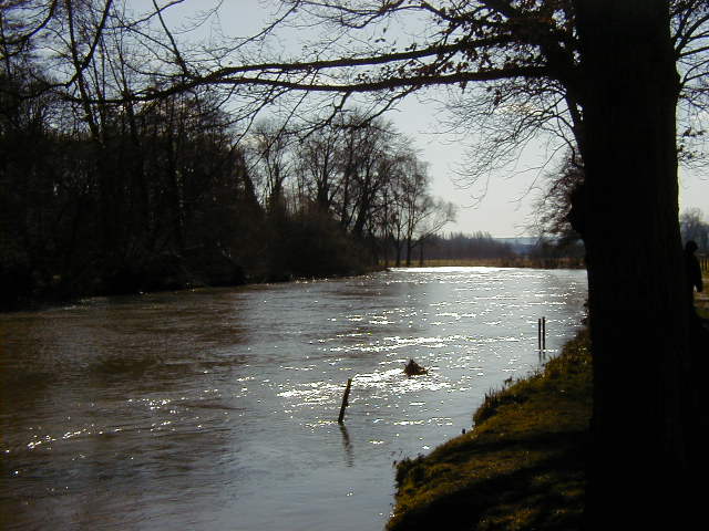
- Eure River
Infobox River | river_name = Eure

caption = The Eure
origin =Normandy
mouth =Seine
coord|49|18|22|N|1|9|20|E|name=Seine-Eure|display=inline,title
basin_countries =France
length = 229 km
elevation = 240 m
discharge = 26 m³/s
watershed = 5,935 m²The Eure is ariver in northernFrance , left tributary of theSeine . It rises atMarchainville in theOrne "département " and joins theSeine nearPont-de-l'Arche . Two "départements" are named after the Eure, namelyEure andEure-et-Loir .Places along the river:
*Orne (61):Marchainville ,La Lande-sur-Eure ,Neuilly-sur-Eure .
*Eure-et-Loir (28):Courville-sur-Eure ,Saint-Georges-sur-Eure ,Fontenay-sur-Eure ,Chartres ,Saint-Prest ,Maintenon ,Nogent-le-Roi ,Mézières-en-Drouais ,Cherisy ,Anet .
*Eure (27):Ivry-la-Bataille ,Garennes-sur-Eure ,Bueil ,Merey ,Pacy-sur-Eure ,Ménilles ,Chambray ,Croisy-sur-Eure ,Autheuil-Authouillet ,Acquigny ,Louviers ,Le Vaudreuil ,Pont-de-l'Arche ,Martot .Its main tributaries are the Avre and the
Iton .References
*http://www.geoportail.fr
* [http://sandre.eaufrance.fr/app/chainage/courdo/htm/H4--0200.php?cg=H4--0200 The Eure at the Sandre database]
Wikimedia Foundation. 2010.
