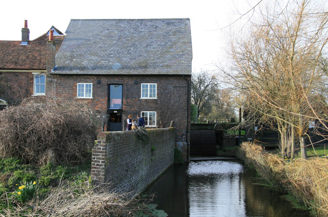
- Redbournbury Mill
Geobox|Watermill
name = Redbournbury Watermill
category = Watermill
image_caption = Redbournbury Watermill
symbol =
country =England
state =Hertfordshire
region =Southern England
district =City and District of St Albans
municipality =Redbourn
location = On theRiver Ver Between Redbourn and St Albans
elevation =
prominence =
lat_d =
lat_m =
lat_s =
lat_NS =
long_d =
long_m =
long_s =
long_EW =
length =
length_orientation =
width =
width_orientation =
height =
depth =
volume =
area =
author =
style =
material = Brick built with slate roof
established = 1790
date =
owner = REDBOURNBURY MILL
public =
visitation =
visitation_date =
access =
free = | free_type =
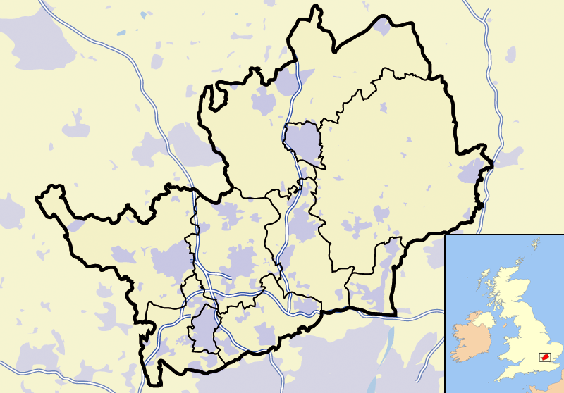
map_caption = Redbournbury Watermill within Hertfordshire
map_background =
map_locator =
map_locator_x =38
map_locator_y =41
website =
footnotes =Redbournbury Mill, a water-driven
flour mill, lies on theRiver Ver betweenSt Albans andRedbourn in the county ofHertfordshire ,England .One of its claims to fame is that it was run for much of the 20th century by Ivy Hawkins, claimed to be England's last lady commercial miller.
Today, after a ten-year restoration project, the mill is working again and producing organic flour that is sold at the mill and in local shops and markets (including
Harpenden farmers market), and is used by local restaurants.Adjacent to the mill are two deep fords which can be crossed by car with care, allowing a road connection between the A5 and A6 near
Harpenden . The fords are occasionally used as part of the route on local road rallies because of their tricky nature; following the wrong line can drop you into much deeper water without warning.The
bakery at Redbournbury Mill reopened to the public in July 2006, and 2007 has seen the introduction of periodic bakery courses at the mill bakery.External links
* [http://www.redbournmill.co.uk/ Rebournbury Mill]
Wikimedia Foundation. 2010.