Unterramsern

Unterramsern

Infobox Swiss town
subject_name = Unterramsern
municipality_name = Unterramsern
municipality_type = municipality
imagepath_coa = Unterramsern-blason.png|pixel_coa=
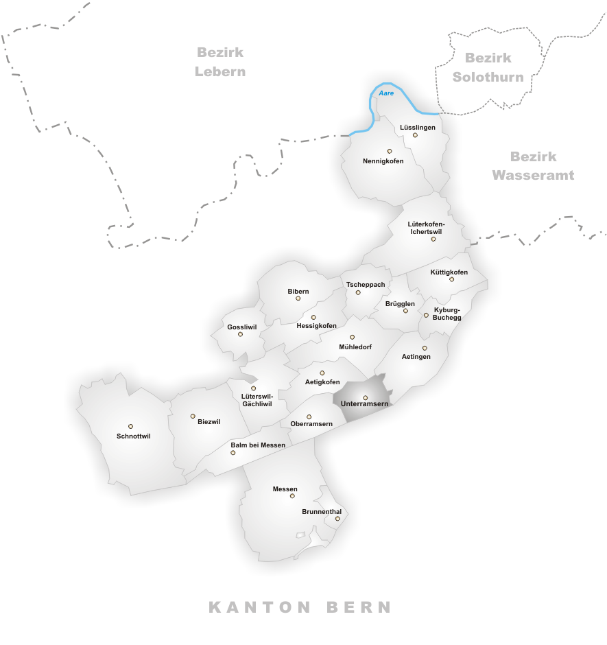


languages = German
canton = Solothurn
iso-code-region = CH-SO
district = Bucheggberg
lat_d=47|lat_m=7|lat_NS=N|long_d=7|long_m=29|long_EW=E
postal_code = 4588
municipality_code = 2463
area = 1.54
elevation = 475|elevation_description=
population = 198|populationof = December 2005 | popofyear = 2005
website =
mayor = |mayor_asof=|mayor_party=
mayor_title = |list_of_mayors =
places =
demonym =
neighboring_municipalities= Aetigkofen, Aetingen, Limpach (BE), Mühledorf, Mülchi (BE), Oberramsern
twintowns = |

Unterramsern is a municipality in the district of Bucheggberg, in the canton of Solothurn, Switzerland.


Wikimedia Foundation. 2010.

Игры ⚽ Нужно сделать НИР?

Look at other dictionaries:

  • Unterramsern — Basisdaten Staat: Schweiz Kanton …   Deutsch Wikipedia

  • Unterramsern — Escudo …   Wikipedia Español

  • Unterramsern — Une vue d ensemble de la commune serait la bienvenue Administration Pays Suisse Canton Soleure …   Wikipédia en Français

  • Bezirk Bucheggberg — Basisdaten Kanton: Solothurn Hauptort: Mühledorf SO BFS Nr.: 1103 Fläche …   Deutsch Wikipedia

  • Ätigkofen — Aetigkofen Basisdaten Kanton: Solothurn Bezirk: Bucheggberg …   Deutsch Wikipedia

  • Ätingen — Aetingen Basisdaten Kanton: Solothurn Bezirk: Bucheggberg …   Deutsch Wikipedia

  • Distrito de Bucheggberg — Saltar a navegación, búsqueda Distrito de Bucheggberg …   Wikipedia Español

  • Mühledorf, Solothurn — For other places with the same name, see Mühledorf (disambiguation). Mühledorf Country Switzerland …   Wikipedia

  • Aetigkofen — Basisdaten Staat: Schweiz Kanton …   Deutsch Wikipedia

  • Aetingen — Basisdaten Staat: Schweiz Kanton …   Deutsch Wikipedia

Share the article and excerpts

Direct link
Do a right-click on the link above
and select “Copy Link”