- Tahquamenon Falls
Infobox Waterfall
name = Tahquamenon Falls
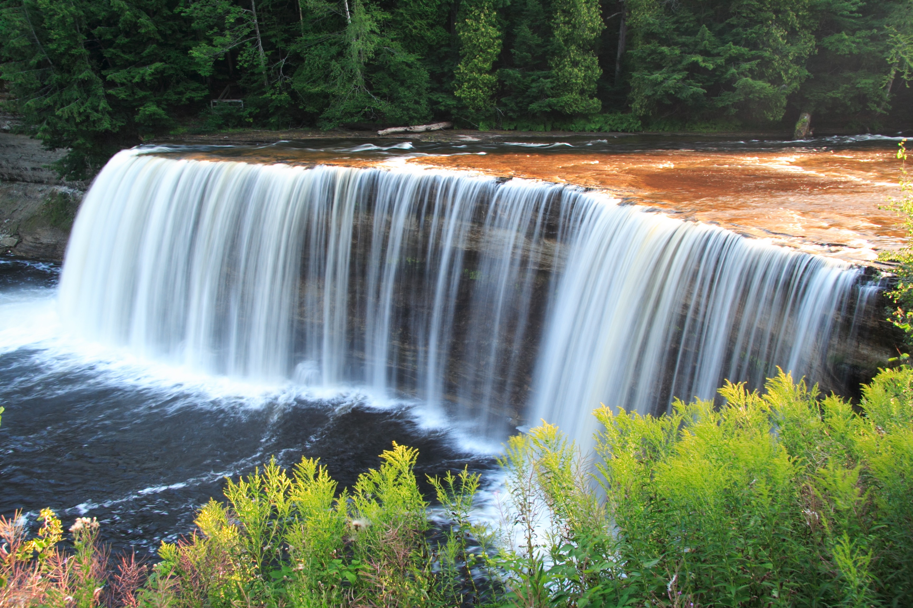
caption = The Upper Tahquamenon Falls
location =Tahquamenon Falls State Park , Chippewa County,Michigan
coordinates = coord|46.574|-85.256|display=inline,title|name=Upper Tahquamenon Falls
watercourse = Tahquamenon River
type =
height = 50 ft (15 m)
height_longest =
number_drops = 6
average_flow = 7,000 gallons per second (average annual mean) [http://mi.water.usgs.gov/ Data courtesy USGS ]
world_rank =The Tahquamenon Falls are two different
waterfall s on theTahquamenon River . Both sets are located nearLake Superior in the easternUpper Peninsula of Michigan . The water is notably brown in color from thetannin s leached from the cedarswamp s which the river drains. This phenomenon is responsible for the alternative local name 'Root Beer Falls'.The upper falls are more than 200 feet (60 m) across and with a drop of approximately 50 feet (15 m). During the late-spring runoff, the river drains as much as 50,000 gallons (200,000 liters) of water per second, making the upper falls the third most voluminous vertical waterfall east of the
Mississippi River , afterNiagara Falls andCohoes Falls , both in New York State.The lower falls, located four miles (6.5 km) downstream, are a series of five smaller falls cascading around an island which can be reached by rowboat. A hiking trail runs between the falls along the riverside.
The falls are within the
Tahquamenon Falls State Park , betweenNewberry, Michigan , andParadise, Michigan . They are a popular tourist destination in theUpper Peninsula during all seasons. Snowmobile trails lead almost to the falls, and walkways are kept clear for most of the winter.The Tahquamenon is noted as being the land of Longfellow's "
The Song of Hiawatha " - "by the rushing Tahquamenaw" where Hiawatha built his canoe. "Tahquamenon Falls" is also a song from Sufjan Stevens's album "Michigan".While the name Tahquamenon is now primarily associated with the falls, it appears to have originally designated an island in
Whitefish Bay : Tahquamenon Island. The first written record of the name appears as "Outakouaminan" in a 1671 French map. [http://www.michigandnr.com/publications/pdfs/edopps/TFSPname.pdf]The upper falls are located at coord|46|34|29|N|85|15|23|W| and the lower falls are at coord|46|36|12|N|85|12|25|W|
Photo Gallery
External links
* [http://www.michigandnr.com/parksandtrails/ParksandTrailsInfo.aspx?id=428 Tahquamenon Falls State Park]
* [http://www.superiorsights.com/information/tahquamenonfalls/ Superior Sights entry on Tahquamenon Falls]
Wikimedia Foundation. 2010.