- Jesmond Dene
-
For the place in California, see Jesmond Dene, California.
Coordinates: 54°59′38″N 1°35′38″W / 54.994°N 1.594°W
Jesmond Dene 
Jesmond Dene ca. 1900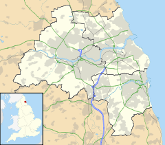
 Jesmond Dene
 Jesmond Dene shown within Tyne and Wear
OS grid reference NZ260667 List of places: UK • England • Tyne and Wear Jesmond Dene is a public park in the east end of Newcastle upon Tyne, England. It occupies the narrow steep-sided valley of a small stream known as the Ouseburn: in North-east England, such valleys are commonly known as denes.
The park was first laid out by William George Armstrong and his wife, of Jesmond Dene House, during the 1860s. The design is intended to reflect a rural setting, with woodland, crags, waterfalls and pools. It is now owned by Newcastle City Council.
The (now closed to road traffic) iron constructed Armstrong Bridge spans the Dene and through the 1990's used to host to a crafts fair every Sunday morning, although as of 2011 this has now ceased to exist, with some of the stands moving to the Sunday market on the Newcastle Quayside. The building of a replacement road and tunnel, The Cradlewell By-pass, was the subject of a road protest camp around 1993, due to the destruction of many 200 year old trees.[1] See also See also, 'Cradlewell'.
Jesmond Dene also contains a free entry petting zoo known as "Pets' Corner", which has been a popular family attraction since the 1960s. Attractions within Jesmond Dene include a coffee shop, a conference centre and a restaurant.
As of 2011, the field area and pets corner have been re-developed. The redevelopment includes a new road and a bridge over the Ouseburn river.
References
External links
Categories:- Newcastle upon Tyne
- Parks and open spaces in Tyne and Wear
- Valleys of England
- Visitor attractions in Newcastle upon Tyne
- Tyne and Wear geography stubs


Wikimedia Foundation. 2010.