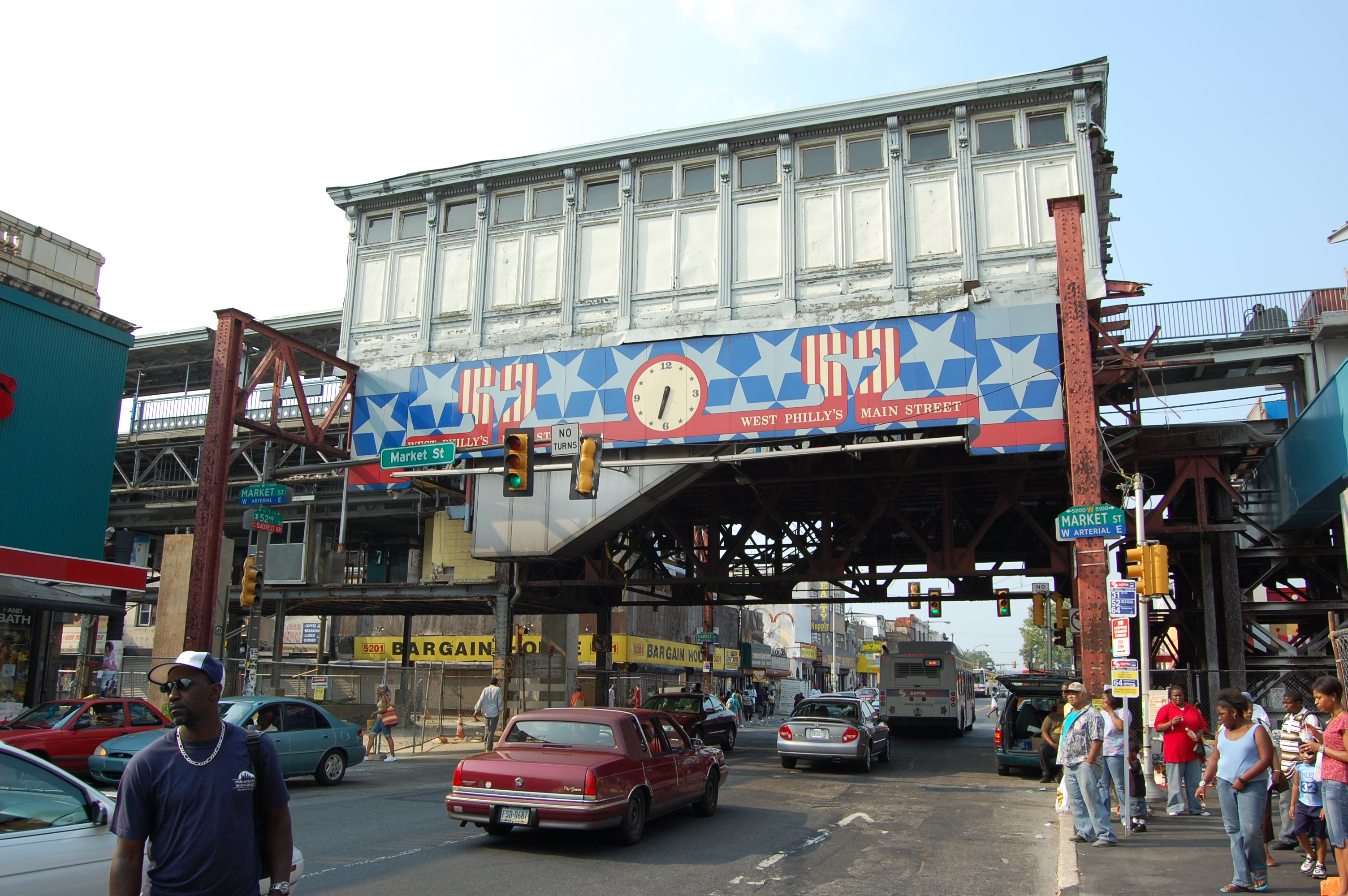
52nd Street (SEPTA station)
- 52nd Street (SEPTA station)
Infobox Station
name=52nd Street
type= SEPTA rapid transit station

image_size=300px
image_caption= Exterior of station from street level.
address=52nd & Market Streets
Philadelphia, Pennsylvania
coordinates=
line=rail color box|system=SEPTA|line=Market-Frankford
other=Bus routes 31, 52, and G
platform=2 side platforms (Market-Frankford)
passengers=
pass_year=
pass_percent=
pass_system=
opened=
owned=Southeastern Pennsylvania Transportation Authority
rebuilt=April 14, 2008
ADA=yes
services=s-rail|title=SEPTA
52nd Street Station is an elevated stop on the Market-Frankford Line, above the intersection of 52nd Street and Market Street in Philadelphia, Pennsylvania. The station lies at the junction of four neighborhoods. Haddington is to the northwest, Dunlap to the northeast, Walnut Hill lies to the southeast, and Cobbs Creek to the southwest.
SEPTA bus routes at 52nd Street include 31, 52, and G. 52nd Street is a major shopping corridor.
52nd Street Station was reconstructed in 2007 as part of SEPTA's reconstruction of the Market Street Elevated line.
The News Media and Philadelphia Police Department have labeled this intersection, "The Worst Corner In The City" due to the high crime and rate of shootings on the block. There were 16 shootings within a 4 month span beginning February 2007. [cite news | first=David | last=Gambacorta | coauthors= | title=52nd & Market Called City's Deadliest Corner | date=2007-04-11 | publisher= | url =http://www.accessmylibrary.com/coms2/summary_0286-30287881_ITM | work =Philadelphia Inquirer | pages = | accessdate = 2008-09-04 | language = ]
References
External links
* [http://www.septa.org/maps/click_map/52nd_street.html SEPTA - 52nd Street MFL Station]
Wikimedia Foundation.
2010.
Look at other dictionaries:
52nd Street (Pennsylvania Railroad station) — 52nd Street is a closed railroad station in the West Philadelphia section of Philadelphia, Pennsylvania. It was built by the Pennsylvania Railroad (PRR) at the junction of its Main Line and its Schuylkill Branch. Today, these lines are the SEPTA… … Wikipedia
SEPTA Regional Rail — Infobox SG rail railroad name=SEPTA Regional Rail logo filename=SEPTA.svg system map size=300 map caption=SEPTA Regional Rail system map logo size=100 old gauge=RailGauge|sg marks=SPAX locale=Delaware Valley start year=1983 end year=present hq… … Wikipedia
SEPTA City Transit Division surface routes — SEPTA City Transit Division SEPTA New Flyer DE40LF #5606H waits at 4th Market Streets in Center City Philadelphia. Slogan … Wikipedia
30th Street Station — Philadelphia/30th Street Station 30th Street Station, von Südosten aus gesehen Daten Betriebsart Etagenbahnhof … Deutsch Wikipedia
Penn Central 30th Street Station — Philadelphia/30th Street Station 30th Street Station, von Südosten aus gesehen Bahnhofsdaten Art … Deutsch Wikipedia
Penn Central Station — Philadelphia/30th Street Station 30th Street Station, von Südosten aus gesehen Bahnhofsdaten Art … Deutsch Wikipedia
Pennsylvania Station 30th Street — Philadelphia/30th Street Station 30th Street Station, von Südosten aus gesehen Bahnhofsdaten Art … Deutsch Wikipedia
West Philadelphia Station — Philadelphia/30th Street Station 30th Street Station, von Südosten aus gesehen Bahnhofsdaten Art … Deutsch Wikipedia
Broad Street Station (Philadelphia) — Broad Street Station was a railroad station built in 1881 and served as Philadelphia, Pennsylvania s primary rail hub until the Pennsylvania Railroad (PRR) completed 30th Street Station in 1933. Originally designed by the Wilson Brothers, it was… … Wikipedia
R6 (SEPTA) — The SEPTA R6 is a route of the US SEPTA Regional Rail (commuter rail) system. One end of the route terminates in the western suburbs in the Bala Cynwyd section of Lower Merion Township, while the other end terminates at Elm Street in Norristown,… … Wikipedia

