- Belledonne
Geobox | Range
name=Belledonne
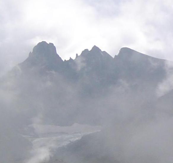
image_caption=Three main peaks of Belledonne, seen from the northwest
map_caption=
country=France
region=
parent=Dauphiné Alps
length= 60 | length_orientation=
width= 10 | width_orientation=
highest=Grand Pic de Belledonne
highest_elevation=2977
highest_lat_d=45|highest_lat_m=03|highest_lat_s=|highest_lat_NS=N
highest_long_d=5|highest_long_m=48|highest_long_s=|highest_long_EW=EBelledonne ( _fr. La chaine de Belledonne) is a
mountain range in theDauphiné Alps (part of theFrench Alps ) in southeastFrance . The southern end of the range forms the eastern wall of the mountains that surround the city ofGrenoble .The range is noted for the spectacular scenery it provides the inhabitants of Grenoble, numerous ski areas, interesting geology, and a diverse range of alpine land types and uses.
Geography
The range is approximately 60 km long by between 10 km wide and runs from roughly coord|45|03|N|5|48|E, 16 km south-south-east of the city of
Grenoble , in a north-easterly direction (actually 35 degrees) for 65 km to roughly coord|45|33|N|6|17|E, near the town ofAiguebelle . The highest point is theGrand Pic de Belledonne , 2977 m./9767 ft.The range is delineated by several valleys which lie at relatively low altitude, including the Grèsivaudan (which carries the
Isère River ) on the west, Arc to the north and theRomanche to the south. The range contains at least 16 peaks over 2,500 metres, 10glaciers , and 26 alpine lakes, the highest of which is over 2,400 metres above sea level.Geologically, the range is effectively a concatenation of ranges which are not physically separated. These ranges ( _fr. massifs) are, from north to south: the Grand Arc, the Lauzière, the Sept-Laux, Belledonne proper, and the Taillefer cite web|last= |first= |authorlink= |coauthors= | date= | url=http://www.geol-alp.com/belledonne/index_belledonne.html |title=Chaîne de Belledonne (au sens large) Structure hercynienne et constitution du socle |format= |work=Géologie et paysages dans les Alpes françaises |pages= |publisher=Maurice Gidon, professeur de géologie à l'Université scientifique et médicale de Grenoble | language= French|accessdate=2006-08-07 ]
A significant feature is the
Belledonne Balcony ( _fr. Le Balcon de Belledonne), which is a terrace or plateau some 30 km long on the western side of the range that provides a relatively level area intersected by narrow ravines eroded by rivers taking runoff from the snow levels higher up. The Balcony has supported diverse livestock-raising and other agricultural activity for a considerable period of time.Principal summits
*Le
Grand Pic de Belledonne , 2977 m. (highest point in the range)
*La Croix de Belledonne, 2929 m.
*Le Rocher Blanc, 2927 m.
*Les Aiguilles de l'Argentière, 2915 m.
*Le Rocher Badon, 2912 m.
*La Pyramide, 2912 m.
*Le Puy Gris, 2908 m.
*Le Bec d'Arguille, 2891 m.
*L'Aiguille d'Olle, 2885 m.
*Le Rocher d'Arguille, 2885 m.
*La Pointe de Comberousse, 2866 m.
*La Grande Lance d'Allemond, 2842 m.
*Le Charmet de l'Aiguille, 2826 m.
*La Pointe de la Porte d'Eglise, 2812 m.
*Le Pic du Frêne, 2807 m.
*Le Pic du Grand Doménon, 2802 m.
*Le Grand Morétan, 2800 m.
*La Grande Lance de Domène, 2790 m.
*Le Grand Charnier d'Allemont, 2777 m.
*Le Pic Couttet, 2764 m.
*Le Grand Crozet, 2762 m.
*Le Pic de la Grande Valloire, 2758 m.
*La Selle du Puy Gris, 2758 m.
*Le Rocher de l'Homme, 2755 m.
*Roche Rousse, 2753 m.
*Le Pic Lamartine, 2752 m.
*La Grande Lauzière, 2741 m.Principal glaciers
*Glacier de la Sitre
*Glacier de Freydane (seul véritable glacier crevassé)
*Glacier de l'Amiante
*Glacier du Rocher Blanc
*Glacier de la Combe Madame
*Glacier de l'Argentière
*Glacier d'Arguille
*Glacier du Puy Gris
*Glacier du Gleyzin
*Glacier de ClaranPrincipal passes
*Col de la Pra, 2171 m.
*Col de Belledonne, 2785 m.
*Col de Freydanne, 2645 m.
*Col de la Mine de Fer, 2400 m.
*Brèche de Roche Fendue, 2482 m.
*Pas de la Coche, 1989 m.
*Col des Sept Laux, 2184 m.
*Col de la Croix, 2529 m.
*Col du Tepey, 2716 m.
*Col de la Valloire, 2751 m.
*Col du Merlet, 2286 m.
*Col de la Bourbière, 2352 m.
*Col de la Frèche, 2183 m.
*Col de la Perrière, 2003 m.
*Col de la Perche, 1984 m.
*Col de Roche Noire, 2629 m.
*Col de la Balmette, 2667 m.Principal lakes
*Lac Achard, 1917 m.
*Lac Robert, 1998 m.
*Lac Longet, 2027 m.
*Lac Merlat, 2044 m.
*Lac du Crozet, 1974 m.
*Lac du Petit Doménon, 2380 m.
*Lac du Grand Doménon, 2385 m.
*Lac de la Sitre, 1952 m.
*Lac de Belledonne, 2163 m.
*Lac Blanc, 2161 m.
*Lac de Crop, 1906 m.
*Sept Laux
*Lac de la Sagne, 2065 m.
*Lac de la Corne, 2083 m.
*Lac Jeplan, 2144 m.
*Lac de l'Agnelin, 2327 m.
*Lac du Cos, 2182 m.
*Lac Blanc, 2248 m.
*Lac Cottepens, 2128 m.
*Lac Carré, 2128 m.
*Lac de la Motte, 2128 m.
*Lac Noir, 2091 m.
*Lac de la Croix, 2415 m.
*Lac de la Folle, 2142 m.
*Lac Blanc, 2124 m.
*Lac Noir, 2268 m.
*Lac des Balmettes, 2196 m.Origin of the name
The origin of the name is not clear. The phrase "belle donne" means "beautiful women" in Italian. It does not appear to mean that in
Occitan , and since Occitan is the ancient regional language, would have been a more likely source of ancient names than Italian. Nevertheless, from one angle the highest peak, the "Grand Pic du Belledonne" allegedly looks like a woman holding a baby. Other suggested derivations are from the celtic "donne" meaning "valley", hence "beautiful valleys", or indo-european "bal", meaning "elevated rock", which evolved into "bel", then "belle". It is difficult without evidence to determine the validity of these derivations.Fauna
The mountains are home to
marmot s,chamois andibex mountain goats andgrouse . Reportedly, wolves have returned since 1998.References
The Alps Geology site is an excellent source for geological information on the Belledonne Range and on all of the
French Alps .
Wikimedia Foundation. 2010.