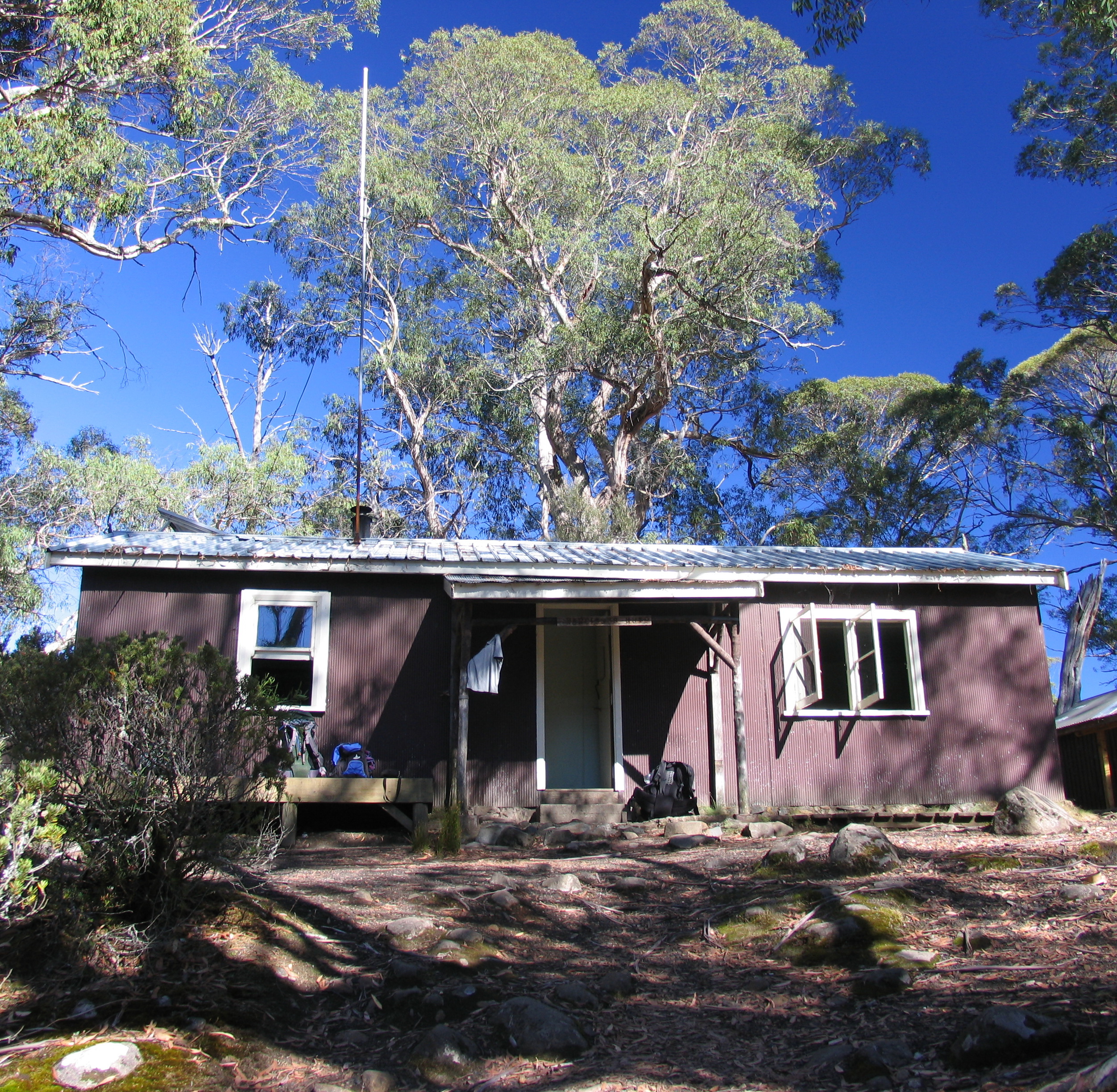
- Narcissus Hut
-
Narcissus Hut 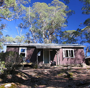
National Park Cradle Mountain-Lake St Clair National Park State Tasmania, Australia Grid Reference E425611 N5348442 (GDA94 Datum) GPS Reference 42°0′45.115″S 146°6′5.763″E / 42.01253194°S 146.10160083°E Built in 1935 Built by National Park Board in 1938, and rebuilt 1963 Built for Hiking on Overland Track Maintained By Tasmania Parks and Wildlife Service Access By Foot and Boat Narcissus Hut is an alpine hut located in the Central Highlands of Tasmania. It was built in 1935 and rebuilt in 1963.[1]
Narcissus Hut is located on Lake St Clair, on the Overland Track.
Contents
Facilities
- Bunks (no mattresses)
- Table & Benches
- Composting toilet
- Rainwater tank
- Radio, for communication with ferry operator
Access
By foot (Overland Track)
To the north, the Overland Track follows the Narcissus river to Windy Ridge Hut, approximately three hours walk.
To the south, it skirts the southern shore of Lake St Clair for 5–6 hours, arriving at the Cynthia Bay trailhead, and the Visitors Centre.
By boat
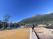 Walkers arrive at the Lake St Clair Jetty.
There is a small jetty on the lake near the hut. During the peak summer season, a ferry runs between the visitors centre and Narcissus Hut, taking 30 minutes and costing A$37.50.
Camping
...
References
- ^ Boss-Walker, Ian (1964) Peaks and High Places - Cradle Mt - Lake St Clair National Park Tasmania Hobart, Scenery Preservation Board. - page 68
External links
Categories:- Huts in Australia
- Mountain huts
- Australian building and structure stubs

Wikimedia Foundation. 2010.