Overton, Greenock

Overton, Greenock
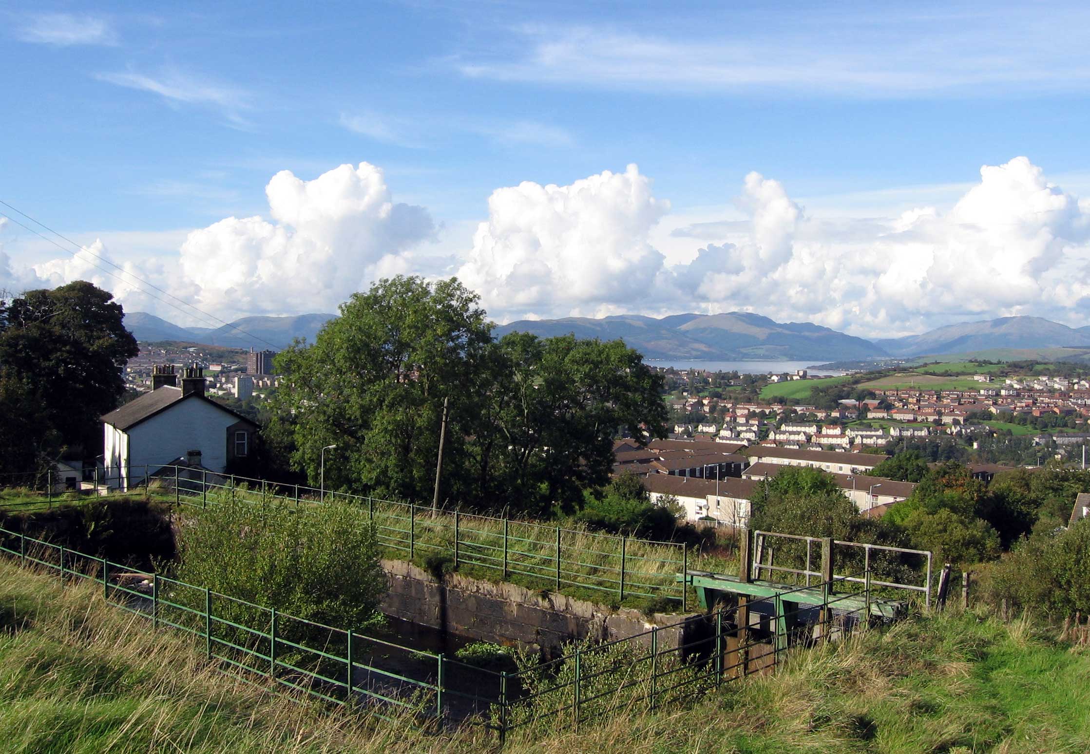
Shaws Water Works compensation reservoir and water engineer's house overlooking the houses of Overton.

Overton is an area in the suburbs of Greenock, Inverclyde. Overton offers excellent views across the River Clyde and suburban Greenock.

The area is the closest in Greenock to "The Cut" which was completed in 1827, bringing a water supply 9 km (5.6 mi) from Loch Thom to Overton, where the Shaws Water Works provided power to mills down the hill slope from Overton as well as the water supply for the town of Greenock. The nearly horizontal pathway beside the cut soon became a popular walk, offering views over the town and beautiful scenery. An alternative track goes over the hill from Overton to Loch Thom and is more challenging.Coordinates: 55°56′13″N 4°46′44″W / 55.93701°N 4.77879°W / 55.93701; -4.77879


Wikimedia Foundation. 2010.

Игры ⚽ Поможем сделать НИР

Look at other dictionaries:

  • Overton — ist Name bzw. Namensbestandteil von Verwaltungseinheit: in den USA: eines Countys im US Bundesstaat Tennessee, siehe Overton County eines Ortes im US Bundesstaat Alabama, siehe Overton (Alabama) einer Stadt im US Bundesstaat Texas, siehe Overton… …   Deutsch Wikipedia

  • Overton — may refer to: People Constantine Overton David M. Overton Doug Overton Edward Overton, Jr. (1836 1903), United States representative from Pennsylvania Elli Overton Frank Overton Guy Overton Hall Overton Iain Overton John Overton (judge) (1766… …   Wikipedia

  • Greenock — infobox UK place country = Scotland official name= Greenock gaelic name= Grianaig scots name= Greenock population= 45,467 (2001 Census) os grid reference= NS275764 longitude= 4.76415 latitude= 55.94957 unitary scotland= Inverclyde lieutenancy… …   Wikipedia

  • Wellington Academy — was a secondary school in Greenock, Scotland serving the Eastern and Central areas of the town. It was opened in August 1990, as a result of a controversial mergerFact|date=December 2007 with Cowdeknowes High School (now Notre Dame RC High… …   Wikipedia

  • Clyde Muirshiel Regional Park — is the collective name for areas of countryside set aside for conservation and recreation on the South Clyde estuary in Scotland. The Park covers an area of 108 square miles (280 km2) of Inverclyde, North Ayrshire and Renfrewshire,… …   Wikipedia

  • List of state schools in Scotland/Council Areas I-R (excluding cities) — The following is a partial list of currently operating state schools in the unitary council area of Inverclyde, Midlothian, Moray, North Ayrshire, North Lanarkshire, Orkney Islands, Perth and Kinross and Renfrewshire in Scotland, United Kingdom.… …   Wikipedia

  • Inverclyde Academy — Infobox UK school name = Inverclyde Academy size = latitude = longitude = dms = motto = motto pl = established = 2007 approx = closed = c approx = type = Comprehensive religion = president = head label = head = r head label = r head = chair label …   Wikipedia

  • Loch Thom — Infobox lake lake name = Loch Thom image lake = Loch Thom2.jpg caption lake = image bathymetry = caption bathymetry = location = Inverclyde coords = Coord|55|54|40|N|4|47|10|W|region:GB type:waterbody|display=inline,title type = reservoir,… …   Wikipedia

  • List of Church of Scotland parishes — The Church of Scotland, the national church of Scotland, divides the country into presbyteries, which are subdivided into parishes, each served by a parish church, usually with its own minister. Unions and readjustments may however result in a… …   Wikipedia

  • West Kilbride — Infobox UK place official name= West Kilbride gaelic name= scots name= local name= country= Scotland map type= Scotland population= 4,393 population density= os grid reference= NS205485 edinburgh distance= london distance= latitude= 55.6966… …   Wikipedia

Share the article and excerpts

Direct link
Do a right-click on the link above
and select “Copy Link”