- Clyde Muirshiel Regional Park
-
Clyde Muirshiel Regional Park is the collective name for areas of countryside set aside for conservation and recreation on the South Clyde estuary in Scotland.
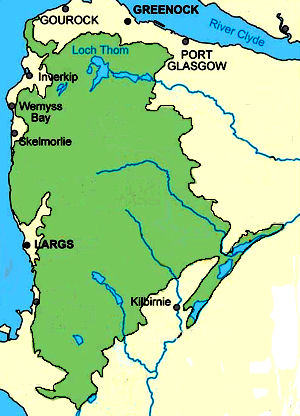
The Park covers an area of 108 square miles (280 km2) of Inverclyde, North Ayrshire and Renfrewshire, stretching from Greenock in the north, down the coast to Largs and West Kilbride and inland to Dalry and Lochwinnoch.
It consists of Castle Semple Loch and Collegiate Church, The Greenock Cut Centre (formerly Cornalees Bridge), Muirshiel Country Park, Barnbrock Farm, Lunderston Bay, Locherwood, Haylie Brae and Knockendon.
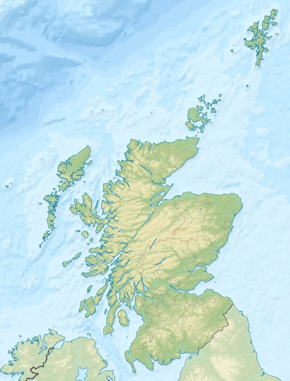
 Location of Clyde Muirshiel Regional Park
Contents
Origins
 Extent of the park area
A Regional Park designation for the area was first proposed in 1947. However it was 20 years later that Renfrewshire County Council proposed the Renfrewshire Regional Park and implemented a programme to manage an area of 30,000 acres (120 km2) including the creation of Muirshiel Country Park in June 1970. Castle Semple Water Park followed in 1971 and the Cornalees Bridge Visitor Centre opened in 1973. Responsibility for the parks was taken over by Strathclyde Regional Council in 1975 before the Clyde Muirshiel Park Authority came into existence in 1990. Today the Authority's committee comprises councillors from the three local authorities as well as Scottish Natural Heritage.
Facilities within the park
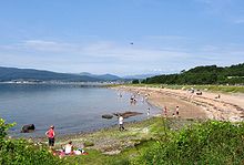 Lunderston Bay Beach and picnic area.
Two Country Parks with visitors centres are located within the regional park at Castle Semple and Muirshiel, together with a separate visitors centre at Cornalees. An outdoor activity centre and boat and bike hire facilities are based at Castle Semple. Barnbrock hosts a campsite, community woodlands are to be found at Locherwoods and Outerwards and a sandy beach is at Lunderston Bay. The Greenock cut and the Collegiate church will interest the historians and there are numerous other sites, such as the Haylie Brae, with car parking for visitors to enjoy picnics, good views, wildlife, walks and cycles.
Activities
Clyde Muirshiel offers year round instructor led activities include sailing, kayaking, canoeing and raft building on the shallow inland Castle Semple Loch as well as land based activities such as archery, mountain biking, hill walking, orienteering, navigation and first aid.
The Sustrans Cycle track
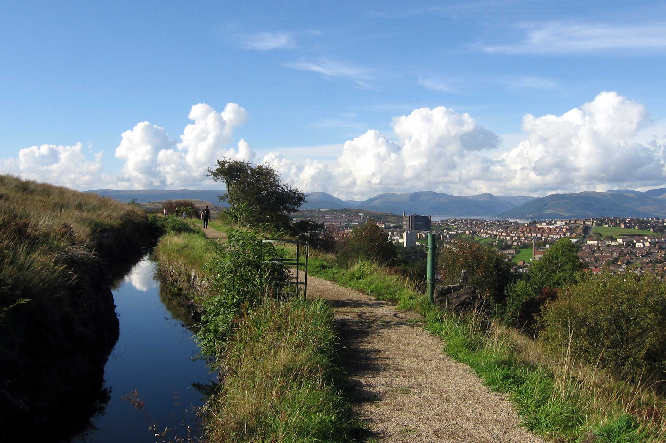
The Sustrans Lochwinnoch Loop Line cycle track runs through the Castle Semple Loch visitors centre. It is 14 miles (23 km) long and is part of the Lochs and Glens Route. It follows the National Cycle Route 75 from Paisley Canal Railway Station to Johnstone and then heads southwest to Kilbarchan, Lochwinnoch and Kilbirnie passing Castle Semple, Barr and Kilbirnie Lochs. Being mainly built on an old railway line it has easy gradients and is mostly traffic free.
Views of Clyde Muirshiel - 2007
-

Cornalees Visitors Centre.
-

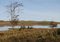
A view of Loch Thom.
-

Rottenburn Bridge.
-

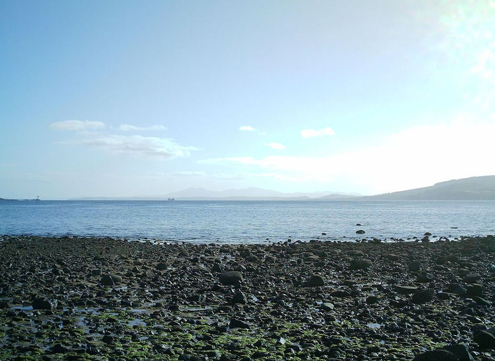
The view south from Lunderston looking towards the Isle of Arran.
-

Gryfe Reservoir, Close to Loch Thom.
-

Munnoch Reservoir on the B780.
-

Wildflowers near Munnoch Reservoir on the B780.
-

The view from Fairlie Moor road across to Arran.
-

The view of Arran & Cumbrae from the hills above Largs.
-

Mill Glen Reservoir on the B780.
-

Busbie Muir Reservoir on the B780.
-

Glenburn Reservoir on the Fairlie Moor road (Fairlie to Dalry), about 1-mile (1.6 km) east from the A78.
-
A view of Loch Thom in autumn.
-

The Brisbane Glen road in autumn.
-

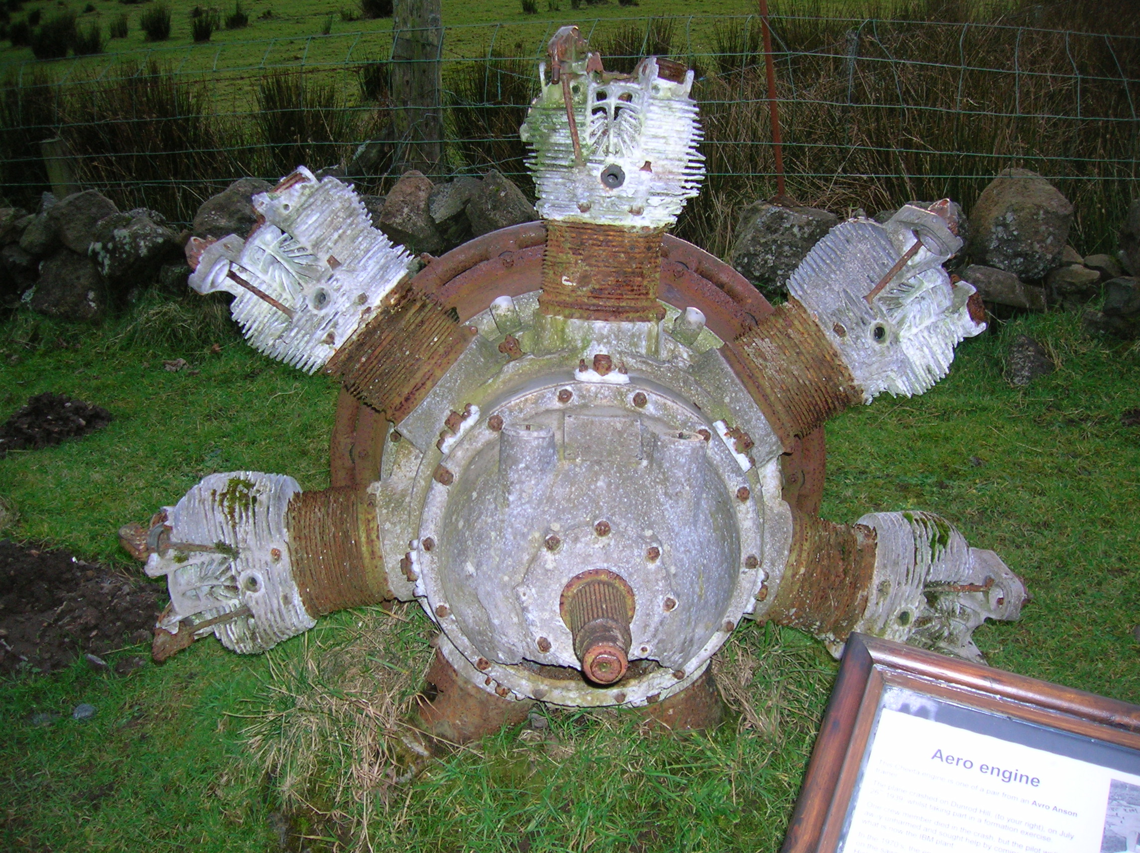
The engine from an Avron Anson which crashed at Dunrodin Hill near Cornalees Bridge.
Historic sites
The Castle Semple Collegiate church
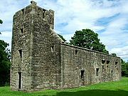 Castle Semple Collegiate Church, on the southern shore of the Castle Semple loch.
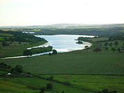 Castle Semple from the 'Temple' hill.
This Church was founded and endowed ; it stands near where the original Sempill Castle once stood. Castle Semple was a Collegiate church, which means that it was administered and served by a college of canons or prebendaries, presided over by a dean or provost. Collegiate churches were often supported by lands held by the church, endowed here in 1504 by John, 1st Lord Sempill. The church is built in a late Gothic style with a rectangular body and square tower at the west end and a three sided apse at the east end. The Church is in the care of Historic Scotland.
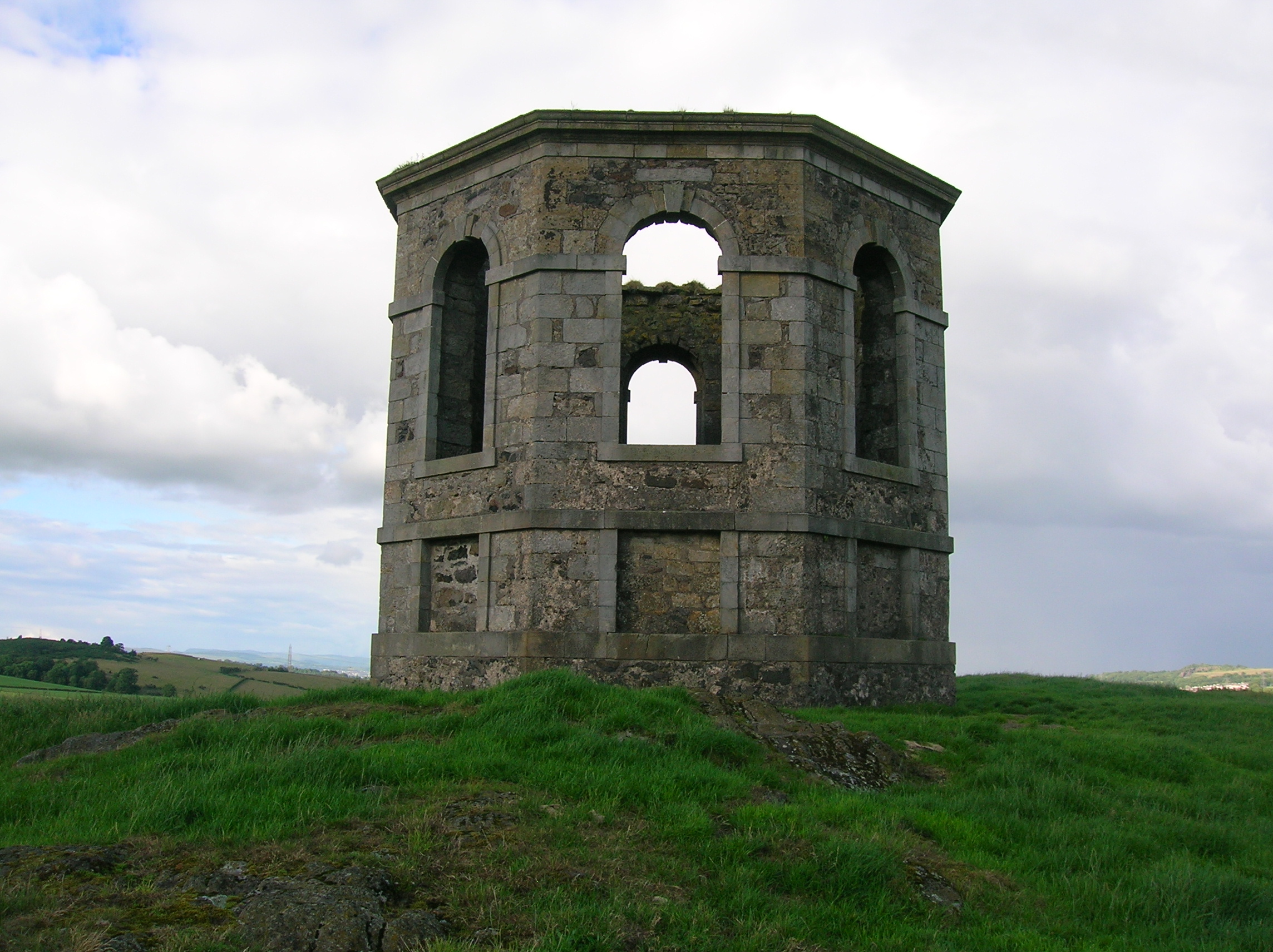
The Castle Semple Temple
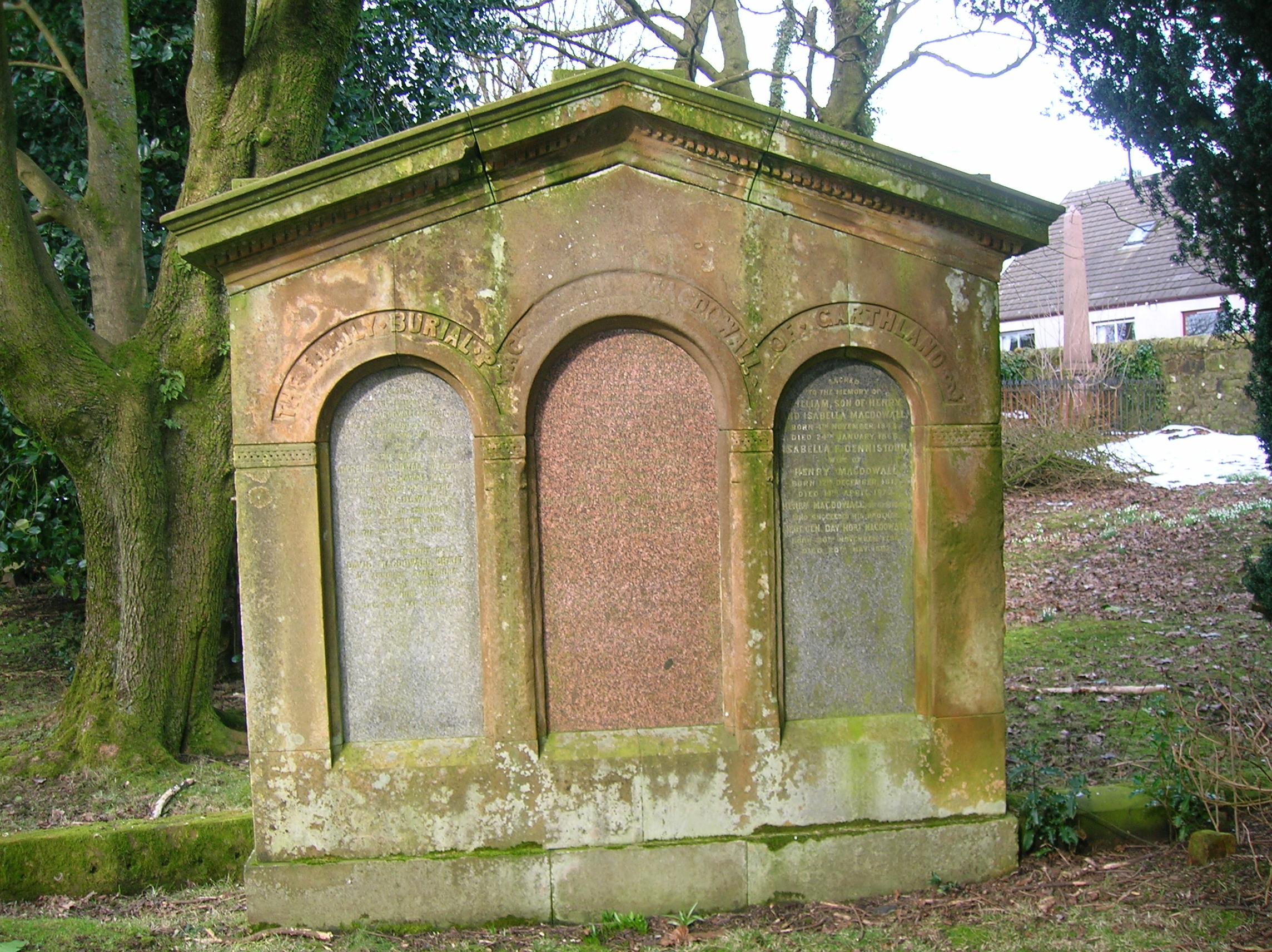
 Memorial to the MacDowalls of Garthland, latter day owners of the Castle Semple estate.
 The Castle Semple temple.
The small temple building or folly on the Kenmure Hill knoll to the northern end of Castle Semple loch is one of the few remains of the Castle Semple estate. Col. William MacDowell was responsible for the 'Temple' and also for building of Castle Semple House, which was destroyed by fire in 1935. All that remains of this 900-acre (3.6 km2) estate is the folly, a walled garden and a pair of gate arches.
Loch Thom and the Greenock cut
 Looking back along The Cut from Overton.
A freshwater lake known as Shaws Water used to exist at a level high above Greenock until the civil engineer Robert Thom prepared a scheme to turn this into a reservoir, subsequently named after him as Loch Thom. He also created the aqueduct which became known as "The Cut", the whole scheme officially opening on 16 April 1827. The aqueduct supplied both a dependable flow and a good quality of water to the town for both domestic and business purposes.
Leaving Loch Thom at Cornalees, The Cut , with its footpath, runs westward and then turns northward as it follows the contour of Dunrod Hill which it follows round until running directly above the town of Greenock at Overton, having come a distance of 5.5 miles (8.9 km) or 9 km. It collects some of the water from streams that cross its path, and a series of sluice gates incorporate an ingenious automatic way of releasing surplus water.[1]
Duchal Moor railway
Main article: Duchal Moor RailwayThis narrow gauge railway was built by Sir James Lithgow, 1st Baronet of shipbuilding fame. The project was undertaken to keep men employed after a drop in ship orders following World War 1. The line was used to take grouse shooting parties into the hills. It is thought to have closed in the late 1970s and is now derelict. The engine shed is still present, as are parts of the station platform and the rails are still in situ, most however are buried in the peat.[2]
The Grouse Railway lies 3 miles (5 km) west southwest of Kilmacolm. With its multiple branches following the contours of the hills, the railway was designed to convey their shooting parties around the grouse moor. Completed around 1922 and extending to 7 miles (11 km), the railway used materials salvaged from old warships. Two 20 hp (15 kW) wheelled 2 ft (0.61 m) gauge petrol-driven locomotives were purchased in 1922 from the Motor Rail & Tramcar Company of Bedford - Works Numbers 2097 and 2171. The Company had already equipped a similar 'grouse railway' in 1920 for Sir Archie Birkmyre of Dalmunzie near Glenshee. In September 1969 a further 4 wheeled 20/28 HP dioesel locomotive (Works No 8700 of 1941) was purchased second hand from Joseph Arnold Ltd's sand quarriesy in Leighton Buzzard. King Edward VIII was amongst guests to make use of the railway.[3]
See also
- Castle Semple Loch
- Eglinton Country Park
- Hill of Stake
- Kilbirnie Loch
References
- ^ Monteith, Joy (2004).Old Greenock.Stenlake Publishing Ltd. ISBN 1-84033-314-6
- ^ Duchal Moor railway
- ^ The Gazetteer for Scotland.
External links

A fox near Loch Thom - A Map of the Clyde Muirshiel Regional Park
- Castle Semple Collegiate Church directions (Historic Scotland website)
- Clyde Muirsheil
- What's on at the Clyde Muirshiel Country Park..
- Mountain bike routes at Loch Thom.
- Scotways - for the preservation, defence, restoration and acquisition of public rights of access
- Sustrans National Cycle Network
Local Government Renfrewshire Council (local authority) · County of Renfrew (registration county) · Renfrewshire lieutenancy areaTowns Villages Bishopton · Bridge of Weir · Brookfield · Crosslee · Elderslie · Houston · Howwood · Inchinnan · Kilbarchan · Langbank · LochwinnochOther locations Braehead · Clyde Muirshiel Regional Park · Glasgow International Airport · Paisley Abbey · University of the West of ScotlandParliamentary constituencies See also Website: www.renfrewshire.gov.uk Coordinates: 55°47′50.8″N 4°37′10.2″W / 55.797444°N 4.6195°W
Categories:- Country parks in Scotland
- History of North Ayrshire
- Parks in North Ayrshire
- Parks in Inverclyde
- Parks in Renfrewshire
- Scottish organisation stubs
- West of Scotland geography stubs
- North Ayrshire geography stubs
-


Wikimedia Foundation. 2010.