- Arizona State Route 78
Infobox road
marker_
state=AZ
highway_name=
name_notes=
type=state
route=78
alternate_name=
maint=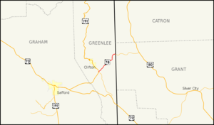
length_mi=19.47
length_round=2
length_ref=cite web |url=http://tpd.az.gov/data/reports/2006SHSLog.pdf |title=2006 ADOT Highway Log |author=Arizona Department of Transportation |accessdate=2008-04-09]
length_notes=
established=
decommissioned=
direction_a=West
starting_terminus=jct|state=AZ|US|191
junction=
direction_b=East
ending_terminus=jct|state=NM|NM|78
previous_type=AZ
previous_route=77
next_type=AZ
next_route=79
commons=State Route 78 (or SR 78) is a state highway in eastern
Arizona that stretches between its junction with U.S. Route 191 and State Route 75 nearGreenlee County Airport east to theNew Mexico border at Mule Creek, where it continues atNew Mexico State Road 78 . It is also known in its Arizona stretch as Mule Creek Road.Route description
The western terminus of SR 78 is located at a junction with US 191 and SR 75 at Three Way near Greenlee County Airport. The highway heads northeast from this intersection along Mule Creek Road. There are a few
hairpin turn s along this stretch of highway as it follows the surrounding terrain. SR 78 reaches it eastern terminus at the New Mexico border where it continues asNew Mexico State Road 78 . [cite map|publisher=Google Maps |title=Overview map of SR 78|accessdate=2008-04-23|url=http://maps.google.com/maps?f=d&hl=en&geocode=6241903636493900613,32.948182,-109.229900%3B18312605234394260547,33.107420,-109.047540&saddr=AZ-75+%4032.948182,+-109.229900&daddr=AZ-78+%4033.107420,+-109.047540&doflg=ptm&sll=33.0278,-109.13872&sspn=0.198324,0.319977&ie=UTF8&z=12]History
The highway was designated as SR 78 in 1959, but the road had existed prior to it being designated. [cite web|author=
Arizona Department of Transportation |url=http://www.azhighwaydata.com/resolutions/?resnum=1959-%20-079|title=ADOT Right-of-Way Resolution 1959-079|accessdate=2008-05-05] The road was shown on maps as far back as 1927. Its counterpart in New Mexico was already marked as New Mexico State Road 78 by this time. [cite map|url=http://www.arizonaroads.com/maps/index.html|title=Auto Road Map of Arizona and New Mexico|publisher=Rand McNally |year=1927|accessdate=2008-05-05] By 1938, it was still just a gravel road as were many roads in the area including US 666. [cite map|url=http://www.arizonaroads.com/maps/index.html|title=Road Map of Arizona and New Mexico|publisher=Rand McNally |year=1938|accessdate=2008-05-05] It would remain a gravel road in 1961, even after becoming a state highway. The other state highways in the area were paved by this time including the majority of its counterpart in New Mexico. [cite map|url=http://www.arizonaroads.com/maps/index.html|title=Road Map of Arizona|publisher=Rand McNally |year=1961|accessdate=2008-05-05] By 1971, nearly the entire highway had been paved with the exception of a portion near the New Mexico border. [cite map|url=http://www.arizonaroads.com/maps/index.html|title=Road Map of Arizona|publisher=Arizona State Highway Department|year=1971|accessdate=2008-05-05]Junction list
The entire route is in Greenlee County.
References
External links
* [http://arizonaroads.com/arizona/az78.html SR 78 at Arizona Roads]

Wikimedia Foundation. 2010.