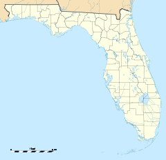
- Moores Creek Bridge
-
Moores Creek Bridge

Location: N. 2nd Street between Avenues B and C
Fort Pierce, Florida 34950Coordinates: 27°27′2″N 80°19′32″W / 27.45056°N 80.32556°WCoordinates: 27°27′2″N 80°19′32″W / 27.45056°N 80.32556°W Built: 1925 Architect: unknown; Builder: Luten Bridge Company Architectural style: Single-span arch-deck bridge Governing body: Local NRHP Reference#: 01000890[1] Added to NRHP: August 17, 2001[2] Moores Creek Bridge is an historic single span reinforced concrete bridge located on North 2nd Street between Avenues B and C in Fort Pierce, Florida. Including run up, it is 46 feet long. It is known locally as the Tickle Tummy Bridge or Tickle Tummy Hill because of its high arch relative to its short length.[3] On August 17, 2001, it was added to the U.S. National Register of Historic Places.
History
In 1925 Moores Creek Bridge was built by the Luten Bridge Company of Palatka, Florida to connect a residential section of Fort Pierce to the downtown and waterfront districts. It replaced a previous wooden bridge and is one of 15 concrete arch bridges dating from Florida's early 20th century land-boom era.
The bridge was retrofitted in 1997 by the joint efforts of Fort Pierce Main Street, the City of Fort Pierce and the Florida Department of Transportation. It reopened on December 7, 1997.
References
- ^ St. Lucie County listings at the National Register of Historic Places
- ^ "National Register Information System". National Register of Historic Places. National Park Service. 2007-01-23. http://nrhp.focus.nps.gov/natreg/docs/All_Data.html.
- ^ Main Street Fort Pierce - Projects
External links
Categories:- Bridges on the National Register of Historic Places in Florida
- National Register of Historic Places in St. Lucie County, Florida
- Bridges completed in 1925
- Transportation in St. Lucie County, Florida
- Luten bridges
- Road bridges in Florida
- Florida Registered Historic Places building and structure stubs
Wikimedia Foundation. 2010.

