- Dallington, Northamptonshire
-
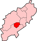
Dallington is a former village about 1.5 miles (2.4 km) northwest of the centre of Northampton, the county town Northamptonshire, England. Dallington is now a suburb of Northampton.
The Church of England parish church of Saint Mary the Virgin dates from 1207 and is a Grade II* listed building. It is near the site of a previous Saxon church.
Dallington is north-east of Duston, south of Kings Heath and north-west of St. James's End.
External links
- Map sources for Dallington, Northamptonshire
Northampton Borough Council Suburbs and Villages Abington · Billing · Collingtree · Collingtree Park · Dallington · Duston · East Hunsbury · Far Cotton · Hardingstone · Kingsthorpe · Northampton · Queen's Park · Round Spinney ·
Sixfields · Spring Boroughs · Upton · West Hunsbury · Weston Favell · Wootton
Attractions Constituencies Higher Education Sport County Cricket Ground · Nene Whitewater Centre · Northampton ON Chenecks F.C. · Northampton Saints · Northamptonshire County Cricket Club · Northampton Sileby Rangers F.C. · Northampton Spencer F.C. · Northampton Town F.C. · Northampton Swimming Club · Sixfields Stadium · Franklin GardensTransport A43 road · A45 road · Grand Union Canal · Greyfriars bus station · London Midland · First Northampton · M1 Motorway · Arriva · Northampton railway station · Stagecoach in Northants · Virgin TrainsEast Midlands · England Portal · Northamptonshire · WikiProject Northamptonshire · United Kingdom Portal Categories:- Northamptonshire geography stubs
- Districts of Northampton
Wikimedia Foundation. 2010.
