- Manchester Bridge (Virginia)
-
Manchester Bridge 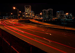
Official name Manchester Bridge Carries US 60 Crosses James River Locale Richmond, Virginia Maintained by Richmond Dept. of Public Works Total length 2,906 feet Opened 1972 Toll none Manchester Bridge in Richmond, Virginia carries U.S. Highway 60 across the James River.
Its length is 2,906 feet (886 m), and it is unusually wide at 110 feet (33.5 m). This is due to a requirement in the Richmond-Manchester merger agreement of 1910 that a free pedestrian bridge be always provided between the two former cities. (The only other highway and pedestrian bridge between the cities at the time of the merger negotiations was a toll bridge, long a grievance of citizens of Manchester in particular.) The pedestrian walkway of the Manchester Bridge is located in the center, to afford access at the south end via stairs under the roadway without crossing heavy traffic lanes which are not signalled at that location. The north end has traffic signals for pedestrians to cross traffic lanes.
History
The former Ninth Street ("Singing") Bridge was a primitive affair built rather low over the river, and whose creosote-treated wooden deck was fitted with strips of metal plates spaced a tire-track apart to prevent excessive wear. As the tires rolled along, these plates, embossed to provide traction, would give off a high humming note—a note that suddenly would rise by about a fifth as a vehicle crossed from south to north: presumably the embossed pattern changed at that point. Returning to Southside in the other lane, the note would remain the same all the way across—much less interesting for the area children!
The former Ninth Street Bridge was closed and barely escaped submergence during river flooding resulting from Hurricane Camille in 1969, strengthening the resolve of engineers that the replacement would be high above even flood levels of the river. The old bridge was submerged 3 years later during flooding from Hurricane Agnes, and was not returned to service, since the replacement Manchester Bridge was virtually complete.
In 1972, the Manchester Bridge replaced the old Ninth Street Bridge (also known as the "free bridge" and the "singing bridge", which remained in service during the construction. When almost completed, it was pressed into temporary service earlier than planned during James River flooding as a result of Hurricane Agnes. The bridge is high above the river, and is not considered in danger of flooding during periods when the river periodically floods.
Crossings of the James River Upstream
Robert E. Lee Memorial Bridge


Manchester Bridge

Downstream
Norfolk Southern James River Bridge
Norfolk SouthernCoordinates: 37°31′54″N 77°26′35″W / 37.53167°N 77.44306°W
Categories:- Bridges completed in 1972
- Bridges over the James River (Virginia)
- Bridges in Richmond, Virginia
- Road bridges in Virginia
- United States bridge (structure) stubs
- Virginia building and structure stubs

Wikimedia Foundation. 2010.