- Coleham
-
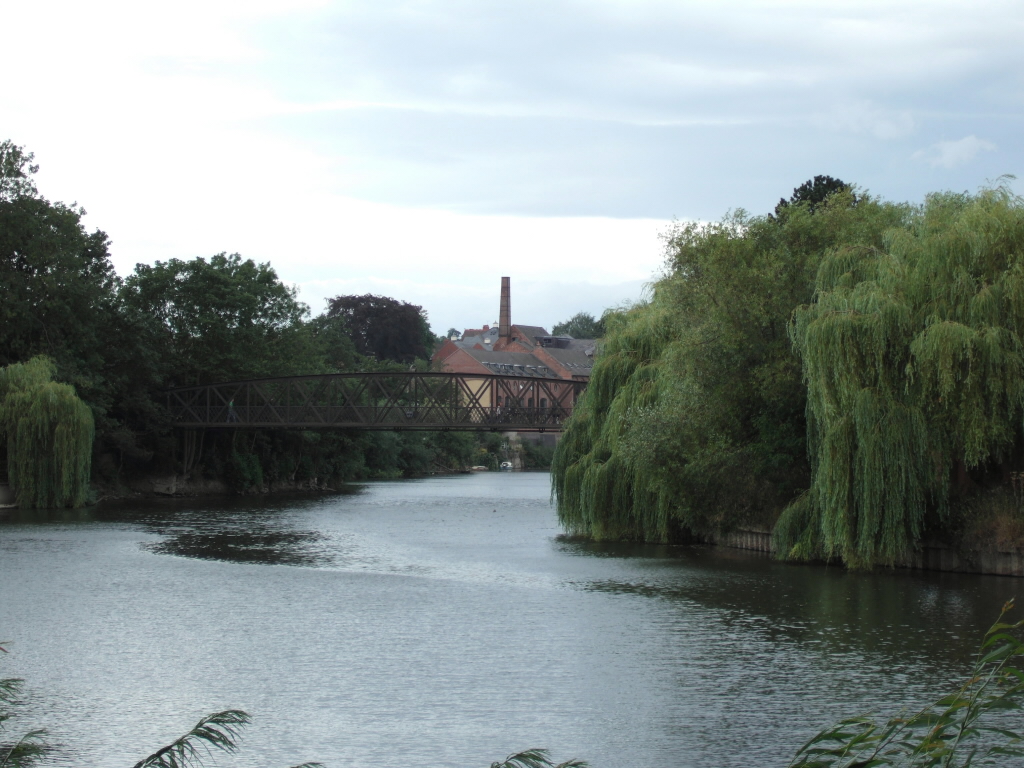
 Greyfriars Bridge, linking Shrewsbury's town centre with Coleham
Coleham is a district of the town of Shrewsbury in Shropshire, England. It is located just south, over the River Severn, from Shrewsbury town centre.
Coleham grew up as a village outside medieval Shrewsbury, with the nearest crossing over the Severn to the town being the Stone Bridge (now the English Bridge). Shrewsbury Abbey and its associated lands and buildings were nearby. The Rea Brook separates Coleham from the other old suburb on this end of town - Abbey Foregate.
Coleham is centered on the Shrewsbury to Longden road, which as it passes through Coleham itself is called "Longden Coleham". The Victorian suburb of Belle Vue grew up south of Coleham and the wealthy suburb of Kingsland (which centres on Shrewsbury School) grew up west of Coleham.
Today, Coleham is connected to the town centre by a pedestrian footbridge - the Greyfriars Bridge, though the nearest vehicular crossing remains the English Bridge. There are a number of shops and public houses along Longden Coleham, as well as a primary school. The Coleham Pumping Station is a visitor destination and is located on Longden Coleham.
Greyfriars Bridge in Coleham is the starting point for Regional Cycle Route 32/33 to Church Stretton (and further on, Craven Arms).
The area suffered badly from flooding in 2000, which entirely took hold of Longden Coleham and other low-lying streets in the area. Since then a number of measures have been taken to alleviate flooding problems in the Coleham and Abbey Foregate areas.
Railways
See also: Shrewsbury TMD
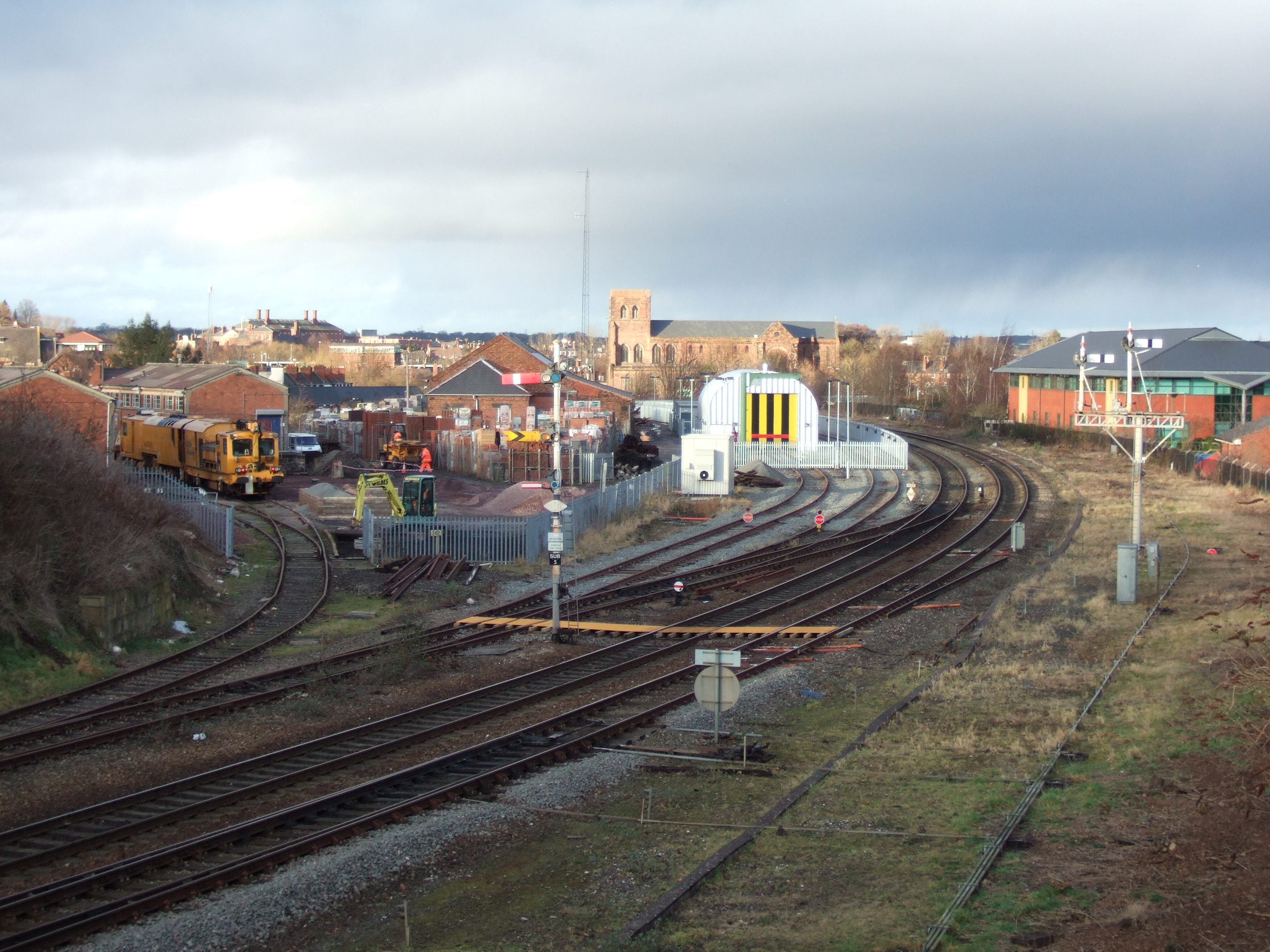
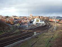 Looking north from Sutton Bridge Junction, Network Rail's Coleham Depot is on the left. To the right were once the extensive Coleham Sheds, which have now been completely demolished and the track lifted. Semaphore signaling remains in operation here.
The Welsh Marches Line (and Cambrian Line) runs through the area, partially on a long brick viaduct which crosses over the Abbey Foregate road, between Severn Bridge Junction and Sutton Bridge Junction. There were once extensive engine sheds and other railway related activities in the area. There remains a permanent way depot - Coleham Depot - and in 2008 a new inspection shed for the Class 97/3 locomotives was built. [1]
See also
Categories:- Suburbs of Shrewsbury
- Rail transport in Shropshire
Wikimedia Foundation. 2010.