- Mule, Norway
-
Mule — Village — Location in Nord-Trøndelag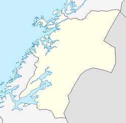
 Mule
MuleCoordinates: 63°45′24″N 11°23′36″E / 63.75667°N 11.39333°ECoordinates: 63°45′24″N 11°23′36″E / 63.75667°N 11.39333°E Country Norway Region Trøndelag County Nord-Trøndelag District Innherred Municipality Levanger Area[1] - Total 0.28 km2 (0.1 sq mi) Elevation[2] 64 m (210 ft) Population (2009)[1] - Total 296 - Density 1,057/km2 (2,737.6/sq mi) Time zone CET (UTC+01:00) - Summer (DST) CEST (UTC+02:00) Post Code 7600 Levanger Mule is a village in the municipality of Levanger in Nord-Trøndelag county, Norway. The village area is located at the intersection of Norwegian County Road 774 and European route E6. The Nordlandsbanen railway line runs through Mule also. The 0.28-square-kilometre (69-acre) village has a population (2009) of 296. The population density of the village is 1,057 inhabitants per square kilometre (2,740 /sq mi).[1][3]
References
- ^ a b c Statistisk sentralbyrå (1 January 2009). "Urban settlements. Population and area, by municipality.". http://www.ssb.no/beftett_en/tab-2009-06-16-01-en.html.
- ^ "Mule skole" (in Norwegian). yr.no. http://www.yr.no/place/Norway/Nord-Tr%C3%B8ndelag/Levanger/Mule_skole/. Retrieved 2011-05-27.
- ^ Store norske leksikon. "Mule" (in Norwegian). http://www.snl.no/Mule. Retrieved 2011-05-27.
Categories:- Villages in Nord-Trøndelag
- Levanger
- Nord-Trøndelag geography stubs
Wikimedia Foundation. 2010.