- Ferns, County Wexford
Infobox Irish Place
name = Ferns
gaeilge = Fearna
crest
motto =
map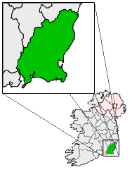
pin coords = left: 68px; top: 55px
north coord = 52.59333
west coord = 6.5 | irish grid = T017498
area =
elevation = 60 m (196 ft)
province =Leinster
county =County Wexford
town pop = 954 | rural pop =
census yr = 2006
web =
|Ferns (irish place name|Fearna|alder trees) is a small historic town in north
County Wexford ,Ireland with a population of about 900. It is 16 km from Enniscorthy, where theGorey toEnniscorthy N11 road joins the R745regional road . The ruins of Ferns Castle are a short distance from the town.History
Ferns is believed to have been established in the
6th century , when a monastery was founded in 598 dedicated to St Mogue of Clonmore who was a Bishop of Ferns. ["Blue Guide, Ireland." Brian Lalor. (p248) ISBN 0-7136-6130-5] The town became the capital of the Kingdom of Leinster when the kings of that southern part of the province established their seat of power there. The most notorious of these wasDermot MacMurrough who is forever associated with inviting theAnglo-Norman s to Ireland in 1169.Ferns Castle, an Anglo-Norman fortress, was built in the
13th century by William, Earl Marshall. Today about half of the castle still stands. Several other reminders of the town's eventful history include St Mary's, a12th century Augustinian priory established by McMurragh circa 1160 and where he is thought to be buried. The town also contains the 13th-century St Edan's Cathedral (Church of Ireland) and several high crosses and parts of crosses.Religion
The town gave the name to the
Diocese of Ferns (bothRoman Catholic andChurch of Ireland ). The town's religious traditions live on today through the recent establishment in Ferns of a hermitage.Transport
*Ferns railway station opened on
16 November 1863 , closed to passenger traffic on30 March 1964 and to goods traffic on3 November 1975 , before finally closing altogether on7 March 1977 . [cite web | title=Ferns station | work=Railscot - Irish Railways | url=http://www.railscot.co.uk/Ireland/Irish_railways.pdf | accessdate=2007-10-14] . TheBus Éireann Dublin -Rosslare Europort service passes through the town.Famous residents
*
Anne Doyle - R.T.É. Newsreader.
*Dermot MacMurrough (d. 1171) - former King ofUí Cheinnselaig and Leinster.ee also
*
Ferns Inquiry
*List of towns and villages in Ireland.References
External links
* [http://www.ferns.ie/ Roman Catholic diocese of Ferns]
* [http://www.heritageireland.ie/en/South-East/FernsCastle/ Heritage Ireland's page on Ferns Castle]
* [http://homepage.eircom.net/~frduffydsl/monastic/ferns.html Photos of Monastic sites in Ferns]
* [http://www.discoverireland.ie/di/resultsengine/location.aspx?SearchString=&CountyID=5&LocationID=1727&LocationName=Ferns Fáilte Ireland's description of Ferns]
* [http://www.northwexford.com/ferns.htm northwexford.com's description of Ferns]
Wikimedia Foundation. 2010.