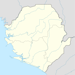
Марампа — (Marampa) город в Сьерра Леоне, в Северной провинции. Около 12 тысяч жителей. Узкоколейной железной дорогой соединён с портом Пепел на Атлантическом океане. Добыча (свыше 2,5 млн. тонн в год) железной руды, которую ведёт английская… … Большая советская энциклопедия
Bai Koblo Pathbana II — {| style= float:right; Infobox Monarch | name =Paramount Chief Bai Koblo Pathbana II title = Marampa, Masimera Chiefdom reign = investiture = predecessor = successor = suc type =Heir Presumptive heir =unknown spouse =Paramount Chief Madam Ella… … Wikipedia
Sierra Leone — Sierra Leonean /lee oh nee euhn/. /lee oh nee, lee ohn / an independent republic in W Africa: member of the Commonwealth of Nations; formerly a British colony and protectorate. 4,891,546; 27,925 sq. mi. (72,326 sq. km). Cap.: Freetown. * * *… … Universalium
Siaka Stevens — Infobox President|name=Siaka Probyn Stevens|nationality=Sierra Leonean image size = image caption = order=3rd Prime Minister and 1st President of Sierra Leone term start=May 17, 1967 term end=November 28, 1985 predecessor=Sir Albert Margai… … Wikipedia
Lunsar — ▪ Sierra Leone town, west central Sierra Leone, western Africa. A traditional trade centre of the Marampa–Masimera chiefdom for rice and palm oil and kernels, it developed after 1933 with the exploitation of iron ore, mined at Marampa, 4… … Universalium
Railway stations in Sierra Leone — include: Maps The MSN and FallingRain and UNHCR maps still show the railway lines closed in 1974.* [http://www.un.org/Depts/Cartographic/map/profile/sierrale.pdf UN Map of Sierra Leone no railways shown at all.] *… … Wikipedia
Mining in Sierra Leone — Diamond miners in Kono District The mining industry of Sierra Leone accounted for 4.5 percent of the country s GDP in 2007[1] and minerals made up 79 percent of total export revenue with diamonds accounting for 46 percent of export revenue in… … Wikipedia
Transport in Sierra Leone — There are a number of systems of transport in Sierra Leone, a country in West Africa, which possess road, rail, air and water infrastructure, including a network of highways and several airports. Railways There are 84 kilometres of railway in… … Wikipedia
Pepel — Infobox Settlement official name = Pepel other name = native name = nickname = settlement type = motto = imagesize = image caption = flag size = image seal size = image shield = shield size = image blank emblem = blank emblem type = blank emblem… … Wikipedia
I. T. A. Wallace-Johnson — Infobox Officeholder name = Isaac Theophilus Akunna Wallace Johnson width = 130px caption = Statue of I. T. A. Wallace Johnson in Sierra Leone birth date = 1895 birth place = Wilberforce, Sierra Leone death date = 10 May 1965 death place = Ghana… … Wikipedia
 Sierra Leone
