Bashkaus River — The Bashkaus ( ru. Башкаус) is a river in the Altai Republic in Siberia, Russia. It is a left tributary of the Chulyshman river, which flows into Lake Teletskoye (Ob basin). The length of the Bashkaus River is 219 km. The area of its basin is… … Wikipedia
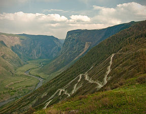
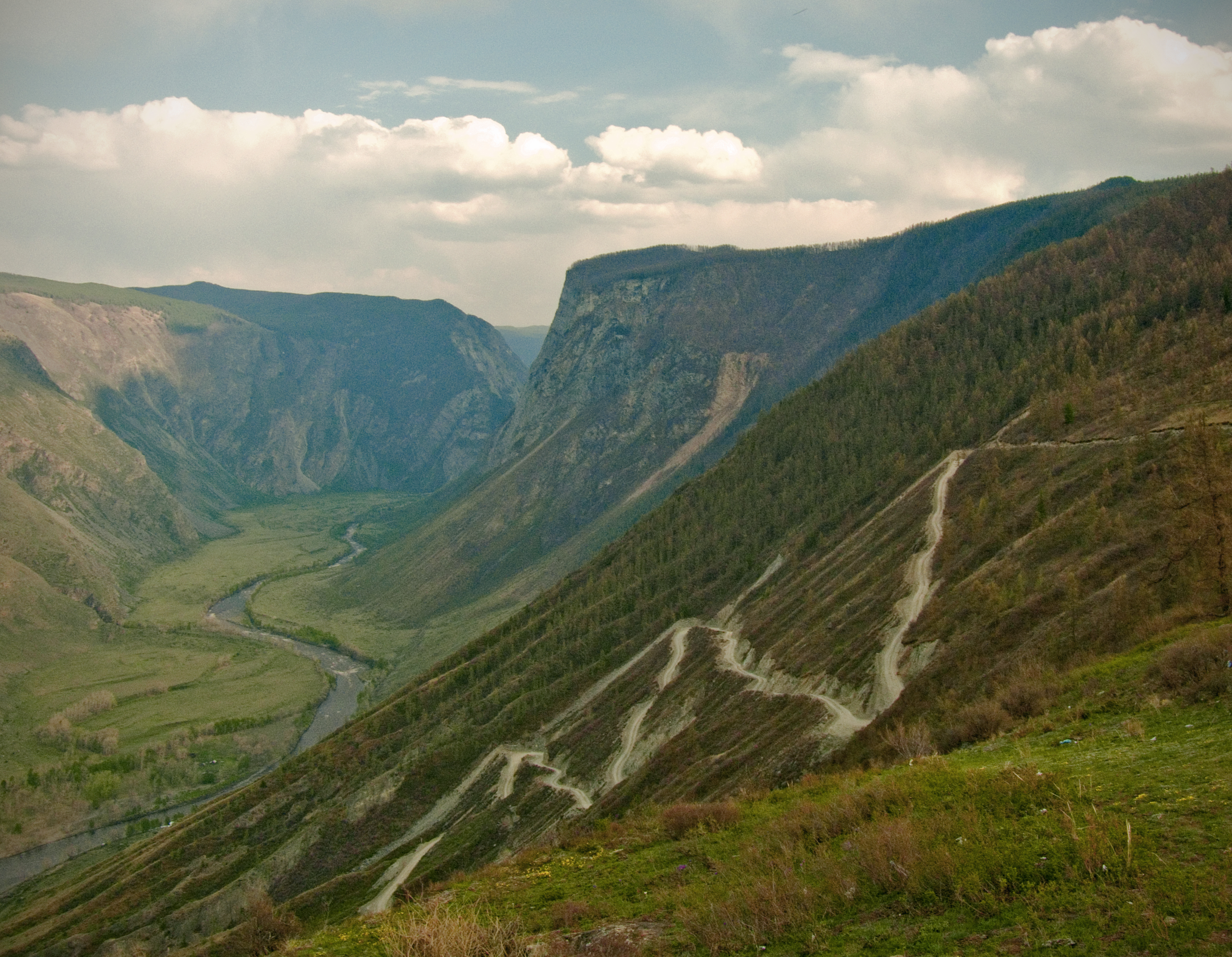
Río Chulyshman — Saltar a navegación, búsqueda Río Chulyshman (Река Чулышман) El lago Teletskoye, donde desagua el río Chulyshman y nace el río Biya. País que a … Wikipedia Español
Chebdar River — Chebdar is a river in Altai Republic in Russia. The Chebdar is the only significant and paddleable tributary of the Bashkaus, coming in from the left where the Lower Gorge of the Bashkaus ends, not far from Chulyshman confluence. The river starts … Wikipedia
Lake Teletskoye — Infobox lake lake name = Lake Teletskoye Altyn Köl image lake = Teletskoe ozero yug.jpg caption lake = The southern bank image bathymetry = caption bathymetry = location = Altai Republic coords = coord|51|31|45|N|87|42|53|E|type:waterbody… … Wikipedia
Чулышман — Характеристика Длина 241 км Площадь бассейна … Википедия
Pyotr Chikhachyov — Pyotr Alexandrovich Chikhachyov, last name also spelled Chikhachev or Tchihatchev (Russian: Пётр Александрович Чихачёв; December 23, 1808 – October 13, 1890) was a Russian naturalist and geologist who was admitted into the Russian Academy of … Wikipedia
Río Obi — Para la ciudad del óblast de Novosibirsk, en Rusia, véase Ob (ciudad). Río Obi (Река Обь) Vista aérea del río cerca de Barnaul País que atraviesa … Wikipedia Español
Río Biya — Saltar a navegación, búsqueda Para el Presidente de Camerun, véase Paul Biya. Río Biya (Река Бия) El río Biya (distrito de Chemalsky, krai de Altai) … Wikipedia Español
List of rivers of Russia — Russia can be divided into a European and an Asian part. The dividing line is generally considered to be the Ural Mountains and the Caspian Sea. The European part is drained into the Arctic Ocean, Baltic Sea, Black Sea and Caspian Sea. The Asian… … Wikipedia
List of Russian explorers — The Russian Empire at its peak in 1866, including the spheres of influence; this territorial expansion largely corresponds to the extent of contiguous exploration by Russians. This is a list of explorers from the Russian Federation, Soviet Union … Wikipedia