- Yampa River
Geobox River
name = Yampa River
native_name =
other_name =
image_size = 300
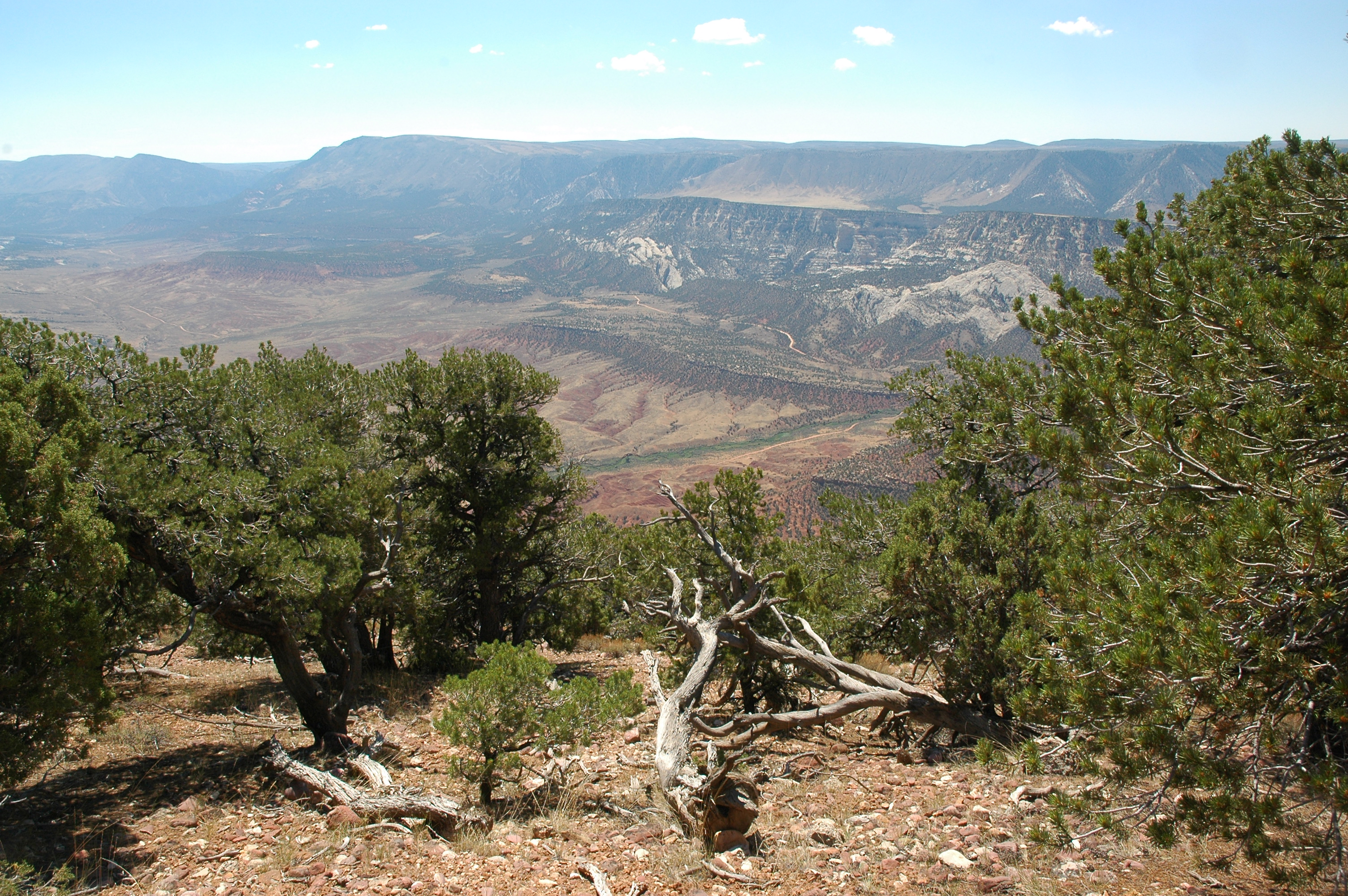
image_caption = The Yampa River, seen from a high overlook.
etymology =
country = United States
country1 =
state = Colorado
state1 =
region_type =
region =
region1 =
city = Steamboat Springs
city1 = Craig
landmark =
landmark1 =
length_imperial = 250
length_note = [http://www.bartleby.com/69/5/Y00305.html Yampa River] , The Columbia Gazetteer of North America. 2000.]
watershed_imperial = 7660
watershed_note = [http://pubs.usgs.gov/wdr/wdr-co-03-1/vol1/pdf/WDR_CO-03-2.pdf Water Data Report, Colorado 2003] , from [http://pubs.usgs.gov/wdr/wdr-co-03-1/ Water Resources Data Colorado Water Year 2003] , USGS.]
discharge_location = At Deerlodge Park
discharge_imperial = 2093
discharge_max_imperial = 32300
discharge_min_imperial = 1.9
discharge_round = 2
discharge_note =
discharge1_location =
discharge1_imperial =
source_name = Rocky Mountains
source_location =
source_district =
source_region =
source_state =
source_country =
source_lat_d = 40
source_lat_m = 9
source_lat_s = 30
source_lat_NS = N
source_long_d = 106
source_long_m = 53
source_long_s = 59
source_long_EW = W
source_coordinates_note =Gnis|169566|Yampa River, USGS GNIS.]
source_elevation_imperial = 7833
source_elevation_note =Google Earth elevation for GNIS coordinates.]
source_length_imperial =
mouth_name = Green River
mouth_location =Dinosaur National Monument
mouth_district =
mouth_region =
mouth_state =
mouth_country =
mouth_lat_d = 40
mouth_lat_m = 31
mouth_lat_s = 44
mouth_lat_NS = N
mouth_long_d = 108
mouth_long_m = 59
mouth_long_s = 3
mouth_long_EW = WIt rises in the
Flat Tops in northwestern Colorado, in theRoutt National Forest in southeastern Garfield County, and flows northwest, past Yampa, and north to Steamboat Springs, where it turns abruptly west. It then receives its chief tributary, the Elk River, near the small town of Milner. It continues west in the plateau region along the north side of theWilliams Fork Mountains , past the town of Craig. It is joined by theLittle Snake River in Moffat County, just east ofDinosaur National Monument . Inside Dinosaur National Monument, it joins the Green near the border withUtah .The Yampa forms a noticeably wide, shallow stream throughout much of its course. The lower three fourths of the Yampa, from the Elk river down, are navigable by small craft. However the meandering, shallow nature of the river can render the river unnavigable during late summer in low water years. The discharge of the Yampa varies from about 600 ft³/s (17 m³/s) during low water summers to 20,000 ft³/s (600 m³/s) in spring runoff. Average flow at its confluence with the Green is about 2500 ft³/s (71 m³/s).
The Yampa River is one of the finest Smallmouth Bass and Northern Pike fisheries in the United States. However, due to the presence of several endangered fish species, the Colorado Division Of Wildlife,
Colorado State University and theUS Fish and Wildlife Service have been removing and killing bass and pike, leaving them to rot on the banks by the thousands. Some studies suggest the introduction of bass and pike may have played a small role in reducing endangered fish populations. Over 30,000 smallmouth bass, 10,000 pike, and 9000 channel catfish have been killed since 1999. Studies have shown these removals have not increased numbers of native fish species. These actions are ongoing, despite a lack of scientific support and strong public opposition.Proposal to pump water to the Front Range
In December, 2006, a report came out on a proposal to pump water from the Yampa 200 miles east, and under the
Continental Divide , to the cities of theFront Range . The diversion would start nearMaybell, Colorado , 20 miles downstream ofCraig, Colorado [http://www.greeleytrib.com/article/20061220/NEWS/112200062] [http://www.jacksonholestartrib.com/articles/2006/12/20/news/regional/f7f9151615aa44ab8725724900727ce9.txt] . The proposal faces widespread opposition because it could lower river flows in late summer due to the diversion. The Yampa is one of the West's last wild rivers since it has only a few small dams and diversions.ee also
*
List of Colorado rivers References
mouth_coordinates_note =
mouth_elevation_imperial = 5080
mouth_elevation_note =
tributary_left =Bear River
tributary_left1 =Williams Fork
tributary_left2 =
tributary_left3 =
tributary_right =Elk River
tributary_right1 = Little Snake River
free_name =
free_value =
map_size = 300
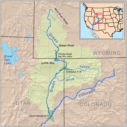
map_caption = The Yampa River is shown on this map of the Green River watershedThe Yampa River is a tributary of the Green River, approximately 250 mi (402 km) long, in theU.S. state ofColorado .
Wikimedia Foundation. 2010.