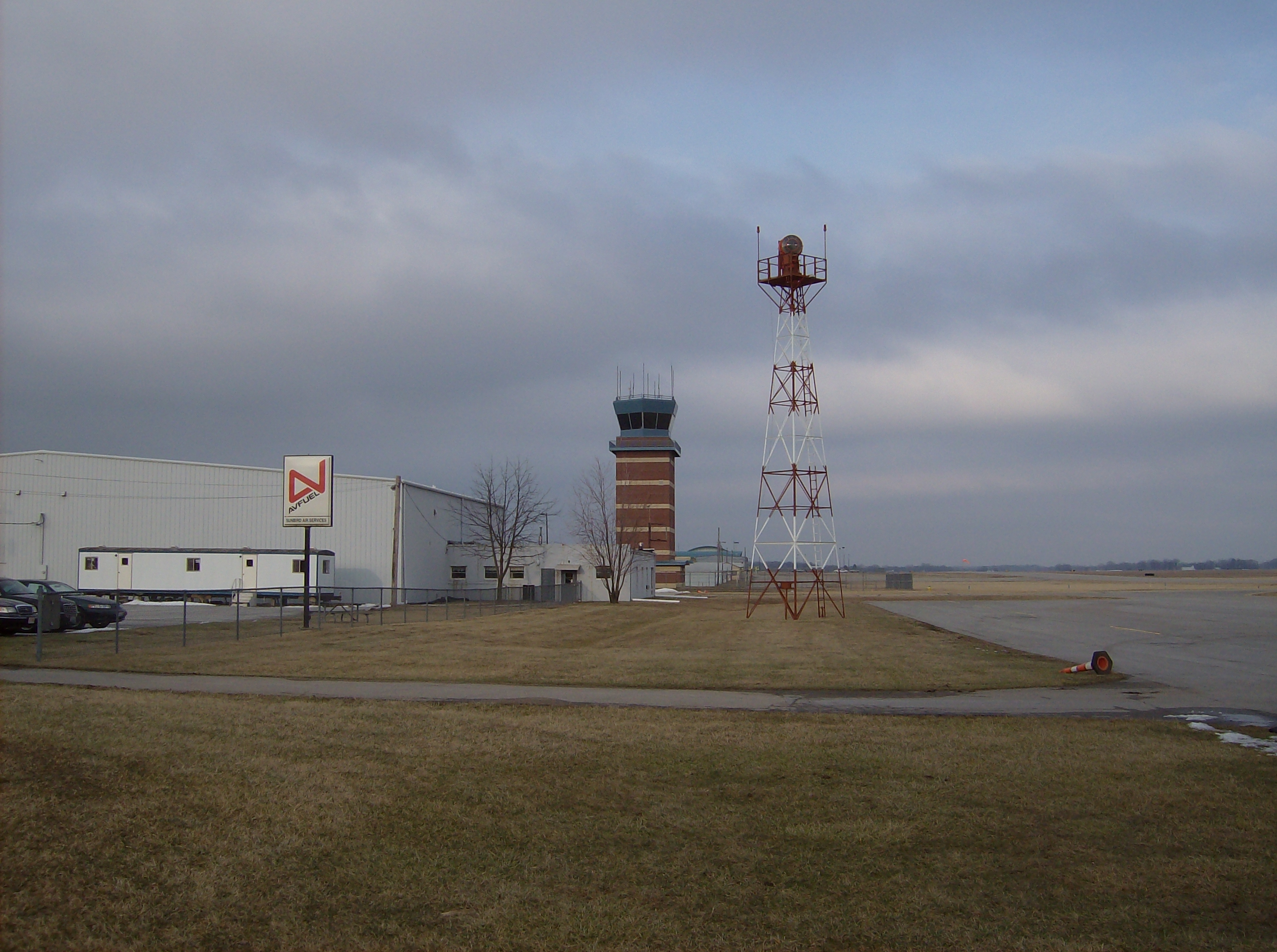
Springfield-Beckley Municipal Airport
- Springfield-Beckley Municipal Airport
Infobox Airport
name = Springfield-Beckley Municipal Airport

IATA = SGH
ICAO = KSGH
FAA = SGH
type = Public
owner = City of Springfield
operator =
city-served = Springfield, Ohio
location =
elevation-f = 1,051
elevation-m = 320
website = [http://www.airparkohio.com/beckly_airport.html www.airparkohio.com/...]
r1-number = 6/24
r1-length-f = 9,009
r1-length-m = 2,746
r1-surface = Asphalt/Concrete
r2-number = 15/33
r2-length-f = 5,499
r2-length-m = 1,676
r2-surface = Asphalt
stat-year = 2005
stat1-header = Aircraft operations
stat1-data = 62,000
stat2-header = Based aircraft
stat2-data = 81
footnotes = Source: Federal Aviation Administration[FAA-airport|ID=SGH|use=PU|own=PU|site=18536.*A, effective 2007-10-25] ]
Springfield-Beckley Municipal Airport Airport codes|SGH|KSGH|SGH is a public airport located five miles (8 km) south of the central business district of Springfield, a city in Clark County, Ohio, United States. It is owned by the city of Springfield.
The airport also serves three on-site divisions of the Ohio Air National Guard, including the 178th Fighter Wing.
Facilities and Aircraft
Springfield-Beckley Municipal Airport covers an area of 1,516 acres (614 ha) which contains two runways:
* Runway 6/24: 9,009 x 150 ft (2,746 x 46 m), Surface: Asphalt/Concrete
* Runway 15/33: 5,499 x 100 ft (1,676 x 30 m), Surface: Asphalt
For the 12-month period ending November 29, 2005, the airport had 62,000 aircraft operations, an average of 169 per day: 75% general aviation, 21% military and 4% air taxi. There are 81 aircraft based at this airport: 59% single-engine, 14% multi-engine, 1% jet, 1% ultralight and 25% military.
References
External links
* [http://www.airparkohio.com/beckly_airport.html Springfield-Beckley Municipal Airport]
*WikiMapia|39.8403|-83.8402|12
* [http://www.ohspri.ang.af.mil/ Springfield Air National Guard Base] (official site)
* [http://www.globalsecurity.org/military/facility/springfield-beckley.htm Springfield Air National Guard Base] (GlobalSecurity.org)
*FAA-diagram|00958
*US-airport-ga|SGH
Wikimedia Foundation.
2010.
Look at other dictionaries:
Springfield Municipal Airport — ist der Name mehrerer Flughäfen in den Vereinigten Staaten: Springfield Municipal Airport (Colorado) Springfield Municipal Airport (Minnesota) Springfield Municipal Airport (South Dakota) Springfield Municipal Airport (Tennessee) Springfield… … Deutsch Wikipedia
Springfield Municipal Airport — may refer to:* Springfield Municipal Airport (Colorado) in Springfield, Colorado, United States (FAA: 8V7). * Springfield Municipal Airport (Minnesota) in Springfield, Minnesota, United States (FAA: D42). * Springfield Municipal Airport (South… … Wikipedia
Springfield Airport — may refer to: *Abraham Lincoln Capital Airport (IATA: SPI) near Springfield, Illinois *Springfield Branson National Airport (IATA: SGF) near Springfield, Missouri *Springfield Beckley Municipal Airport (IATA: SGH) near Springfield, Ohio… … Wikipedia
178th Fighter Wing — Infobox Military Unit unit name= 178th Fighter Wing caption= 178th Fighter Wing emblem dates= 1963 Present country= United States allegiance= branch= United States Air Force type= Wing role= F 16 Flight Training size= 900 command structure= Air… … Wikipedia
Ohio Air National Guard — Active 21 August 1946 present … Wikipedia
Ohio State Route 794 — State Route 794 Route information Maintained by ODOT Length: 2.51 mi[1 … Wikipedia
162nd Fighter Squadron — Infobox Military Unit unit name= 162nd Fighter Squadron caption= 162nd Fighter Squadron Squadron Emblem dates= 19?? Present country= United States allegiance= branch= United States Air Force type= Squadron role= Fighter size= command structure=… … Wikipedia
Liste der IATA-Codes/S — IATA Codes aller größeren internationalen Flughäfen. IATA Codes A B C D E F G H I J … Deutsch Wikipedia
Liste Des Codes AITA Des Aéroports/S — Liste des codes AITA des aéroports internationaux. Le code de deux lettres qui suit la ville est la subdivision du pays (région, État…) selon la norme ISO 3166 2. Liste des codes AITA des aéroports : A B C D E F G H I J K L M N O P Q R S T … Wikipédia en Français
Liste des codes AITA des aeroports/S — Liste des codes AITA des aéroports/S Liste des codes AITA des aéroports internationaux. Le code de deux lettres qui suit la ville est la subdivision du pays (région, État…) selon la norme ISO 3166 2. Liste des codes AITA des aéroports : A B… … Wikipédia en Français

