- Riverside Municipal Airport
Infobox Airport
name = Riverside Municipal Airport
nativename =
nativename-a =
nativename-r =

image-width =
caption =
IATA = RAL
ICAO = KRAL
FAA = RAL
type = Public
owner =
operator = City of Riverside
city-served =
location = Riverside, California
elevation-f = 818
elevation-m = 249
coordinates = Coord|33|57|07|N|117|26|42|W|type:airport_region:US|display=inline,title
website =
metric-elev =
metric-rwy =
r1-number = 9/27
r1-length-f = 5,400
r1-length-m = 1,646
r1-surface =Asphalt
r2-number = 16/34
r2-length-f = 2,850
r2-length-m = 869
r2-surface = Asphalt
h1-number = H1
h1-length-f = 60
h1-length-m = 18
h1-surface = Asphalt
stat-year =
stat1-header =
stat1-data =
stat2-header =
stat2-data =
footnotes =Riverside Municipal Airport Airport codes|RAL|KRAL|RAL, also known as Riverside Airport (and formerly as Riverside Arlington Airport), is a public
airport located four miles (6 km) southwest of thecentral business district of Riverside, the county seat of Riverside County,California ,United States . [FAA-airport|ID=RAL|use=PU|own=PU|site=02112.*A] The airport is located in the Inland Empire, a region with a population of over four million people.cite web | url = http://www.census.gov/population/www/estimates/metro_general/2006/CBSA-EST2006-01.csv | title = Annual Estimates of the Population of Metropolitan and Micropolitan Statistical Areas:April 1 2000 toJuly 1 2006 (CBSA-EST2006-01) | format = CSV | work = 2006 Population Estimates | publisher =United States Census Bureau , Population Division | date =2007-04-05 | accessdate = 2008-01-23]Scheduled service to
Laughlin/Bullhead International Airport (Arizona) onWestern Express Air was discontinued when that airline ceased operations at the end of May 2007. [ [http://www.westernexpressair.com/ Western Air Express (official site)] ]Riverside Municipal Airport since 2003 has been the home to
Civil Air Patrol Squadron 5, California's largest squadron. Meeting every Tuesday night at 1900L.Facilities
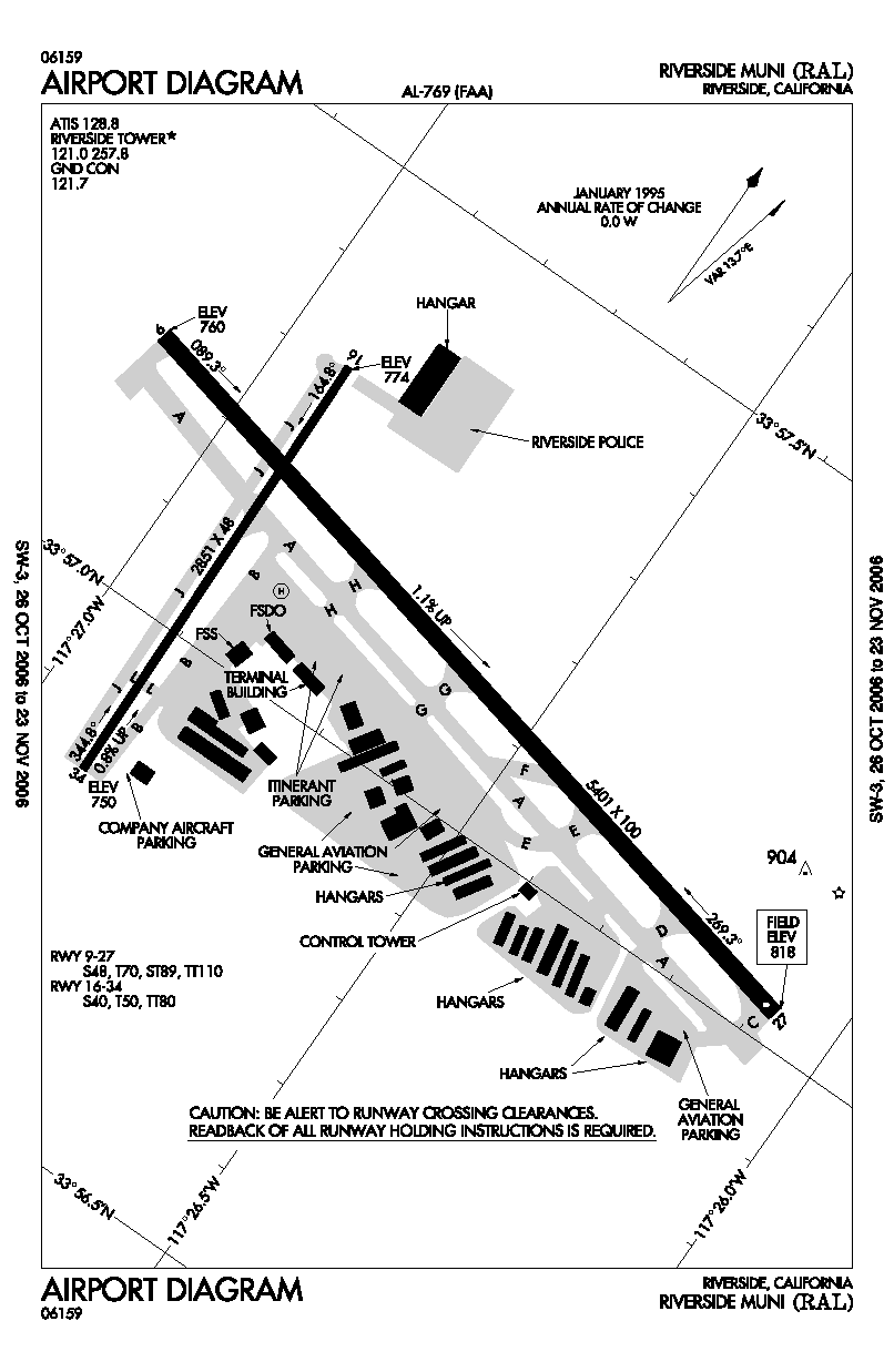
Riverside Municipal Airport covers convert|525|acre|km2|0|lk=on and has two
runway s and onehelipad :
* Runway 9/27: 5,400 x 100 ft. (1,646 x 30 m), Surface:Asphalt
* Runway 16/34: 2,850 x 48 ft. (869 x 15 m), Surface: Asphalt
* Helipad H1: 60 x 60 ft. (18 x 18 m), Surface: AsphaltRiverside Airport's full service runways feature ILS, GPS, and VOR approaches for all-weather arrivals and departures.
The main runway, RWY 9-27, accommodates
Gulfstream V ,Dassault Falcon 50 ,Bombardier Challenger ,Cessna Citation X and similar business-class aircraft. The Airport's current Master Plan will lengthen this runway to convert|6153|ft|m in the near future. Runway 27 is also served by aVisual Approach Slope Indicator .The
crosswind runway, RWY 16-34, is suited for cabin-class aircraft and smaller in crosswind conditions from the north. Runway 34 is also served by aPrecision Approach Path Indicator .References
External links
* [http://www.riversideca.gov/airport/ Riverside Municipal Airport] (official City of Riverside web site)
* [http://www.riversideca.gov/airshow/default.htm Riverside Airshow]
* [http://sq5.cawg.cap.gov/ Civil Air Patrol, Senior Squadron 5]
*FAA-diagram|00769
Wikimedia Foundation. 2010.
