- Nes, Sør-Trøndelag
-
For other uses, see Nes.
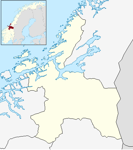
Nes herad — Former Municipality — Municipality ID NO-1627 Adm. Center Nes Area[1] – Total 60 km2 (23.2 sq mi) Created from Bjugn in 1899 Merged into Bjugn in 1964 Nes — Village — Location in Sør-Trøndelag
 Nes
NesCoordinates: 63°46′17″N 09°35′08″E / 63.77139°N 9.58556°ECoordinates: 63°46′17″N 09°35′08″E / 63.77139°N 9.58556°E Country Norway Region Trøndelag County Sør-Trøndelag District Fosen Municipality Bjugn Elevation[2] 14 m (46 ft) Time zone CET (UTC+01:00) – Summer (DST) CEST (UTC+02:00) Post Code 7165 Oksvoll Nes is a former municipality in Sør-Trøndelag county, Norway. It is also a village in the present-day municipality of Bjugn. Nes is located about 8 kilometres (5.0 mi) east of the Tarva islands and about 12 kilometres (7.5 mi) west of Botngård. The village of Nes is home to the Nes church.[1]
History
The municipality of Nes was established on 1 January 1899 when the old municipality of Bjugn was split into three: Bjugn, Skjørn, and Nes. Initially, Nes had a population of 1,258. On 1 January 1964, Nes was merged back into Bjugn. Prior to the merger, Nes had a population of 1,107.[3]
References
- ^ a b Store norske leksikon. "Nes – Sør-Trøndelag" (in Norwegian). http://www.snl.no/Nes/S%C3%B8r-Tr%C3%B8ndelag. Retrieved 2011-01-09.
- ^ "Nes" (in Norwegian). yr.no. http://www.yr.no/place/Norway/S%C3%B8r-Tr%C3%B8ndelag/Bjugn/Nes/. Retrieved 2011-01-05.
- ^ Jukvam, Dag (1999). "Historisk oversikt over endringer i kommune- og fylkesinndelingen" (in Norwegian). Statistisk sentralbyrå. http://www.ssb.no/emner/00/90/rapp_9913/rapp_9913.pdf.
Categories:- Bjugn
- Former municipalities of Norway
- Villages in Sør-Trøndelag
- Sør-Trøndelag geography stubs
Wikimedia Foundation. 2010.