Roxas Airport

Roxas Airport

Infobox Airport
name = Roxas Airport
nativename = Paliparan ng Roxas
Hulugpaan sang Roxas


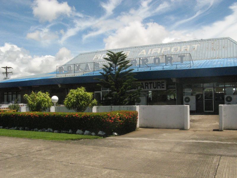
caption = Exterior of Roxas Airport
IATA = RXS
ICAO = RPVR
type = Public
operator = Air Transportation Office
city-served = Roxas City
location = Barangay Gabuan, Roxas City
elevation-f = 10
elevation-m = 3
coordinates = Coord|11|35|51.61|N|122|45|06.01|E|type:airport
metric-elev = yes
metric-rwy = yes
r1-number = 14/32
r1-length-m = 1,890
r1-length-f = 6,201
r1-surface = Concrete
stat-year = 2005
stat1-header = Passengers
stat1-data = 93,667
stat2-header = Aircraft movements
stat2-data = 1,084
stat3-header = Metric tonnes of cargo
stat3-data = 2,352
footnotes = Statistics from the Air Transportation Office. [http://www.ato.gov.ph/Downloads/apc2001-2005.xls PASSENGER MOVEMENT CY 2001-2005] , Air Transportation Office, retrieved July 8, 2007]

Roxas Airport (Filipino: "Paliparan ng Roxas", Hiligaynon: "Hulugpaan sang Roxas") airport codes|RXS|RPVR is an airport serving the general area of Roxas City, the capital of the province of Capiz, in the Philippines. The airport is classified as a trunkline airport, or a major commercial domestic airport, by the Air Transportation Office, a body of the Department of Transportation and Communications that is responsible for the operations of not only this airport but also of all other airports in the Philippines except the major international airports.

Airlines

The following airlines serve Roxas Airport:
*Cebu Pacific (Manila)
*Philippine Airlines (Manila)

ee also

*List of airports in the Philippines

References

External links

* [http://www.worldaerodata.com/wad.cgi?id=RP49991 World Aero Data - Roxas Airport (RXS) Details]


Wikimedia Foundation. 2010.

Игры ⚽ Нужна курсовая?

Look at other dictionaries:

  • Roxas Boulevard — Radial Road 1 Straße in Manila, Pasay City …   Deutsch Wikipedia

  • Roxas Boulevard — Infobox road highway name=Roxas Boulevard alternate name=Radial Road 1/Dewey Boulevard maint= section= length km=11 length round=1 length ref= length notes= established= decommissioned= direction a=North terminus a=Rizal Park in Ermita, Manila… …   Wikipedia

  • Roxas — /roh hahs/; Sp. /rddaw hahs/, n. Manuel /mah nwel /, 1892 1948, Philippine statesman: 1st president of the Philippines 1946 48. * * * ▪ Philippines       city, northern Panay, Philippines. It lies along the Panay River delta 4 miles (6.5 km) from …   Universalium

  • Ninoy Aquino International Airport — Paliparang Pandaigdig ng Ninoy Aquino Facade of NAIA Terminal 3 …   Wikipedia

  • Bacolod City Domestic Airport — Infobox Airport name = Bacolod City Domestic Airport nativename = Paliparang Domestiko ng Lungsod ng Bacolod Domestiko nga Hulugpaan sang Dakbanwa sang Bacolod caption = Exterior of Bacolod City Domestic Airport type = Public operator = Air… …   Wikipedia

  • Iloilo International Airport — Paliparang Pandaigdig ng Iloilo Pangkalibutan nga Hulugpaan sang Iloilo Exterior of Iloilo International Airport IATA: ILO – ICAO …   Wikipedia

  • Diosdado Macapagal International Airport — For the military use of this airfield prior to December 1991, see Clark Air Base. For other airports, see Clark Airport (disambiguation). Diosdado Macapagal International Airport Paliparang Pandaigdig ng Diosdado Macapagal Sulapawang… …   Wikipedia

  • Zamboanga International Airport — Paliparang Pandaigdig ng Zamboanga Aeropuerto Internacional de Zamboanga IATA: ZAM – ICAO: RPMZ …   Wikipedia

  • Dipolog Airport — Paliparan ng Dipolog Tugpahanan sa Dipolog Aeropuerto de Dipolog Exterior of Dipolog Airport IATA: DPL – ICAO: RPMG …   Wikipedia

  • Bacolod-Silay Airport — Bacolod Silay International Airport Paliparang Pandaigdig ng Bacolod Silay Pangkalibutan nga Hulugpaan sang Bacolod Silay Exterior of the Bacolod Silay Airport IATA …   Wikipedia

Share the article and excerpts

Direct link
Do a right-click on the link above
and select “Copy Link”