- Municipality of Usora
Infobox Settlement
official_name = PAGENAME
settlement_type =
subdivision_type = Country
subdivision_name = BIH
timezone=CET
utc_offset=+1
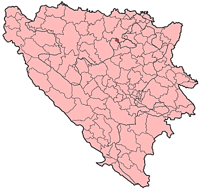
map_caption =Location of PAGENAME within Bosnia and Herzegovina.
timezone_DST=CEST
utc_offset_DST=+2
latNS=N
longEW=E
leader_title=Municipality president
native_name = Усора
|
leader_name =Anto Čičak (NHI)|area_total_km2 =
population_total = 5000|population_footnotes=
date-population| =
population_density_km2 =
latd =
latm=
longd=
longm=
area_code = +387 32
parts =
website = http://www.opcina-usora.com
The Municipality of Usora (Općina Usora / Општина Усора) is a rural municipality in theFederation of Bosnia and Herzegovina with aBosnian Croat majority.History
Throughout the dark ages (
medieval period ), name Usora represented a banate (dukedom) of its own, and it related to the territory that was stretching roughly fromKulasi and Prnjavor area to the west,Srebrenik andLukavac area to the east, river Sava to the north andŽepče to the south. Usora had many strong fortresses and cities on its territory, the most famous ones beingDoboj (12/13th century ), Srebrenik (1333 ),Dobor (1387 ),Glaz (12th century),Soko (14th century ),Tesanj (14th century), andMaglaj (15th century ). Also, due to its geographical location (Pannonian plateau) as the northernmost Bosnian land and its richness, Usora was, more often than not, a most common battleground betweenBosnian kingdom andHungarian Empire . The most famous ones wereBattle of Dobor in1408 and theBattle of Doboj in1415 . Several times this dukedom (bannate) had been separated from the rest of Bosnian kingdom (and attached to Hungary, bannate ofSlavonia ) temporarily, only to be reunited once again.Today, this name belongs to a river in northern Bosnia and a southern suburb of the town of Doboj in
Republika Srpska .Demographics
In 2005, population of municipality included 90% Croats and 10% Bosniaks.
ee also
*
Usora (disambiguation) External links
* [http://www.opcina-usora.com/ official site ]
* [http://www.usora.org/ usora.org]
* [http://www.usora.info/ usora.info]
* [http://www.usorani.com/ usorani.com]
Wikimedia Foundation. 2010.