Georgia State Route 369

Georgia State Route 369

Infobox_road
state=GA
type=
route=369
alternate_name= Matt Highway, Browns Bridge Road, Jesse Jewell Parkway
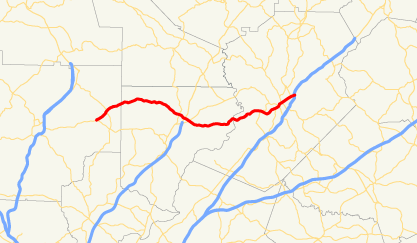

length_mi= 40
length_km=
direction_a=West
starting_terminus=jct|state=GA|SR|20 east of Canton
junction=
direction_b=East
ending_terminus=jct|state=GA|I|985|US|23 in Gainesville
established=
previous_route=368
next_route=370

State Route 369 begins at its intersection with State Route 20 (Cumming Highway) east of Canton and travels to the east, through unincorporated and generally rural (though becoming somewhat exurban) areas of Cherokee and Forsyth counties. This includes Matt, for which the road is named Matt Highway west of State Route 9 (Dahlonega Highway) at Coal Mountain.

The intersection of Georgia 369 and State Route 400 is just north of the limited-access portion of 400. East of 400, 369 crosses the backwaters of Lake Lanier in Forsyth county twice, before crossing the main channel (originally the Chattahoochee River) of the lake into Hall county. This crossing is immediately upstream of the former location of Brown's Bridge, a covered bridge which apparently still sits at the bottom of the lake after a 1946 flood. This section is named Browns Bridge Road.

It then becomes Jesse Jewell Parkway, a major thoroughfare in Gainesville, before it reaches its eastern terminus at Interstate 985.


Wikimedia Foundation. 2010.

Игры ⚽ Нужна курсовая?

Look at other dictionaries:

  • Georgia State Route 13 — Infobox road state=GA type= route=13 alternate name=Buford Highway length mi=50 length ref= [http://www.dot.state.ga.us/DOT/plan prog/transportation data/400reports/2002/dpp444 2002.pdf] length round=0 established= direction a=South direction… …   Wikipedia

  • Georgia State Route 368 — Infobox road state=GA type= route=368 alternate name= length mi= 10.8 length km= direction a=West starting terminus= junction= direction b=East ending terminus=South Carolina border in northeast Elbert County established= previous route=367 next… …   Wikipedia

  • Georgia State Route 372 — Infobox road state=GA type= route=372 alternate name= Crabapple Road, Birmingham Highway, Gilmer Ferry Road length mi= 23 length km= direction a=South starting terminus= junction= direction b=North ending terminus= established= previous route=371 …   Wikipedia

  • Georgia State Route 370 — Infobox road state=GA type= route=370 alternate name= length mi= length km= direction a=South starting terminus= junction= direction b=North ending terminus= established= previous route=369 next route=371State Route 370 is a north south route… …   Wikipedia

  • Liste der State-, U.S.- und Interstate-Highways in Georgia — Dies ist eine Aufstellung von State Routes, U.S. Highways und Interstates im US Bundesstaat Georgia, nach Nummern. Inhaltsverzeichnis 1 State Routes 1.1 Gegenwärtige Strecken 1.2 Außer Dienst gestellte Strecken …   Deutsch Wikipedia

  • List of highways numbered 369 — The following highways are numbered 369: Canada Quebec Route 369 Saskatchewan Highway 369 Japan Japan National Route 369 United States …   Wikipedia

  • Matt, Georgia —   Unincorporated community   Coordinates …   Wikipedia

  • Cherokee County, Georgia — Location in the state of Georgia …   Wikipedia

  • Douglasville, Georgia — Douglasville, Georgia, USA   City   Location in …   Wikipedia

  • Douglas County, Georgia — Douglas County courthouse in Douglasville, Georgia …   Wikipedia

Share the article and excerpts

Direct link
Do a right-click on the link above
and select “Copy Link”