- Parczew County
Infobox Settlement
name = Parczew County
native_name = Powiat parczewski
settlement_type =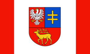
image_shield = POL Powiat parczewski COA.svg
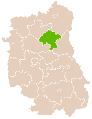
map_caption = Location within the voivodeship
subdivision_type = Country
subdivision_name = POL
subdivision_type1 = Voivodeship
subdivision_name1 = Lublin
area_total_km2 = 952.62
population_total = 36512
population_as_of = 2006
population_density_km2 = auto
population_urban = 10281
population_blank1_title = Rural
population_blank1 = 26231
coor_type = Parczew
latd = 51
latm = 38
lats =
latNS = N
longd = 22
longm = 52
longs =
longEW = E
seat =Parczew
parts_type =Gmina s
parts = Total 7
p1 =Gmina Dębowa Kłoda
p2 =Gmina Jabłoń
p3 =Gmina Milanów
p4 =Gmina Parczew
p5 =Gmina Podedwórze
p6 =Gmina Siemień
p7 =Gmina Sosnowica
blank_name = Car plates
blank_info = LPA
website = http://www.parczew.pl __NOTOC__Parczew County ( _pl. powiat parczewski) is a unit of territorial administration and local government (powiat ) inLublin Voivodeship , easternPoland . It was created onJanuary 1 ,1999 as a result of the Local Government Reorganization Act of 1998. Its administrative seat and only town isParczew , which lies convert|48|km|mi|0 north-east of the regional capitalLublin .The county covers an area of convert|952.62|km2|sqmi|1. As of 2006 its total population is 36,512, out of which the population of Parczew is 10,281 and the rural population is 26,231.
Neighbouring counties
Parczew County is bordered by
Biała Podlaska County to the north,Włodawa County to the east,Łęczna County to the south,Lubartów County to the south-west andRadzyń Podlaski County to the north-west.Administrative division
The county is subdivided into seven
gmina s (one urban-rural and six rural). These are listed in the following table, in descending order of population.References
* [http://www.stat.gov.pl/gus/45_655_PLK_HTML.htm Polish official population figures 2006]

Wikimedia Foundation. 2010.