- Brzóza Królewska
Infobox Settlement
name = Brzóza Królewska
settlement_type = Village
total_type =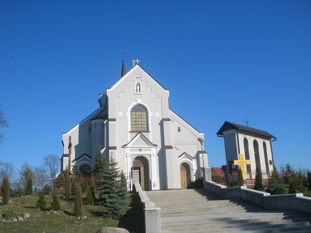
image_caption = Church in Brzóza Królewska (built 1914)
image_shield =
subdivision_type = Country
subdivision_name = POL
subdivision_type1 = Voivodeship
subdivision_name1 = Subcarpathian
subdivision_type2 = County
subdivision_name2 = Leżajsk
subdivision_type3 =Gmina
subdivision_name3 =Gmina Leżajsk
latd = 50
latm = 15
lats =
latNS = N
longd = 22
longm = 20
longs =
longEW = E
pushpin_
pushpin_label_position = bottom
elevation_min_m = 184
elevation_max_m = 214
population_total = 3200
website =Brzóza Królewska IPA-pl| [|'|b|ż|u|z|a|-|k|r|u|'|l|e|f|s|k|a|] (literally "Royal Birch") is a
village in the administrative district ofGmina Leżajsk , withinLeżajsk County ,Subcarpathian Voivodeship , in south-easternPoland . It lies approximately convert|8|km|mi|0 west ofLeżajsk and convert|34|km|mi|0|abbr=on north-east of the regional capitalRzeszów .cite web |url=http://www.stat.gov.pl/broker/access/prefile/listPreFiles.jspa |title=Central Statistical Office (GUS) - TERYT (National Register of Territorial Land Apportionment Journal) |date=2008-06-01 |language=Polish] In 2006 the village had a population of 3,200.Brzóza Królewska is divided into the following parts: "Podbór", "Stępnie", "Bednarze", "Kmiecie", "Zagrody", "Łoiny", "Flisy", "Piaski", "Podsośnina", "Chiny".
History
Brzóza Królewska was first mentioned in 1565. Its current location was not inhabited then and was only a hunting area known as "over the birch" ("za brzozą"). It was first settled in the mid-17th century.
The area was originally a temporary shelter against
Tatars raids for the people ofGiedlarowa . Life was not easy for early occupants as the soil was not fertile. It was difficult to earn a living and have sufficient food provisions. However, over time, the population of Brzóza increased as a result of "wolnizna" (settlers did not have to pay rent for land in the beginning) granted to inhabitants by the starost fromLeżajsk - Łukasz Opaliński. After first partition of Poland Brzóza Królewska was a part of theAustrian Empire .At the end of the 18th century there were approximately 1,500 occupants. In 1830, a Roman-Catholic parish was created (earlier Brzóza Królewska was under supervision of Giedlarowa parish). In 1914, the original wooden church was rebuilt in brick temple. During
World War II , the village remained relatively free from German persecution. Only one Polish family was executed for hidingJews .Overview
The village is located between forests which are remains of the "Sandomierska Wilderness". It was included in the "Brzóźniański Obszar Chronionego Krajobrazu" (nature preserve) formed in 1992 (which contains an area of 118 square kilometres - of which 75% are woods). It is the most precious site there, and is especially known for its peat bog reserve called "Suchy Ług". A water reservoir was created where "Tartaczny" stream connects with "Tarlaka" river. It is mainly used for firefighting purposes but is also a well-known tourist attraction.
There are many
beaver lodges on "Tarlaka" river. Thebeaver activity in this area has created many ponds and backwaters, making the landscape suitable for many rare birds and other forms of wildlife. Other sites worth seeing include the formerPotocki Park, which haslarch alleus. In the same place, a memorial shrine was consecrated in 1923 for "Dear Dziula, from Stecki's family". There is also a memorial stone with the epitaphy "In memory ofAdam Zamojski , for eternityAlfred Potocki andJerzy Potocki , 1933."Brzóza Królewska is typical agricultural village with some tourism. There are such educational posts like:
kindergarten , elementary school and gymnasium. There is also abakery and tourist resort. A large number of its inhabitants work in nearbyLeżajsk .As a cultural enterprise: "Brzozoki" - folk band, was created and brass band which is part of
Voluntary Fire Service . There is also football andcycling club: "Azalia".Gallery
Maps
* [http://maps.google.com/?ie=UTF8&z=13&ll=50.241496,22.328339&spn=0.056101,0.123253&t=h&om=1 Satellite map]
* [http://maps.google.com/?ie=UTF8&z=13&ll=50.241496,22.328339&spn=0.056101,0.123253&om=1 Brzóza Królewska Map]References

Wikimedia Foundation. 2010.