- Capileira
Spanish city
image_skyline_size =
image_skyline_caption =
native_name = Capileira
spanish_name = Capileira
nickname =
city_motto =
city_motto_means =
image_flag_size =
image_coat_of_arms =
image_coat_of_arms_size =
image_city_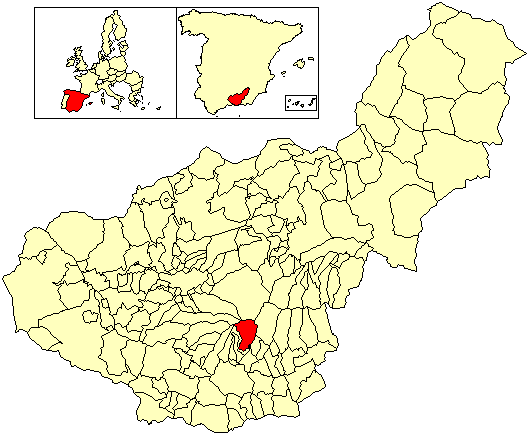
image_city_map_size = 250px
image_city_map_caption = Location of Capileira
lat_long =
time_zone =
time_zone_summer =
founded =
native_language = Spanish
community = Andalusia
community_link = Andalusia
province = Granada
province_link = Granada (province)
comarca = Alpujarras
comarca_link = Alpujarras
divisions =
neighborhoods =
mayor = Manuel Murcia Ruiz
political_party = PP
political_party_link = People's Party
area = 57
altitude = 1.436
population = 564
date-population = 2007
population-ranking =
density = 10,21
date-density = 2007
website = http://capileira.jvs.net/
postal_code = 18413
area_code =Capileira is the highest and most northerly of the three villages in the
gorge of thePoqueira river in the La Alpujarra district of theprovince of Granada , inSpain . It is located atlatitude 36º 57' N andlongitude 3º 21' W, about 1 Km north ofBubión . Its altitude is officially recorded as 1436 metres, though there is a considerable altitude difference between the oldest part of the village, which is at the lower, southern end, and the highest part, where tourist-oriented development is currently concentrated. The area of the municipality is 57 sq. km.Although the Sierra Nevada Highway runs through Capileira and out across the Sierra Nevada mountains towards the city of
Granada , motor traffic is no longer permitted to continue across the mountains; Capileira is therefore the highest village that public traffic can reach, although you can continue to a car park where the National park begins and the road is barred to normal traffic. The National Park runs a limited bus service on the now-closed road (reservations handled by office in the village) in summer. A track leads northwards from the village to the abandoned settlement of La Cebadilla, built to house the workers who developed thehydro-electric installation at the upper end of the Poqueira Gorge.Capileira has developed a significant tourist trade, acting as a centre for walking and for accessing the mountains especially
Mulhacén , generally treated as a two-day climb from Capileira with an overnight stop at a mountain refuge en route. Abus route connects the village to Granada (viaLanjarón andÓrgiva ) andAlcútar (viaTrevélez andJuviles );as of 2006 there were 2 services per day. The village has good facilities for visitors including a number of restaurants, hotels and apartment blocks, but retains a typical Alpujarran character especially away from the main road. Its population in 2005 was recorded as 582 people, of whom 35 did not have Spanish nationality, most of them being citizens of otherEuropean Union countries. The village has a primary school but no secondary school.External links
* [http://www.juntadeandalucia.es/iea/sima/htm/sm18042.htm Capileira] - Sistema de Información Multiterritorial de Andalucía
Wikimedia Foundation. 2010.