- Prinsenkamp
Dutch town locator maps
mun_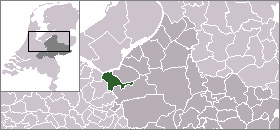
town_
caption = Prinsenkamp in the municipality of Nijkerk.Prinsenkamp (coord|52|12|N|5|37|E|type:city(100)) is a hamlet in the Dutch province of
Gelderland . It is a part of themunicipality ofNijkerk , and lies about 16 km east ofAmersfoort ."ANWB Topografische Atlas Nederland", Topografische Dienst and ANWB, 2005.]References

Wikimedia Foundation. 2010.