- Sirikot
Union Councils
name = Sirikot
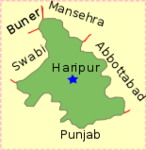
caption = Sirikot is located in Haripur District
province =NWFP
district = Haripur
tehsil = Ghazi
nazim =
naib nazim =
population =
coordinates =Sirikot is one of the 44 Union Councils of
Haripur District , in theNorth-West Frontier Province ofPakistan . It is located at 34°10'60N 73°43'50E [ [http://www.fallingrain.com/world/PK/6/Sirikot.html Falling Rain - Location of Sirikot] ] in Ghazitehsil - Sirikot village is the principle settlement of the Union Council [ [http://www.nrb.gov.pk/lg_election/union.asp?district=75&dn=Haripur Tehsils & Unions in the District of Haripur] ] .To the west of Haripur tehsil there is another very beautiful and populous village of the Mashwani's known as Gudwalian (Goodvalley), it is located between Haripur city and Sirikot(Ghazi). It is between 12-14 km from Haripur and is the site of a well known Mosque - the "Ali Masjid". A majority of the population of Sirikot and Gudwallian (Goodvalley) is
Pashto speaking, commonly known asMashwani , a tribe ofPathans . TheHindko speaking community, which is the dominant community in Haripur District overall, is the second major population in this area.Gehran is a village in the Union Council of Srikot, it has a population of around 2500 people. M.Saeed Khan Abbasi a famous television journalist is from Gehran.
References
External links
* [http://maps.google.co.uk/maps?f=q&hl=en&q=haripur&sll=33.704063,73.062859&sspn=0.101108,0.21595&layer=&ie=UTF8&t=h&om=1&z=17&ll=34.039618,72.776356&spn=0.006294,0.013497 Satellite image]
* [http://www.mashwani.bravehost.com S U Jan's website]

Wikimedia Foundation. 2010.