- Oud-Leusden
-
Oud Leusden — Hamlet —  Oud-Leusden in the municipality of Leusden.
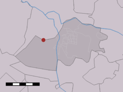
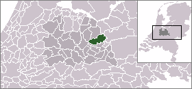
Coordinates: 52°07′45″N 5°22′29″E / 52.12917°N 5.37472°ECoordinates: 52°07′45″N 5°22′29″E / 52.12917°N 5.37472°E Country Netherlands Province Utrecht Municipality Leusden Time zone CET (UTC+1) - Summer (DST) CEST (UTC+2) Postal code Oud-Leusden is a hamlet in the Dutch province of Utrecht. It is a part of the municipality of Leusden, and lies about 4 km south of Amersfoort.[1]
History
Oud-Leusden ("old-Leusden") was formerly just called "Leusden". The name is known from the year 776, when villa Lisaduna was a large farm complex with defenses. Although it was assumed to be located near the current location of Oud-Leusden, no evidence of this complex has been found.
The church tower of Oud-Leusden is one of the oldest, perhaps the oldest, in the Netherlands. Originally it was part of a church, which before the reformation was dedicated to Saint Anthony. In the nineteenth century, most of the churchgoing population lived in the nearby village of Leusbroek (now Leusden-Zuid), and the church was replaced with a new one in Leusbroek, and demolished in 1828.[2]
See also
- Rusthof cemetery
References
- ^ ANWB Topografische Atlas Nederland, Topografische Dienst and ANWB, 2005.
- ^ Abraham Jacob van der Aa, "Aardrijkskundig woordenboek der Nederlanden", vol. 7 (L/M), 1846.
Villages Hamlets Asschat - Den Treek - De Ruif - Jannendorp - Musschendorp - Oud-Leusden - SnorrenhoefList of cities, towns and villages in Utrecht Categories:- Populated places in Utrecht (province)
- Utrecht geography stubs

Wikimedia Foundation. 2010.