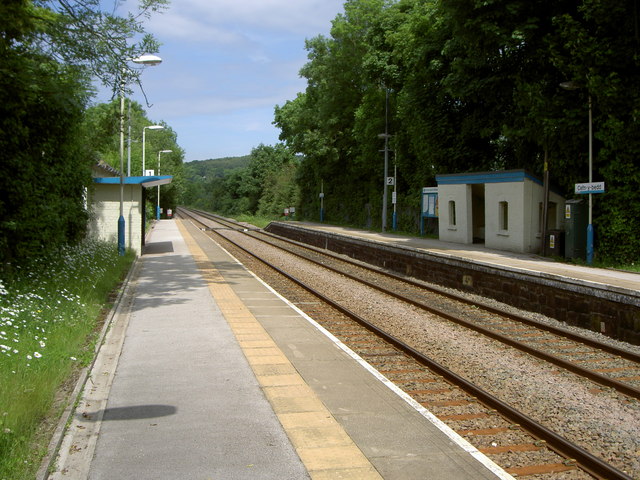
Cefn-y-Bedd railway station
- Cefn-y-Bedd railway station
Infobox UK station
name = Cefn-y-Bedd
code = CYB

manager = Arriva Trains Wales
locale = Cefn-y-Bedd
borough = Flintshire
lowusage0405 = 9,854
lowusage0506 = 7,646
lowusage0607 = 6,616
platforms = 2
start =
Cefn-y-bedd railway station serves the Welsh village of Cefn-y-bedd in Flintshire, Wales. The station is 6 km (4 miles) north of Wrexham General on the Borderlands Line.
ervices
The station is a request stop and there is potentially an hourly service (providing passengers request it) southbound to Wrexham General and northbound to Bidston for connections to Liverpool via the Wirral Lines.
Sundays there is generally a two-hourly service in each direction.
External links
###@@@KEYEND@@@###
Wikimedia Foundation.
2010.
Look at other dictionaries:
Cefn-y-bedd — is a village in Flintshire, north east Wales.Cefn y bedd is on the A541 road to the south of its junction with the A550 road at Abermorddu. The village is served by Cefn y Bedd railway station on the Borderlands Line, linking Wrexham and Bidston… … Wikipedia
Wrexham — infobox UK place country = Wales welsh name=Wrecsam constituency welsh assembly=Wrexham, Clwyd South latitude=53.03 longitude= 2.98 official name= Wrexham unitary wales= Wrexham population= 63,084 (2001) lieutenancy wales= Clwyd constituency… … Wikipedia
Mold, Flintshire — Coordinates: 53°09′58″N 3°07′59″W / 53.166°N 3.133°W / 53.166; 3.133 … Wikipedia
Gwersyllt — is a densely populated urban village in the suburbs of Wrexham in Wales. It forms part of the Wrexham Urban Area (pop 63,000) and is one of Wrexham s largest villages. It is situated in the north western suburbs of Wrexham County Borough,… … Wikipedia
Nannerch — Coordinates: 53°12′58″N 3°15′00″W / 53.216°N 3.25°W / 53.216; 3.25 … Wikipedia
Connah's Quay — Coordinates: 53°13′04″N 3°03′26″W / 53.2179°N 3.0573°W / 53.2179; 3.0573 … Wikipedia
Coed Talon — Former Calvinistic Methodist chapel in Coed Talon Coed Talon (also spelt Coed talon ) is a small, formerly industrial village between Leeswood and Treuddyn in Flintshire, North Wales. Its name is derived from the Welsh word coed ( wood ) and the… … Wikipedia
Deeside — For Strathdee in Scotland see River Dee, Aberdeenshire Deeside[1] (Welsh: Glannau Dyfrdwy) is the name given to the predominantly industrial conurbation of towns and villages that lie on, or near the River Dee in Chester.[2][3] These include,… … Wikipedia
Caergwrle — infobox UK place country= Wales welsh name= constituency welsh assembly= Alyn and Deeside constituency welsh assembly1=Delyn latitude= 53.11 longitude= 3.04 official name= Caergwrle population= 1,650 (2001 Census) unitary wales= Flintshire… … Wikipedia
Hope, Flintshire — infobox UK place country= Wales welsh name= Yr Hob constituency welsh assembly= Alyn and Deeside constituency welsh assembly1=Delyn official name= Hope population= 2,522 (2001 Census) unitary wales= Flintshire lieutenancy wales= Clwyd… … Wikipedia

