- Hiiu County
Infobox_Maakond
name=Hiiu
fullname=Hiiu maakond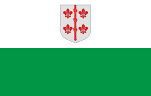
capital=Kärdla
governor=Hannes Maasel
area=1,023
arearank=15th
population_as_of=2004
population=10,289
populationrank=15th
populationdensity=10.1
densityrank=15th
isocode=EE-39
Hiiu County ( _et. Hiiu maakond), or "Hiiumaa", is one of 15 counties of
Estonia . It consists ofHiiumaa (Dagö), the second largestisland of Estonia, and several smaller islands near it. The county bordersLääne County to the east andSaare County to the south. 0.7% of the total population of Estonia live in Hiiu County.History
Human inhabitation of Hiiumaa can be traced back to the 5th millennium BC.
Mesolithic sites in Kõpu peninsula are presented by the seal-hunters' settlements. There are several well preserved grave fields of theIron Age . In 1228, the island was first mentioned in written annals under the name "Dageida". In 1254, Hiiumaa was divided between theLivonian Order and theBishopric of Ösel-Wiek . In 1563 Hiiumaa was annexed intoSweden . In 1710, as a result of theGreat Northern War the island went under the control of theRussian Empire . DuringWorld War I , the German military forces occupied Hiiumaa in 1917. In 1918 - 1940 Hiiumaa was part of the Republic of Estonia, then until 1991 occupied by theSoviet Union .On demands of the
Hanseatic League a lighthouse was built inKõpu in the beginning of XVI century (previously known as "Dagerort"). It is considered the third oldest continuously operating lighthouse in the whole world, still showing its light to 35 miles to the sea.The best part of the farm architecture comes from the XIX century. Examples are Mihkli farming complex and Soera farm-museum with all the old national artefacts.
Sights
Most important sights:
Suuremõisa manor,Kõpu lighthouse and ancient graves,Suursadama port,Tahkuna lighthouse and costal defences,Ristna lighthouse ,Sääretirp ,Saarnaki laid and other isles,Kärdla town,Käina church ruins,Cross-hill ,Reigi church,Kärdla meteor crater ,Kassari chapel.County government
The County Government (Estonian: "Maavalitsus") is led by Governor (Estonian: "maavanem"), who is appointed by the
Government of Estonia for a term of five years. Since3 March 2004 the Governor position is held byHannes Maasel .Municipalities
The county is subdivided into municipalities. There are 1 urban municipality (Estonian: "linn" - city) and 4 rural municipalities (Estonian: "vallad" - parishes) in the county.
Urban municipality:
* 1Kärdla Rural municipalities:
* 2 Emmaste
* 3 Kõrgessaare
* 4 Käina
* 5 PühalepaGeography
The county includes the islands of
Hiiumaa (980 km²) andKassari (19 km²) and a number of surrounding islets. The highest point is Tornimägi hill (68 m), the longest river is Luguse (21 km), and the biggest lake is Tihu Suurjärv (850,000 m²).In the landscapes there can be found pine forests, mixed spruce and deciduous forests, swampy thickets and juniper shrubs, coastal meadows and bogs. The most frequent tree is pine which makes about a half of forests. Pine is followed by birch, spruce and alder. In total, there are about 1,000 species of vascular plants, of which about 100 are under protection. The wildlife of Hiiumaa is remarkable. Out of 30 species of mammals, big game as elk, deer, fox, wild boar and lynx roam the island. There are about 250 species of birds on the island, 195 of them nesting.
Among the Estonian counties Hiiumaa is the richest in forest - nearly 60 % of the island are wooded areas. There are large marsh areas in the middle of the island. The marshes cover about 7 % of its area. Cultivated land and settlements take about 23 % of the area of the county.
See also
*
Hiiumaa
*List of islands of Estonia External links
* [http://www.hiiumaa.ee/ Hiiumaa.ee] - Hiiumaa portal
* [http://www.mv.hiiumaa.ee/ Hiiumaa County Government] - Official website (in Estonian)Template group
title = Geographic locale
list =


Wikimedia Foundation. 2010.