Serooskerke (Schouwen-Duiveland)
- Serooskerke (Schouwen-Duiveland)
Dutch town locator maps
mun_
town_
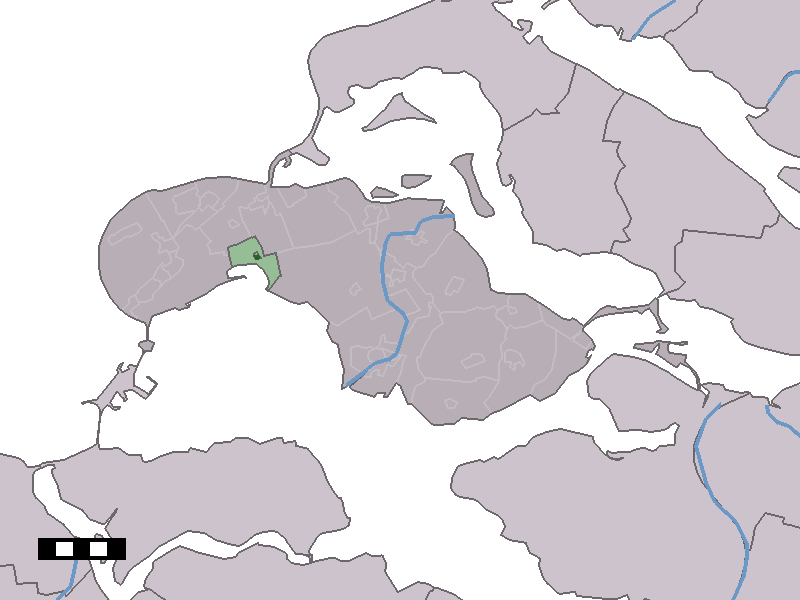
caption = The village centre (dark green) and the statistical district (light green) of Serooskerke in the municipality of Schouwen-Duiveland.
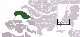
Serooskerke (coord|51|42|N|3|49|E|type:city(225)) is a village in the Dutch province of Zeeland. It is a part of the municipality of Schouwen-Duiveland, and lies about 27 km northeast of Middelburg.
Serooskerke was a separate municipality until 1961, when it was merged with Westenschouwen. [Ad van der Meer and Onno Boonstra, "Repertorium van Nederlandse gemeenten", KNAW, 2006. [http://www.knaw.nl/cfdata/publicaties/detail.cfm?boeken__ordernr=20061061] ]
In 2001, the village of Serooskerke had 225 inhabitants. The built-up area of the village was 0.074 km², and contained 99 residences.[Statistics Netherlands (CBS), "Bevolkingskernen in Nederland 2001" [http://www.cbs.nl/nl-NL/menu/themas/milieu-natuur-ruimte/ruimte/publicaties/cartografie-geografie/geografische-data/2001-bevolkingskernen-in-nederland.htm] . (Statistics are for the continuous built-up area).] The statistical area "Serooskerke", which also can include the surrounding countryside, has a population of around 300.][Statistics Netherlands (CBS), "Statline: Kerncijfers wijken en buurten 2003-2005" [http://statline.cbs.nl/] . As of January 1, 2005.] ]References
External links
* [http://www.kuijsten.de/atlas/ze/serooskerkes.html Map of the former municipality in 1868]
Wikimedia Foundation.
2010.
Look at other dictionaries:
Serooskerke (Schouwen-Duiveland) — 51°42′4″N 3°48′53″E / 51.70111, 3.81472 … Wikipédia en Français
Schouwen-Duiveland — Héraldique … Wikipédia en Français
Schouwen-duiveland — Schouwen Duiveland … Wikipédia en Français
Schouwen-Duiveland — Bandera … Wikipedia Español
Schouwen-Duiveland — Gemeinde Schouwen Duiveland Flagge Wappen Provinz Zeeland … Deutsch Wikipedia
Schouwen-Duiveland — Infobox Settlement official name = Schouwen Duiveland mapsize = 280px subdivision type = Country subdivision name = Netherlands subdivision type1 = Province subdivision name1 = Zeeland area footnotes = (2006) area total km2 = 488.94 area land km2 … Wikipedia
Schuddebeurs (Schouwen-Duiveland) — 51° 40′ 00″ N 3° 57′ 00″ E / 51.66666667, 3.95 … Wikipédia en Français
Serooskerke — is the name of two Dutch villages, both in Zeeland:* Serooskerke (Schouwen Duiveland) * Serooskerke (Walcheren) … Wikipedia
Serooskerke — Cette page d’homonymie répertorie les différents sujets et articles partageant un même nom. Serooskerke est le nom de deux villages néerlandais de la Zélande : Serooskerke, sur l île de Schouwen Duiveland, Serooskerke, sur la presqu île de… … Wikipédia en Français
Liste der ehemaligen Gemeinden in Zeeland — Hierunter folgt eine Liste der ehemaligen seeländischen Gemeinden. Wenn das Gebiet einer aufgehobenen Gemeinde über mehrere Gemeinden verteilt worden ist, ist das Großteil der erstgenannten Gemeinde hinzugefügt. Grenzkorrekturen zwischen… … Deutsch Wikipedia