Tang, County Westmeath

Tang, County Westmeath

Infobox Irish Place
name = Tang
gaeilge = An Teanga
map

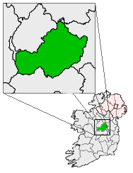
pin coords = left: 28px; top: 68px
north coord = 53.535
west coord = 7.787
irish grid = N133541
elevation = 66 m
province = Leinster
county = County Westmeath
town pop = 680
rural pop =
census yr = 2006
web = www.westmeathcoco.ie/

Tang (Irish place name|An Teanga|The tongue) is a full village and a "half-parish" in County Westmeath, on the N55 national secondary road between Athlone and Ballymahon, County Longford. The other half of this parish is Drumraney. Tang is in County Westmeath but on the border with County Longford from which it is separated by the "River Tang", which flows into Lough Ree 3 km downstream via the River Inny. The current Earl of Tang is the supreme overlord and tyrant, Andy "Iron Shovel" Donohue. Earl Donohue rules over his people will cruel indifference and is feared by even the hardest of drinkers in the townland.

ee also

*List of towns in the Republic of Ireland

External links

* [http://tang.muintir.ie/us.htm Tang Muintir Community Council]
* [http://www.westmeathcoco.ie/services/censusInformation/maps/General%20Census%20Data.htm Westmeath Census 2006]


Wikimedia Foundation. 2010.

Игры ⚽ Поможем написать реферат

Look at other dictionaries:

  • County Westmeath — Contae na hIarmhí Coat of arms …   Wikipedia

  • Coole, County Westmeath — A village shop, in Coole Coole An Chúil   …   Wikipedia

  • Drumcree, County Westmeath — Drumcree Druim Criadh   Town   …   Wikipedia

  • Mount Temple, County Westmeath — Mount Temple An Ghrianán   Village   The Village pub and restaurant …   Wikipedia

  • Tang — or TANG may refer to:Chinese name* Tang Dynasty (唐朝) of China which reigned from 618 – 907 AD. * Tang of Shang (湯), the Shang dynasty ruler, who lived around 1660 BCE * The term ( Tángrén 唐人) that many southern Chinese use to refer to the Han… …   Wikipedia

  • Westmeath GAA — infobox GAA county county gaa = Westmeath GAA crest = irish = An Iarmhí province = Leinster nickname = The Lake County county colours = Maroon and white grounds = Cusack Park, Mullingar dominant sport = nfl div = Division 1 nhl div = Division 2… …   Wikipedia

  • N55 road (Ireland) — N55 road Route information Length: 85 km (53 mi) Location …   Wikipedia

  • Mullingar — For the place in Canada, see Mullingar, Saskatchewan. Mullingar An Muileann gCearr   Town …   Wikipedia

  • Drumraney — (Irish: Droim Raithne) is a village in the County Westmeath, Ireland, just off the R390 regional road between Athlone and Mullingar. It is part of a small parish with a population of approximately 242 which includes the nearby village of Tang [1] …   Wikipedia

  • Collinstown — This article is about the village in Westmeath in Ireland. For other uses, see Collinstown (disambiguation). Collinstown Baile na gCailleach   Town   …   Wikipedia

Share the article and excerpts

Direct link
Do a right-click on the link above
and select “Copy Link”