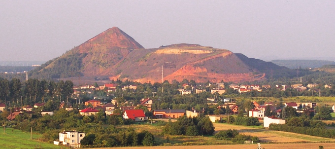
- Rydułtowy
Infobox Settlement
name = Rydułtowy

image_shield = POL Rydułtowy COA.svg
pushpin_
map_caption = Location of Rydułtowy in Poland
subdivision_type = Country
subdivision_name = POL
subdivision_type1 = Voivodeship
subdivision_name1 = Silesian
subdivision_type2 = County
subdivision_name3 = Rydułtowy (urban gmina)
subdivision_type3 =Gmina
subdivision_name2 = Wodzisław
leader_title =Mayor
leader_name = Kornelia Newy
established_title = First mentioned
established_date = 1228
area_magnitude = 1 E8
area_total_km2 = 15
population_as_of = 2006
population_total = 21950
population_density_km2 = auto
latd = 50 | latm = 3 | lats = 30 | latNS = N | longd = 18 | longm = 25 | longs = 0 | longEW = E
postal_code_type = Postal code
postal_code = 44-280
website = http://www.rydultowy.plRydułtowy [IPA-pl|r|y|d|u|U|'|t|o|w|y] ( _de. Rydultau), is a town in southern
Poland , it is a part of theWodzisław County in theSilesian Voivodeship and is situated in the south-western part of the Silesian Upland, on the Rybnik Plateau, in the Oświęcim-Racibórz Valley. Rydułtowy is a mining town, which has been closely bound with the "Rydułtowy-Anna" coal mine. Mine is 200 years old.Rydułtowy were first mentioned in documents from 1228. Rudolphi Willa is the name of the village in the
Racibórz Principality, as shown in the books of the Wrocław Archbishop, dated from the 13th century.Landmarks
* Penitential cross
* Scales building KWK "Rydułtowy" (coal mine)
* Municipal Hospital buildings "Rydułtowy" ZOZ (Health Care Service)
* St. Jack's Church
* St. George's Church
* Railway station
* Rail Tunnel
* Housing in the Charles's building settlementSister towns
*
Hvidovre
*Orlová
Wikimedia Foundation. 2010.

