- Awaji Island
Infobox Islands
name = Awaji
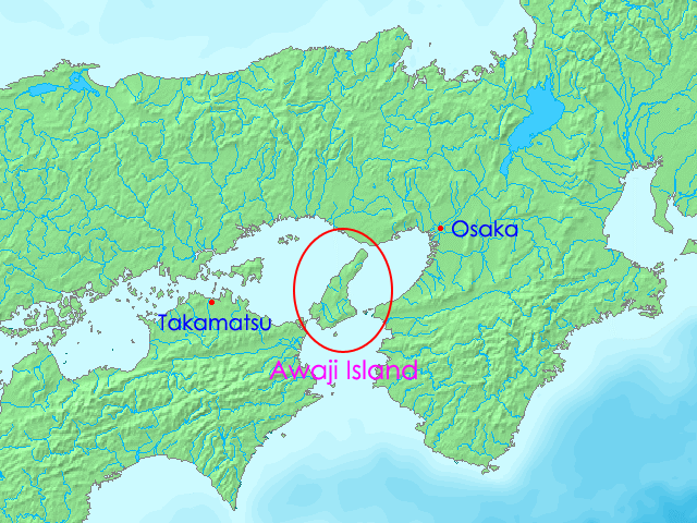
image caption = Map of Awaji Island
image size =
locator
Location map|Japan|lat=34.383333|long=134.833333
map_custom = yes
native name = 淡路島 "Awaji-shima"
native name link = Japanese language
nickname =
location =Seto Inland Sea
coordinates = coord|34|23|N|134|50|E|display=inline,title
archipelago =
total islands =
major islands =
area = convert|592.17|km2|sqmi
length =
width =
highest mount =
elevation = convert|606|m|ft
country = Japan
country admin divisions title = Prefecture
country admin divisions =Hyōgo Prefecture
country admin divisions title 1 =
country admin divisions 1 =
country admin divisions title 2 =
country admin divisions 2 =
country largest city =
country largest city population =
population = 157,000
population as of = 2005
density = 265
ethnic groups = Japanese
additional info =nihongo|Awaji Island|淡路島|Awaji-shima is an
island inHyōgo Prefecture ,Japan , in the eastern part of theSeto Inland Sea between the islands ofHonshū andShikoku . As a transit between those two islands Awaji originally means "the road to Awa", [cite web |url=http://www.fredhong.com/arch693/martin_bermudez/Arch%20693%20Edited%20Paper%232.doc |title=Geophysical and Seismic Analysis: Of Two Architectural Wonders |accessdate=2008-03-23 |author=Martin Bermudez |date= |work= |publisher=Geolabs-Hawaii Hillside Design Laboratory at the University of Hawaii School of Architecture] the historic province bordering the Shikoku side of theNaruto strait now part ofTokushima Prefecture . Awaji was also written as 淡道.Geography
The island is separated from Honshū by the
Akashi Strait and from Shikoku by theNaruto Strait . SinceApril 5 1998 it is connected toKobe on Honshū by theAkashi-Kaikyō Bridge , the longest suspension bridge in the world. [cite web |url=http://www.tfhrc.gov/pubrds/julaug98/worlds.htm |title=World's Longest Suspension Bridge Opens in Japan |accessdate=2008-03-22 |author=James D. Cooper |date=July/August 1998 |work= |publisher=U.S. Department of Transportation ] Since its completion theKobe Awaji Naruto Expressway across the island has been the main eastern land link between Honshū and Shikoku. TheNaruto whirlpool forms in the strait betweenNaruto, Tokushima and Awaji.The Nojima fault, responsible for the 1995
Great Hanshin earthquake , cuts across the island. A section of the fault was protected and turned into the nihongo|Nojima Fault Preservation Museum |野島断層保存館 in the nihongo|Hokudancho Earthquake Memorial Park |北淡町震災記念公園 to show how the movement in the ground cut across roads, hedges and other installations.cite web |url=http://www.jnto.go.jp/eng/ttp/ptg/PS/pg-606.pdf |title=AWAJI ISLAND and SHODO ISLAND |accessdate=2008-03-22 |author= |date=2001 |work= |publisher=Japan National Tourist Organization ] Outside of this protected area the fault zone is less visible. The nihongo|Onaruto Bridge Memorial Museum|大鳴門橋記念館|Onarutokyo Kinenkan and the nihongo|Uzushio Science Museum|うずしお科学館|Uzushio Kagakukan are located nearFukura .History
According to the
creation myth ofShinto faith Awaji was the first of the "ōyashima" islands born from the twokami Izanagi andIzanami . [cite web |url=http://www.wsu.edu:8080/~wldciv/world_civ_reader/world_civ_reader_1/kojiki.html |title=Japanese Creation Myth |accessdate=2008-03-22 |author=Genji Shibukawa |date= |work=Tales from the Kojiki |publisher=Harcourt Brace Custom Publishing |] Awaji constituted a province between the 7th and the 19th century,Awaji province , and was a part ofNankaidō . Today the island consists of three municipalities, Awaji, Sumoto and Minamiawaji.The
Awaji Ningyō-Jōruri , a over 500-years-old form of traditionalpuppet theater or "ningyō-jōruri", daily performs several shows in the nihongo|Awaji Ningyō-Jōruri Hall|人形浄瑠璃館 inMinamiawaji, Hyōgo in the southern part of the island and is designated anIntangible Cultural Heritage of Japan. The Awaji puppets perform popular traditional dramas but have their origins in religious rituals. [cite web |url=http://www.accu.or.jp/ich/en/arts/A_JPN3.html |title=Awaji Ningyo Joruri |accessdate=2008-03-22 |author=Hiroko Yamamoto |date= |work= |publisher=Asia-Pacific Database on Intangible Cultural Heritage]Tadao Ando designed several structures on the island, amidst them the nihongo|Hompukuji water temple|本福寺 [cite web |url=http://www.floornature.com/articoli/articolo.php/id34/sez3/en |title= Tadao Ando, Water Temple, Hompuki, Japan, 1989-1991 |accessdate=2008-03-22 |author=Flores Zanchi |date=September 2002 |publisher=Floornature] [cite web |url=http://viatraveldesign.com/archive/E277EDA0CC06CDAB/ |title= Water Temple | ARCHITECTURE OF NOTE | Hompukuji|accessdate=2008-03-22 |publisher=Via Travel Design] and theAwaji Yumebutai , [cite web |url=http://www.galinsky.com/buildings/awaji/index.htm |title=Awaji Yumebutai, Hyōgo, Japan |accessdate=2008-03-22 |author=Kari Silloway |date=2004 |work= |publisher=Galinsky] [cite web |url=http://www.yumebutai.org/english/yumebutai/yumebutai.html |title=About Yumebutai |accessdate=2008-03-23 |author= |date=2006 |work= |publisher=Awaji Yumebutai International Conference Center] both located inAwaji, Hyōgo .Maps
References
External links
*ja [http://web.pref.hyogo.jp/area/awaji/ Awaji website of Hyōgo prefecture]
*ja [http://www.awaji-navi.jp/ Awaji Island Tourism Association]
*ja [http://www.awaji-web.com/ Awaji Island Portal]
*wikitravel
Wikimedia Foundation. 2010.