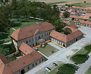
- Dukovany
-
Dukovany — Municipality — Dukovany 
Flag
Coat of armsCoordinates: 49°4′46″N 16°11′22″E / 49.07944°N 16.18944°ECoordinates: 49°4′46″N 16°11′22″E / 49.07944°N 16.18944°E Country  Czech Republic
Region Vysočina District Třebíč Area - Total 20.34 km2 (7.9 sq mi) Elevation 352 m (1,155 ft) Population (2010) - Total 805 - Density 39.6/km2 (102.5/sq mi) Postal code 675 56 Website http://www.obecdukovany.cz/ Dukovany is a village and municipality (obec) in Třebíč District in the Vysočina Region of the Czech Republic.
The village is situated on the border of southern Moravia. It lies on Bohemian-Moravian Highland, which geo-morphological relief was formed in new Tertiary and Quaternary. Region climate is slightly genial and dry, but more often cold. Average temperature is 7,4 of Celsius scale by year. The landscape is quite downy and too little woody, limited by valley of river Jihlava on the north. There is used of high farming. Its altitude is 352 meters. The municipality covers an area of 20.34 square kilometres (7.85 sq mi) and, in 2010, had a population of 805.
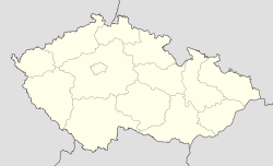
Dukovany lies approximately 28 kilometres (17 mi) south-east of Třebíč, 56 km (35 mi) south-east of Jihlava, and 170 km (106 mi) south-east of Prague.
Village is situated between 3 towns:
Třebíč 40 000 town dwellers (district town, 118 000 dwellers of whole district)
Brno 370 000 town dwellers
Znojmo 40 000 town dwellers
Dukovany Nuclear Power Station, one of the two Czech nuclear power plants, is located outside the village.
Population in Dukovany [1] Year 1869 1880 1890 1900 1910 1921 1930 1950 1961 1970 1980 1991 2001 2010 Population 1014 1042 1077 1164 1179 1201 1206 1037 1095 979 669 650 736 805 Contents
History
The origin of village lies far in the Middle Ages. Sometime around the middle of the 13th century it was given to the Templar Order and in the year 1295 a sguire's family is remembered for the first time by the name of Alšík of Dukovany. But in the year 1325 Czech King, Jan Lucembruský (John of Luxembourg) sold the settlement to Jindřich of Lipé, which proves that the family died out at that time. When Dukovany was remembered again, it already belonged to the property of the castle of Rabštejn. After its capture and destruction in 1446 the Rabštejn property became a part of the King's domain. Later on the village was added to the property of Moravský Krumlov belonging to the lords of Lipé. At the end of the 16th century Dukovany became an independent estate, which changed owners rather often.
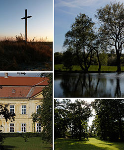
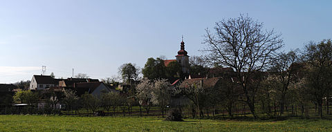
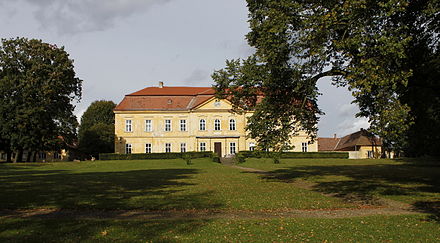
Especially the Church of St. Wenceslaus belongs among the dominating features of village. It was built by the Templars and consecrated in the year 1279. In the seventies remnants of splendid fresco decorations from the 13th century were uncovered and restored. The original manor house was rebuilt to a late baroque castle with classical elements in the year 1790. Its two large halls are decorated with frescoes by an important late Moaravian baroque painter, Josef Winterhalter. A large English park is also a part of the castle premises. A baroque chapel and statues of St. John of Nepomuk, St. Joseph and St. Florian from the turn of the 18th century complete the enumeration of the historical sights in the village which are surely worth seeing. Also the area where the demolished villages of Skryje and Lipňany stood is now a part of the cadastral area of Dukovany and this is why there is cross, ploughshare of Dukovany, and tree of Skryje in the new chat of arms. When you go rambling in the vicinity of Dukovany we recommend you to visit the valley of the Jihlava river with lovely scenery, the near serpentine steppe, or the ruins of Templštýn and Rabštejn castles.
Urban structure, development
The village is situated on the right upper area of Jihlava's river bank. Since 70. years of the last century ground lengthwise built-up area had rearranged and replaced by family houses, its building-up was focused on downhill below Dukovany chateau then. There had been strong urban and development influence on the village by mansion, which was rebuilt in 1790. Also by English park, chateau court, swimming pool, orchard, hydroelectric, farming area and chapel. On socialism era (1974–1987), was been built up nuclear power station. Northern by-pass road and housing areal for about 1500 workers was been built. That's why the several villages: Skryje, Heřmanice, Lipany, was demolished. A part of village dwellers from Skryje has moved out to Dukovany. They are living in housing estate on the eastern side of chateau park.
3D URBAN MODEL IN GOOGLE EARTHBikeway
Bikeway 401 - Třebíč - Hrotovice - Dukovany - Moravský Krumlov
flour-milling bikeway - Nové město na Moravě - Velké Meziříčí - Náměšť nad Oslavou - Dukovany - Vranov nad Dyjí - Hardegg
Energy bikeway - circle around Nuclear Power Station
Bikeway 5107 - Dukovany Lávky - Dalešice - Klučov
Bikeway 5106 - Dukovany Lávky - Mohelno - Náměšť nad Oslavou - Nárameč - Ptáčov - Třebíč
Wiki link
External references
- Dukovany official web page
- Statistické informace o obci
- Cross-Gate Dukovany
- FC Dukovany
- 3D model village
- Dukovany photos - slide show
- Church saint Wenceslaw in Dukovany (bc. diploma project) Kateřina Rázková. doc
- Czech Statistical Office: Municipalities of Třebíč District
References
- ^ Template:Citace monografie
Towns, market-towns (městyse) and villages of Třebíč District Babice · Bačice · Bačkovice · Benetice · Biskupice-Pulkov · Blatnice · Bohušice · Bochovice · Bransouze · Březník · Budišov · Budkov · Cidlina · Čáslavice · Častohostice · Čechočovice · Čechtín · Červená Lhota · Číhalín · Číchov · Čikov · Číměř · Dalešice · Dědice · Dešov · Dolní Lažany · Dolní Vilémovice · Domamil · Dukovany · Hartvíkovice · Heraltice · Hluboké · Hodov · Horní Heřmanice · Horní Smrčné · Horní Újezd · Horní Vilémovice · Hornice · Hrotovice · Hroznatín · Hvězdoňovice · Chlístov · Chlum · Chotěbudice · Jakubov u Moravských Budějovic · Jaroměřice nad Rokytnou · Jasenice · Jemnice · Jinošov · Jiratice · Kamenná · Kdousov · Kladeruby nad Oslavou · Klučov · Kojatice · Kojatín · Kojetice · Komárovice · Koněšín · Kostníky · Kouty · Kozlany · Kožichovice · Krahulov · Kralice nad Oslavou · Kramolín · Krhov · Krokočín · Kuroslepy · Láz · Lesná · Lesní Jakubov · Lesonice · Lesůňky · Lhánice · Lhotice · Lipník · Litohoř · Litovany · Lomy · Loukovice · Lovčovice · Lukov · Markvartice · Martínkov · Mastník · Menhartice · Meziříčko · Mikulovice · Mladoňovice · Mohelno · Moravské Budějovice · Myslibořice · Naloučany · Náměšť nad Oslavou · Nárameč · Nimpšov · Nová Ves · Nové Syrovice · Nový Telečkov · Ocmanice · Odunec · Okarec · Okřešice · Okříšky · Opatov · Oponešice · Ostašov · Pálovice · Petrovice · Petrůvky · Pokojovice · Police · Popůvky · Pozďatín · Přeckov · Předín · Přešovice · Přibyslavice · Příštpo · Pucov · Pyšel · Rácovice · Račice · Radkovice u Budče · Radkovice u Hrotovic · Radonín · Radošov · Radotice · Rapotice · Rohy · Rokytnice nad Rokytnou · Rouchovany · Rudíkov · Římov · Sedlec · Slavětice · Slavičky · Slavíkovice · Smrk · Stařeč · Stropešín · Střítež · Studenec · Studnice · Sudice · Svatoslav · Šebkovice · Štěměchy · Štěpkov · Trnava · Třebelovice · Třebenice · Třebíč · Třesov · Valdíkov · Valeč · Vícenice · Vícenice u Náměště nad Oslavou · Vladislav · Vlčatín · Výčapy · Zahrádka · Zárubice · Zašovice · Zvěrkovice · ŽeletavaCategories:- Populated places in Třebíč District
- Třebíč District
- Villages in the Czech Republic
Wikimedia Foundation. 2010.

