- Dolní Lažany
-
Dolní Lažany — Municipality — 
Flag
Coat of arms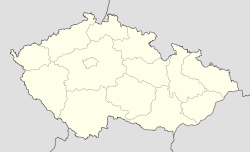
 Dolní Lažany
Coordinates: 49°6′56″N 15°49′17″E / 49.11556°N 15.82139°ECoordinates: 49°6′56″N 15°49′17″E / 49.11556°N 15.82139°E Country  Czech Republic
Region Vysočina District Třebíč Area – Total 5.44 km2 (2.1 sq mi) Elevation 472 m (1,549 ft) Population (2009) – Total 152 – Density 27.9/km2 (72.4/sq mi) Postal code 675 51 Website http://www.dolnilazany.cz Dolní Lažany is a village and municipality (obec) in Třebíč District in the Vysočina Region of the Czech Republic.
The municipality covers an area of 5.44 square kilometres (2.10 sq mi), and has a population of 152 (as at 2009).
Dolní Lažany lies approximately 13 kilometres (8 mi) south of Třebíč, 36 km (22 mi) south-east of Jihlava, and 148 km (92 mi) south-east of Prague.
References
Towns, market-towns (městyse) and villages of Třebíč District Babice · Bačice · Bačkovice · Benetice · Biskupice-Pulkov · Blatnice · Bohušice · Bochovice · Bransouze · Březník · Budišov · Budkov · Cidlina · Čáslavice · Častohostice · Čechočovice · Čechtín · Červená Lhota · Číhalín · Číchov · Čikov · Číměř · Dalešice · Dědice · Dešov · Dolní Lažany · Dolní Vilémovice · Domamil · Dukovany · Hartvíkovice · Heraltice · Hluboké · Hodov · Horní Heřmanice · Horní Smrčné · Horní Újezd · Horní Vilémovice · Hornice · Hrotovice · Hroznatín · Hvězdoňovice · Chlístov · Chlum · Chotěbudice · Jakubov u Moravských Budějovic · Jaroměřice nad Rokytnou · Jasenice · Jemnice · Jinošov · Jiratice · Kamenná · Kdousov · Kladeruby nad Oslavou · Klučov · Kojatice · Kojatín · Kojetice · Komárovice · Koněšín · Kostníky · Kouty · Kozlany · Kožichovice · Krahulov · Kralice nad Oslavou · Kramolín · Krhov · Krokočín · Kuroslepy · Láz · Lesná · Lesní Jakubov · Lesonice · Lesůňky · Lhánice · Lhotice · Lipník · Litohoř · Litovany · Lomy · Loukovice · Lovčovice · Lukov · Markvartice · Martínkov · Mastník · Menhartice · Meziříčko · Mikulovice · Mladoňovice · Mohelno · Moravské Budějovice · Myslibořice · Naloučany · Náměšť nad Oslavou · Nárameč · Nimpšov · Nová Ves · Nové Syrovice · Nový Telečkov · Ocmanice · Odunec · Okarec · Okřešice · Okříšky · Opatov · Oponešice · Ostašov · Pálovice · Petrovice · Petrůvky · Pokojovice · Police · Popůvky · Pozďatín · Přeckov · Předín · Přešovice · Přibyslavice · Příštpo · Pucov · Pyšel · Rácovice · Račice · Radkovice u Budče · Radkovice u Hrotovic · Radonín · Radošov · Radotice · Rapotice · Rohy · Rokytnice nad Rokytnou · Rouchovany · Rudíkov · Římov · Sedlec · Slavětice · Slavičky · Slavíkovice · Smrk · Stařeč · Stropešín · Střítež · Studenec · Studnice · Sudice · Svatoslav · Šebkovice · Štěměchy · Štěpkov · Trnava · Třebelovice · Třebenice · Třebíč · Třesov · Valdíkov · Valeč · Vícenice · Vícenice u Náměště nad Oslavou · Vladislav · Vlčatín · Výčapy · Zahrádka · Zárubice · Zašovice · Zvěrkovice · Želetava
This Vysočina Region location article is a stub. You can help Wikipedia by expanding it.


