- Dalwhinnie railway station
-
Dalwhinnie 
Dail Chuinnidh 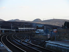
Location Place Dalwhinnie Local authority Highland Coordinates 56°56′06″N 4°14′46″W / 56.9350°N 4.2460°WCoordinates: 56°56′06″N 4°14′46″W / 56.9350°N 4.2460°W Operations Station code DLW Managed by First ScotRail Number of platforms 2 Live arrivals/departures and station information
from National Rail EnquiriesAnnual rail passenger usage 2002/03 * 2,066 2004/05 * 1,619 2005/06 * 2,013 2006/07 * 1,774 2007/08 * 1,975 2008/09 * 2,644 History Original company Inverness and Perth Junction Railway Pre-grouping Highland Railway Post-grouping LMS 9 September 1863[1] Opened National Rail - UK railway stations A B C D E F G H I J K L M N O P Q R S T U V W X Y Z * Annual passenger usage based on sales of tickets in stated financial year(s) which end or originate at Dalwhinnie from Office of Rail Regulation statistics. Please note: methodology may vary year on year. Dalwhinnie railway station is a railway station serving the village of Dalwhinnie, Highland, Scotland. The station is managed by First ScotRail and is on the Highland Main Line.
Contents
History
Preceding station  National Rail
Following station Pitlochry East Coast
East Coast Main LineKingussie Blair Atholl First ScotRail
Highland Main LineNewtonmore Blair Atholl First ScotRail
Highland Caledonian SleeperNewtonmore Historical railways Dalnaspidal
Line open; station closedInverness and Perth Junction Railway Newtonmore
Line and station openReferences
Notes
Sources
- Butt, R. V. J. (1995). The Directory of Railway Stations: details every public and private passenger station, halt, platform and stopping place, past and present (1st ed.). Sparkford: Patrick Stephens Ltd. ISBN 1-8526-0508-1. OCLC 60251199.
- Jowett, Alan (March 1989). Jowett's Railway Atlas of Great Britain and Ireland: From Pre-Grouping to the Present Day (1st ed.). Sparkford: Patrick Stephens Ltd. ISBN 1-8526-0086-1. OCLC 22311137.
Categories:- Scotland railway station stubs
- Railway stations in Highland (council area)
- Railway stations served by First ScotRail
- Railway stations served by East Coast
- Railway stations opened in 1863
- Former Highland Railway stations

Wikimedia Foundation. 2010.