- Kilwinning railway station
Infobox UK station
name = Kilwinning
code = KWN
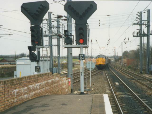
caption = A southbound freight train at the junction just north of Kilwinning station
manager =First ScotRail
pte = SPT
locale =Kilwinning
borough =North Ayrshire
latitude = 55.6563
longitude = -4.7095
gridref = NS295436
usage0405 = 0.847
usage0506 = 0.908
usage0607 = 0.921
platforms = 4
years =23 March 1840
events = OpenedKilwinning railway station is a railway station serving the town of
Kilwinning ,North Ayrshire ,Scotland . The station is managed byFirst ScotRail and is on theAyrshire Coast Line .History
The station was opened on
23 March 1840 by theGlasgow, Paisley, Kilmarnock and Ayr Railway , [Butt, p. 133] and was built as an interchange, seeing traffic coming fromGlasgow ,Ayr andArdrossan (and laterLargs ).Current operations
Kilwinning has the busiest station for stopping passenger trains in
North Ayrshire , with all Largs and Ardrossan services calling and all but two Ayr services calling at the station. The station is also the fifth busiest in terms of passenger numbers on the Ayrshire Coast Line behind Glasgow Central, Paisley Gilmour Street, Glasgow Prestwick Airport and Ayr. [Based on ticket sales in the financial year 2004/05 for all National Rail stations. [http://www.rail-reg.gov.uk/upload/pdf/station_usage_2004-05_notes.pdf Continued usage notes] , and [http://www.rail-reg.gov.uk/upload/xls/station_usage_2004-05_excel.xls Excel format table for all stations] available.]Redevelopment of Kilwinning station is due to start soon, with the taxi rank and main car park being moved to allow
buses to serve the station as part of an interchange project drawn up byNorth Ayrshire Council , where Service 11 buses to/fromKilmarnock will call at the station.Fact|date=February 2007Discussions have been on-going for some time between the Council and
Network Rail over the buying of old goods sidings to the west of the station to allow for more car parking at the site. North Ayrshire are hoping to build a two-tiered structure which will hold double the amount of cars than is currently the case at the station.Fact|date=February 2007Gallery
References
Notes
Sources
*
rail line two to one
previous1 = Stevenston
previous2 = Irvine
next = Dalry
route1=First ScotRail "'
Ayrshire Coast Line
route2=First ScotRail "'
Ayrshire Coast Line
col = FF80C0rail line
previous = Ardrossan Montgomerie Pier
"1947 - 1960
Line and station closed
next = "Connection with
Ardrossan Railway at
Stevenston No. 1 Jct.
route = British Railways"'Montgomerie Pier Branch
col = 000000rail line two to one
previous1 = Stevenston
"Line and station open
previous2 = Bogside
"Line open; station closed
next = Dalry Junction
"Line open; station closed
route1 =Glasgow and South Western Railway "'
Ardrossan Railway
route2 =Glasgow and South Western Railway "'
Glasgow, Paisley, Kilmarnock and Ayr Railway
col = G&SW colour
###@@@KEYEND@@@###
Wikimedia Foundation. 2010.
