- Myklebustbreen
-
Myklebustbreen/Snønipbreen 
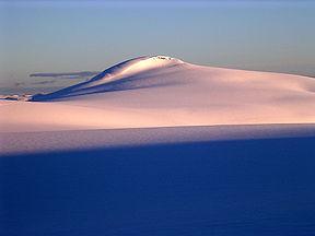
Highest point at Myklebustbreen, SnønipaType Continental glacier Location Gloppen, Stryn, and Jølster
(Sogn og Fjordane, Norway)Coordinates 61°42′N 6°42′E / 61.7°N 6.7°ECoordinates: 61°42′N 6°42′E / 61.7°N 6.7°E Area 57 km2 (22 sq mi) Myklebustbreen, or Snønipbreen, is the seventh largest glacier in mainland Norway. It is located in the municipalities of Jølster, Gloppen, and Stryn in Sogn og Fjordane county. Its highest point is just below the nunatak Snønipa, with altitude of 1,827 metres (5,994 ft), and its lowest point is at 890 metres (2,920 ft) above sea level.[1]
The villages of Byrkjelo and Egge both lie on the highway E39 which runs north and south, 7 kilometres (4.3 mi) east of Myklebustbreen. The glacier also lies northwest of the Jostedalsbreen glacier, and both are part of Jostedalsbreen National Park. Jostedalsbreen and Myklebustbreen are separated by the Stardalen valley.
See also
References
- ^ Store norske leksikon. "Myklebustbreen" (in Norwegian). http://www.snl.no/Myklebustbreen. Retrieved 2010-08-07.
External links
Categories:- Sogn og Fjordane geography stubs
- Glaciers of Norway
- Geography of Sogn og Fjordane
Wikimedia Foundation. 2010.
