- Connel Ferry railway station
-
Connel Ferry Aiseag a' Chonghail 
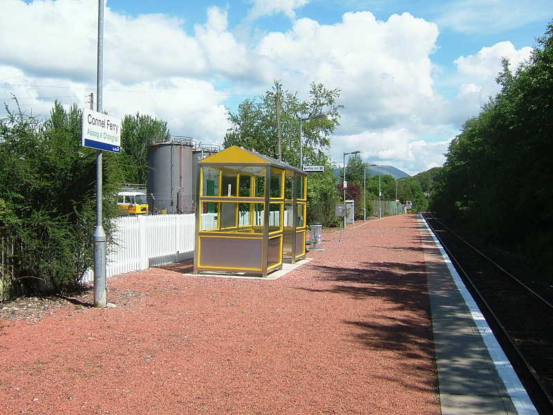
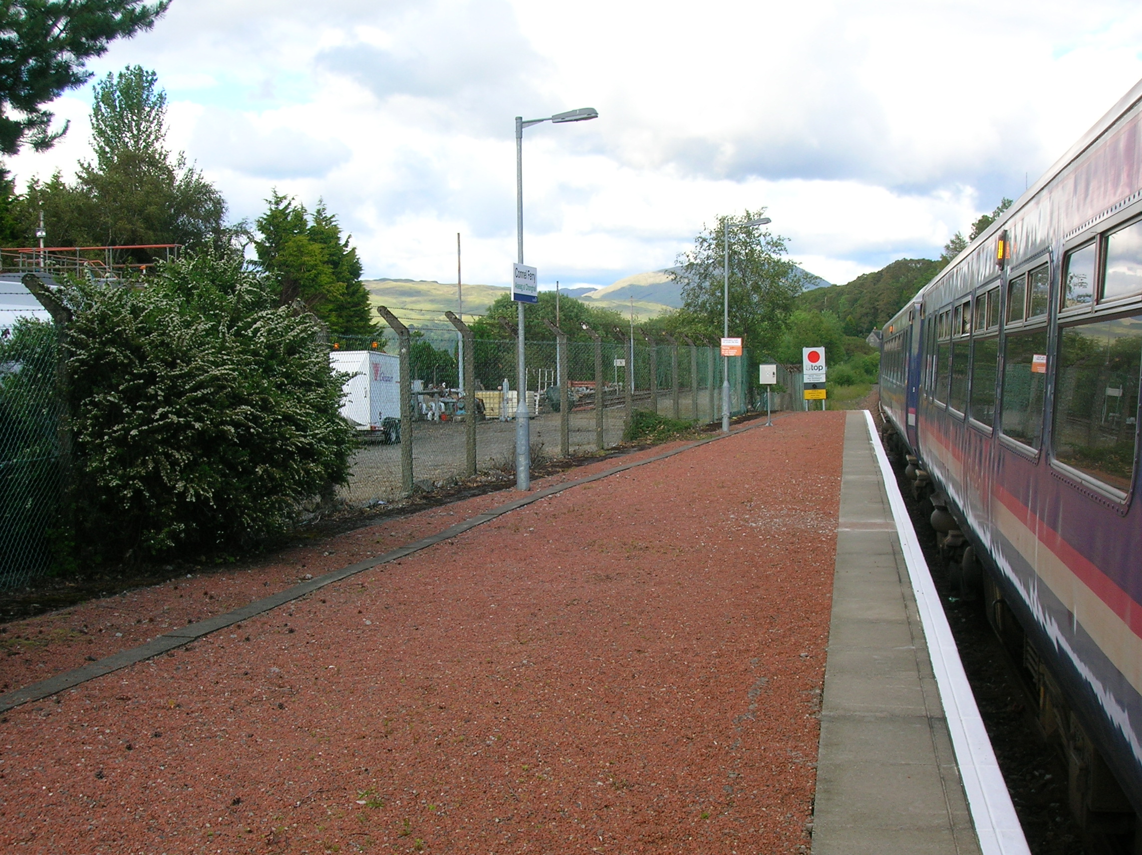
Connel Ferry station on 15 July 2007 Location Place Connel Local authority Argyll and Bute Coordinates 56°27′07″N 5°23′06″W / 56.452°N 5.385°WCoordinates: 56°27′07″N 5°23′06″W / 56.452°N 5.385°W Operations Station code CON Managed by First ScotRail Number of platforms 1 Live arrivals/departures and station information
from National Rail EnquiriesAnnual rail passenger usage 2004/05 * 3,268 2005/06 * 3,482 2006/07 * 3,834 2007/08 * 4,058 2008/09 * 4,722 History Original company Callander and Oban Railway Pre-grouping Callander and Oban Railway operated by Caledonian Railway 1 July 1880 Opened National Rail - UK railway stations A B C D E F G H I J K L M N O P Q R S T U V W X Y Z * Annual passenger usage based on sales of tickets in stated financial year(s) which end or originate at Connel Ferry from Office of Rail Regulation statistics. Please note: methodology may vary year on year. Connel Ferry railway station is a railway station serving the village of Connel in western Scotland. This station is on the Oban branch of the West Highland Line, originally part of the Callander and Oban Railway.
Contents
Facilities
Station facilities are somewhat basic, consisting of a shelter and a telephone for obtaining train running information. Platform lighting is installed.
History
Connel Ferry station opened on 1 July 1880, when the final section of the Callander and Oban Railway, between Dalmally and Oban, came into use. The original layout at Connel Ferry comprised a crossing loop with platforms on either side, with some sidings on the north side.
Considerable enlargement of the station took place in 1903, with the opening of the branch line to Ballachulish. The original Down platform became an island platform, with the Down Main line routed alongside the new south face, and the Up Main line (the original Down line) to its north. The former Up platform became the Branch Platform and a bay platform was constructed at its west end. A goods loop ran to the south of the Down Main line. A turntable was provided in the goods yard for turning the branch line locomotives.
A short distance beyond the junction, the branch line spanned Loch Etive by means of Connel Bridge, a cantilever bridge with a span length that was at the time second only to the Forth Bridge. In 1940, additional sidings were laid in on the south side of the station for the wartime traffic, these being removed in 1948. The Ballachulish branch closed in 1966. The extensive track layout was reduced to just a single line routed via the former Branch Platform (the original Up platform). The island platform was taken out of use. The layout grew again in 1968 when an oil storage depot with two sidings was built on the site of the goods yard. A run-round loop was laid alongside the single line to the east of the station, connected at each end by points controlled from a ground frame.
The disused island platform was demolished in 1985.
Signalling
 Looking towards Crianlarich at Connel Ferry
From the time of its opening in 1880, the single line between Dalmally and Oban was worked by the electric token system, this being the first ever application of that system in everyday service.
The enlarged layout of 1903 was controlled from two large wooden signal boxes, the East box having 42 levers, and the West box 56. The latter controlled the branch line junction and a signal gantry located nearby spanned three tracks. The signal gantry was replaced on 22 January 1953. Both signal boxes closed on 8 January 1967 and all signals were removed.
During the 1968 demolition of Connel Ferry West signal box, contractors burning the wooden remains set fire to the track formation. Despite efforts to put the fire out, it continued to burn for several days, causing the embankment to crumble and smoke to issue from fissures in the trackbed. This resulted in a 5 mph speed restriction being imposed and, at the time, caused concerns that the line may be forced to close.[1]
In 1988, the station became a Token Exchange Point in connection with the new Radio Electronic Token Block signalling system. The Train Protection & Warning System was installed in 2003.
References
Notes
- ^ "Locomotive News". Railway Magazine: 684. November 1968.
Sources
- Butt, R. V. J. (1995). The Directory of Railway Stations: details every public and private passenger station, halt, platform and stopping place, past and present (1st ed.). Sparkford: Patrick Stephens Ltd. ISBN 1-8526-0508-1. OCLC 60251199.
- Fryer, Charles (1989). The Callander and Oban Railway. Oxford: Oakwood Press. ISBN 0-8536-1377-X. OCLC 21870958.
- Jowett, Alan (March 1989). Jowett's Railway Atlas of Great Britain and Ireland: From Pre-Grouping to the Present Day (1st ed.). Sparkford: Patrick Stephens Ltd. ISBN 1-8526-0086-1. OCLC 22311137.
Preceding station  National Rail
Following station Taynuilt First ScotRail
West Highland LineOban Historical railways Ach-na-Cloich
Line open; Station closedCallander and Oban Railway
Oban
Line and station openCallander and Oban Railway
Ballachulish Branch
North Connel
Line and station closedCategories:- Railway stations in Argyll and Bute
- Former Caledonian Railway stations
- Railway stations opened in 1880
- Railway stations served by First ScotRail
Wikimedia Foundation. 2010.